
Utah has a scenery problem.
There’s too much of it.
Five national parks.
Snow-covered mountains.
Desert arches.
Turquoise lakes.
Slot canyons.
Salt flats.
Ancient rock art.
Ghost towns.
And enough bizarre sandstone formations to make you wonder whether geology occasionally gets bored and starts showing off.
The best day trips in Utah range from easy escapes outside Salt Lake City to full-day adventures through some of America’s most spectacular landscapes.
The trick is understanding the map.
Utah looks manageable until you decide you’re going to visit Salt Lake City, Zion and Moab before dinner.
You aren’t.
Pick a region.
Explore it properly.
Then come back.
Jump to a Utah Region
Northern Utah
Salt Lake City, Antelope Island, Park City, Bear Lake, Logan, Ogden and the Wasatch Mountains.
Southeastern Utah
Moab, Arches, Canyonlands, Goblin Valley, San Rafael Swell, Bears Ears and dinosaur country.
Southwestern Utah
Zion, Bryce Canyon, Capitol Reef, St. George, Escalante, Kanab and Scenic Byway 12.
Or jump directly to:
Mighty Five | Scenic Drives | Slot Canyons | Ancient Places | Ghost Towns | Hidden Gems | Family Trips
Northern Utah Day Trips
Northern Utah combines mountains and metropolitan areas better than almost anywhere in the West.
You can eat breakfast in Salt Lake City, hike through the Wasatch Mountains before lunch and watch the sun disappear over the Great Salt Lake that evening.
Not bad for a Tuesday.
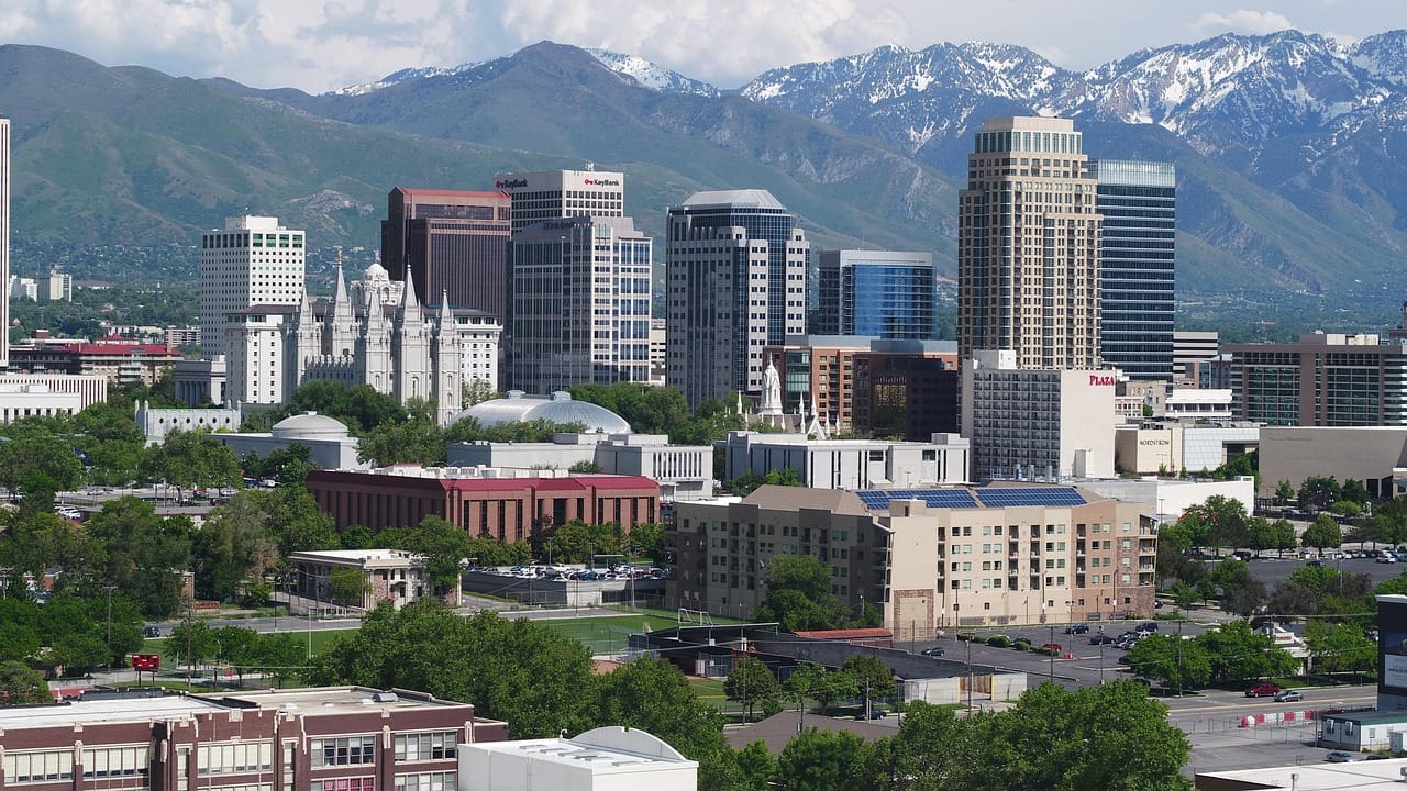
Salt Lake City
Location: Salt Lake City
Map: Open in Google Maps
Planning: Visit Salt Lake
Utah’s capital makes an excellent base for exploring northern Utah.
Downtown museums and historic sites sit beneath mountains that seem almost ridiculously close to the city.
Antelope Island State Park
Location: Great Salt Lake
Map: Open in Google Maps
Official Site: Utah State Parks
Antelope Island rises from the Great Salt Lake northwest of Salt Lake City.
Bison roam the island.
So do pronghorn, mule deer and numerous bird species.
Trails climb above the shoreline to enormous views across the lake.
Sunset can be spectacular.
City Unknown Tip
Bison are magnificent.
Bison are also enormous wild animals capable of moving considerably faster than tourists holding phones.
Use the zoom.
Great Salt Lake
Location: Northern Utah
Map: Open in Google Maps
One of America’s most unusual natural landscapes sits beside Utah’s largest city.
Water levels vary considerably over time, changing shorelines and access.
Antelope Island is one of the easiest places to experience the lake.
Park City
Location: Park City
Map: Open in Google Maps
Planning: Visit Park City
Historic Main Street climbs through a former silver-mining town that became one of America’s best-known mountain destinations.
Winter means skiing.
Summer brings hiking, mountain biking and outdoor events.
Any season works for wandering Main Street.
Utah Olympic Park
Location: Park City
Map: Open in Google Maps
Facilities created for the 2002 Winter Olympics remain active.
Depending on the season, visitors can explore Olympic history and watch athletes train.
Big Cottonwood Canyon
Location: Wasatch Mountains
Map: Open in Google Maps
This dramatic canyon begins just outside Salt Lake City.
Trails, picnic areas, ski resorts and mountain lakes provide year-round recreation.
Fall color can be beautiful.
Little Cottonwood Canyon
Location: Wasatch Mountains
Map: Open in Google Maps
Another spectacular canyon climbs toward Alta and Snowbird.
Winter conditions can become serious.
Check road and avalanche conditions before heading uphill.
Bonneville Salt Flats
Location: Near Wendover
Map: Open in Google Maps
A vast white salt crust stretches toward the horizon.
The landscape is surreal.
It’s also environmentally fragile.
Vehicle access can be restricted when the salt is wet.
Follow current BLM guidance rather than assuming every white patch is your personal racetrack.
Spiral Jetty
Location: Great Salt Lake, Rozel Point
Map: Open in Google Maps
Artist Robert Smithson created this enormous spiral earthwork in 1970.
Its appearance changes dramatically with Great Salt Lake water levels.
The remote drive is part of the experience.
Golden Spike National Historical Park
Location: Promontory Summit
Map: Open in Google Maps
Official Site: National Park Service
The Union Pacific and Central Pacific railroads met here in 1869, completing the first transcontinental railroad.
The famous ceremony tends to dominate the story.
Look deeper.
The railroad’s construction depended heavily on immigrant labor, particularly Chinese workers building the Central Pacific.
That broader history deserves attention.
Bear River Migratory Bird Refuge
Location: Brigham City area
Map: Open in Google Maps
Wetlands near the Great Salt Lake provide habitat for enormous numbers of migratory birds.
A wildlife drive makes this an easy northern Utah nature trip.
Ogden
Location: Ogden
Map: Open in Google Maps
Railroad history and mountain recreation meet in this underrated northern Utah city.
Historic 25th Street deserves a walk.
Hill Aerospace Museum
Location: Roy
Map: Open in Google Maps
Aircraft from several eras fill this large aviation museum near Hill Air Force Base.
A particularly good rainy-day—or blazing-hot-day—option.
Logan Canyon
Location: Logan
Map: Open in Google Maps
US 89 winds through limestone cliffs and forests between Logan and Bear Lake.
Hiking trails and campgrounds line the canyon.
Bear Lake
Location: Utah-Idaho border
Map: Open in Google Maps
The lake’s striking turquoise color earned it the nickname “Caribbean of the Rockies.”
Summer brings beaches and water recreation.
And raspberry shakes.
The raspberry shake is not optional.
We’ve reviewed the rules.
Provo Canyon
Location: Provo/Orem area
Map: Open in Google Maps
The canyon connects Utah Valley with Heber Valley through dramatic Wasatch scenery.
Bridal Veil Falls
Location: Provo Canyon
Map: Open in Google Maps
This tall waterfall is easily accessible from Provo Canyon.
Conditions around waterfalls change seasonally, especially during winter and spring runoff.
Timpanogos Cave National Monument
Location: American Fork Canyon
Map: Open in Google Maps
Official Site: National Park Service
Guided cave tours reveal elaborate formations inside Mount Timpanogos.
Here’s the important part:
You hike uphill before entering the cave.
Quite uphill.
Reserve tours ahead when available and don’t underestimate the approach trail.
Heber Valley
Location: Heber City/Midway
Map: Open in Google Maps
Mountain scenery, historic trains and outdoor recreation make Heber Valley an easy Salt Lake City or Provo getaway.
Alpine Loop Scenic Byway
Location: Wasatch Mountains
Map: Open in Google Maps
This seasonal mountain road connects American Fork Canyon with the Provo Canyon area.
Fall color can be spectacular.
Snow closes the high route seasonally.
Southeastern Utah Day Trips
Welcome to red-rock country.
This is the Utah that appears on calendars, desktop backgrounds and approximately half the outdoor-adventure photos on the internet.
Moab anchors the region.
But Arches is only the beginning.
Moab
Location: Moab
Map: Open in Google Maps
Planning: Discover Moab
Moab is the gateway to Arches, Canyonlands, Dead Horse Point and miles of public land.
Stay here for several days.
Seriously.
Trying to “day trip to Moab” from Salt Lake City misses the point.
Use Moab as the base and take day trips from there.
Arches National Park
Location: Moab
Map: Open in Google Maps
Official Site: National Park Service
More than 2,000 documented natural stone arches occur within the park.
Delicate Arch gets the fame.
But Balanced Rock, Windows, Landscape Arch and Devils Garden make this a full-day destination.
Arrive early and stay flexible during busy periods.
Delicate Arch
Location: Arches National Park
Map: Open in Google Maps
Utah put it on the license plate for a reason.
The hike crosses exposed slickrock with little shade.
Bring water.
Canyonlands National Park — Island in the Sky
Location: Near Moab
Map: Open in Google Maps
Official Site: National Park Service
Island in the Sky is the easiest Canyonlands district to reach from Moab.
Overlooks reveal enormous canyon systems carved by the Colorado and Green rivers.
Mesa Arch
Location: Canyonlands
Map: Open in Google Maps
A short trail leads to one of Utah’s most photographed arches.
Sunrise is famous.
Sunrise is also when every photographer on Earth appears to have received the same memo.
Dead Horse Point State Park
Location: Near Moab
Map: Open in Google Maps
The overlook sits high above a bend in the Colorado River.
It’s one of Utah’s great viewpoints.
And unlike many attractions described as “breathtaking,” this one may actually cause you to stop talking for a minute.
Fisher Towers
Location: Northeast of Moab
Map: Open in Google Maps
Massive red-rock towers rise above the Colorado River corridor.
The hiking trail provides increasingly dramatic views.
Corona Arch
Location: Near Moab
Map: Open in Google Maps
A popular public-land hike reaches a huge sandstone arch outside Arches National Park.
Potash Road
Location: Moab
Map: Open in Google Maps
Drive alongside the Colorado River beneath enormous sandstone cliffs.
Rock art and dinosaur-track sites can be found along the corridor.
Respect archaeological sites.
Don’t touch or trace rock art.
Goblin Valley State Park
Location: Near Green River/Hanksville
Map: Open in Google Maps
Thousands of strange mushroom-shaped hoodoos fill a broad valley.
There are few places where geology looks this determined to entertain you.
Explore carefully.
The formations are fragile.
Little Wild Horse Canyon
Location: Near Goblin Valley
Map: Open in Google Maps
This accessible slot canyon makes an excellent introduction to Utah canyon hiking.
But slot canyons require serious weather awareness.
Never enter when storms threaten anywhere in the drainage.
Flash floods can arrive even when the sky directly overhead appears harmless.
San Rafael Swell
Location: Central-Eastern Utah
Map: Open in Google Maps
Cliffs, canyons, desert roads and rock art fill this enormous landscape.
Some roads require high-clearance or four-wheel-drive vehicles.
Know where you’re going.
Wedge Overlook
Location: San Rafael Swell
Map: Open in Google Maps
Often nicknamed the “Little Grand Canyon,” the overlook reveals the San Rafael River far below.
Nine Mile Canyon
Location: Eastern Utah
Map: Open in Google Maps
Despite the name, the broader canyon corridor extends much farther than nine miles.
Thousands of Indigenous rock-art images and archaeological sites occur throughout the area.
This is not an outdoor art gallery created for modern visitors.
These are culturally significant places connected to Indigenous peoples.
Look.
Learn.
Photograph respectfully.
Do not touch.
Dinosaur National Monument
Location: Jensen/Vernal area and Colorado
Map: Open in Google Maps
Official Site: National Park Service
At the Quarry Exhibit Hall, visitors can see dinosaur fossils embedded directly in rock.
The monument extends into Colorado and also contains dramatic river canyons and extensive human history.
Dinosaurs get the kids through the door.
The landscape keeps everybody else there.
Fantasy Canyon
Location: South of Vernal
Map: Open in Google Maps
Wind and water sculpted bizarre, delicate formations from soft rock.
It looks like somebody gave erosion too much creative freedom.
Bears Ears National Monument
Location: Southeastern Utah
Map: Open in Google Maps
Bears Ears contains an extraordinary concentration of archaeological, cultural and natural resources.
The landscape remains culturally significant to multiple Tribal Nations.
Visit with considerably more care than you would an ordinary roadside attraction.
Stay on established routes.
Never remove artifacts.
Do not enter or climb on archaeological structures.
Natural Bridges National Monument
Location: Southeastern Utah
Map: Open in Google Maps
Official Site: National Park Service
Three enormous natural bridges sit within a remote canyon landscape.
It’s also an exceptional dark-sky destination.
Monument Valley
Location: Utah-Arizona border
Map: Open in Google Maps
Monument Valley Navajo Tribal Park lies within the Navajo Nation.
Those towering sandstone buttes may look familiar from Western films.
Remember that this is not simply a movie backdrop.
It is part of Diné homeland.
Follow Navajo Nation rules and remain on permitted routes.
Southwestern Utah Day Trips
If southeastern Utah is dramatic, southwestern Utah apparently took that personally.
Zion.
Bryce.
Capitol Reef.
Grand Staircase-Escalante.
Cedar Breaks.
Snow Canyon.
You could spend weeks here.
Visit Utah itself recommends several days for the region.
They’re right.
Zion National Park
Location: Springdale
Map: Open in Google Maps
Official Site: National Park Service
Massive sandstone walls rise above the Virgin River.
Zion Canyon contains famous hikes, overlooks and river scenery.
The park can become extremely busy.
Use the shuttle when it is operating and check current conditions before arriving.
Angels Landing
Location: Zion National Park
Map: Open in Google Maps
This legendary hike climbs to a narrow ridge high above Zion Canyon.
The final chain section is exposed.
A permit is required to hike beyond Scout Lookout to Angels Landing.
If heights aren’t your thing, that’s fine.
Utah contains approximately nine billion other rocks.
The Narrows
Location: Zion National Park
Map: Open in Google Maps
The route follows the Virgin River between towering canyon walls.
Conditions depend heavily on water flow, weather and flash-flood risk.
Check NPS conditions before entering.
Kolob Canyons
Location: Northern Zion National Park
Map: Open in Google Maps
A separate entrance provides access to dramatic red-rock scenery away from Zion Canyon’s busiest corridor.
Snow Canyon State Park
Location: St. George/Ivins
Map: Open in Google Maps
Red cliffs, petrified dunes, lava flows and desert trails make this one of Utah’s best state parks.
If Snow Canyon were located in many other states, it would probably be their signature landscape.
In Utah it gets casually placed down the road from Zion.
That’s just unfair.
Bryce Canyon National Park
Location: Bryce Canyon City
Map: Open in Google Maps
Official Site: National Park Service
Thousands of hoodoos fill enormous natural amphitheaters.
Sunrise and sunset create dramatic light.
But Bryce’s elevation means winter conditions can arrive while lower desert country remains warm.
Cedar Breaks National Monument
Location: Near Brian Head
Map: Open in Google Maps
A huge natural amphitheater cuts into the high plateau.
Because the rim sits above 10,000 feet, snow controls seasonal road access.
Coral Pink Sand Dunes State Park
Location: Kanab area
Map: Open in Google Maps
Wind created massive dunes from colorful sandstone.
Hiking and sandboarding are popular.
Certain areas also permit off-highway vehicles.
Kanab
Location: Kanab
Map: Open in Google Maps
Kanab is one of southern Utah’s best adventure bases.
Zion, Grand Staircase-Escalante, Coral Pink Sand Dunes and numerous canyon destinations surround the town.
Grand Staircase-Escalante National Monument
Location: Southern Utah
Map: Open in Google Maps
This enormous landscape contains canyons, plateaus, arches and remote backroads.
Do not confuse “road shown on map” with “road appropriate for my rental sedan.”
Weather can turn backcountry roads into impassable mud.
Check conditions locally.
Lower Calf Creek Falls
Location: Escalante area
Map: Open in Google Maps
A desert trail follows Calf Creek to a beautiful waterfall.
Summer heat can be intense.
Carry plenty of water.
Scenic Byway 12
Location: Southern Utah
Map: Open in Google Maps
This road connects some of Utah’s greatest landscapes.
Red Canyon.
Bryce country.
Escalante.
Boulder.
Capitol Reef.
The road itself is a destination.
Capitol Reef National Park
Location: Torrey
Map: Open in Google Maps
Official Site: National Park Service
The Waterpocket Fold creates a nearly 100-mile wrinkle in Earth’s crust.
Fruita adds historic orchards, petroglyphs and pioneer-era buildings.
Yes.
There is pie.
Plan accordingly.
Goblin Valley—
No.
We’ve crossed back into southeastern Utah.
This is what happens after writing about Utah for too long.
Every direction contains another national park.
Fishlake National Forest & Pando
Location: Central Utah
Map: Open in Google Maps
Thousands of aspen stems share one root system known as Pando.
It is frequently described as one of Earth’s largest organisms by mass.
Visit gently.
Scientists continue working to protect the clone from threats including over-browsing.
Fremont Indian State Park & Museum
Location: Sevier
Map: Open in Google Maps
Road construction revealed an enormous Fremont archaeological site here.
The museum and surrounding trails interpret rock art and archaeological remains.
Utah’s Mighty Five National Parks
Utah has five national parks:
Arches National Park
Canyonlands National Park
Capitol Reef National Park
Bryce Canyon National Park
Zion National Park
Do not attempt all five as day trips from Salt Lake City.
That’s not a vacation.
That’s an endurance event.
Better bases include:
Moab for Arches and Canyonlands.
Torrey for Capitol Reef.
Bryce Canyon City for Bryce.
Springdale or St. George for Zion.
City Unknown Tip
The famous national parks are absolutely worth visiting.
But combine each one with a lesser-known state park, national monument or scenic road.
That’s where Utah gets really interesting.
Best Scenic Drives in Utah
Scenic Byway 12
One of Utah’s signature road trips.
Highway 128 near Moab
Follow the Colorado River beneath towering canyon walls.
Potash Road
Colorado River scenery, rock art and desert cliffs.
Burr Trail
Travel between Boulder and the Waterpocket Fold through spectacular canyon country.
Road conditions vary.
Mirror Lake Scenic Byway
High mountain scenery in the Uinta Mountains.
Seasonal.
Alpine Loop
Wasatch Mountain scenery and excellent fall color.
Seasonal.
Logan Canyon
US 89 climbs through northern Utah toward Bear Lake.
Highway 163
Classic Monument Valley scenery.
Highway 24
Capitol Reef, desert scenery and small towns.
Highway 89
One of the best north-south road-trip corridors in Utah.
Utah Slot Canyon Day Trips
Utah’s slot canyons are spectacular.
They can also be deadly.
Popular options include:
Little Wild Horse Canyon
Buckskin Gulch
Willis Creek
Peek-a-Boo and Spooky Gulch
Kanarra Falls
The Narrows
Never enter a slot canyon when storms threaten anywhere in the watershed.
Flash floods can arrive suddenly.
Check weather and current conditions immediately before entering.
Some canyons require permits.
Ancient Places & Rock Art in Utah
Utah contains thousands of archaeological and culturally significant Indigenous sites.
Explore responsibly:
Nine Mile Canyon
Bears Ears National Monument
Hovenweep National Monument
Natural Bridges
Fremont Indian State Park
Parowan Gap
Sego Canyon
Buckhorn Wash
McConkie Ranch
Newspaper Rock
Butler Wash
These aren’t simply “cool petroglyphs.”
Many places remain culturally and spiritually important to Native communities.
Never touch rock art.
Never remove pottery, stone tools or other artifacts.
Never climb archaeological structures.
Leave everything where it is.
Utah Ghost Town Day Trips
Mining, railroads and settlement left dozens of abandoned communities across Utah.
Grafton
Location: Near Rockville
Map: Open in Google Maps
Historic buildings survive near Zion National Park.
It’s one of Utah’s most photogenic ghost towns.
Silver Reef
Location: Leeds
Map: Open in Google Maps
A silver-mining town once stood here.
Historic structures and museum interpretation survive.
Frisco
Location: Western Utah
Map: Open in Google Maps
Mining ruins and enormous charcoal kilns remain in the desert.
Sego
Location: Near Thompson Springs
Map: Open in Google Maps
Remnants of a former coal-mining community survive near Sego Canyon.
Cisco
Location: Near the Colorado River
Map: Open in Google Maps
This old railroad community nearly disappeared but has seen limited modern activity return.
So “ghost town” comes with an asterisk.
City Unknown Ghost-Town Rule
Utah has enormous areas of public land.
That does not mean every abandoned building is public.
Respect fences, signs, archaeological resources and private property.
Ghost hunting does not come with a trespassing exemption.
Hidden Gems Worth the Utah Detour
Fantasy Canyon
Alien-looking geology near Vernal.
Wedge Overlook
Huge canyon scenery in the San Rafael Swell.
Goblin Valley
Not exactly secret anymore.
Still wonderfully strange.
Moonshine Arch
A quieter natural arch near Vernal.
Hell’s Backbone
A dramatic backroad near Boulder.
Red Canyon
Red-rock hoodoos near Bryce without entering Bryce Canyon itself.
Snow Canyon
National-park-quality scenery hiding in state-park clothing.
Spiral Jetty
Land art in the Great Salt Lake.
Buckhorn Wash
Rock art and canyon scenery.
Pando
A forest that’s actually one enormous genetic individual.
Utah hidden gems have range.
Best Utah Day Trips for Families
Try:
Dinosaur National Monument
Goblin Valley
Antelope Island
Hill Aerospace Museum
Bear Lake
Thanksgiving Point
Timpanogos Cave
Snow Canyon
Bryce Canyon
Arches
Capitol Reef
Coral Pink Sand Dunes
Utah Olympic Park
Golden Spike
Fremont Indian State Park
Dinosaurs plus goblins plus caves?
Utah has family vacation marketing pretty much handled.
Best Utah Spring Day Trips
Spring works especially well for:
Moab
Arches
Canyonlands
Goblin Valley
Zion
Snow Canyon
Capitol Reef
San Rafael Swell
Higher mountain roads may still be snowbound.
Desert weather can change quickly.
Best Utah Summer Day Trips
Summer brings:
Bear Lake
Uinta Mountains
Wasatch Mountains
Cedar Breaks
Bryce Canyon
High-elevation trails
Avoid strenuous low-desert hiking during peak afternoon heat.
Places like Moab, Zion and St. George can become dangerously hot.
Start early.
Carry water.
Then carry more water.
Best Utah Fall Day Trips
Fall is spectacular in:
Alpine Loop
Big Cottonwood Canyon
Logan Canyon
Fishlake National Forest
Pando
Mirror Lake Highway
Park City
Capitol Reef
Aspens turn entire mountainsides gold.
Peak color varies with elevation and weather.
Best Utah Winter Day Trips
Winter belongs to:
Park City
Alta
Snowbird
Brighton
Solitude
Brian Head
Southern Utah desert parks during mild conditions
Snow can dramatically change access to high-elevation destinations.
Check road conditions before driving mountain routes.
Utah Road-Trip Combinations
Try:
Salt Lake City → Antelope Island
Salt Lake City → Park City
Salt Lake City → Big Cottonwood Canyon
Ogden → Golden Spike → Spiral Jetty
Logan → Logan Canyon → Bear Lake
Provo → Provo Canyon → Heber Valley
Moab → Arches
Moab → Canyonlands → Dead Horse Point
Moab → Highway 128 → Fisher Towers
Goblin Valley → Little Wild Horse Canyon
Vernal → Dinosaur National Monument → Fantasy Canyon
St. George → Snow Canyon
St. George → Zion
Zion → Kanab → Coral Pink Sand Dunes
Bryce Canyon → Red Canyon
Bryce → Scenic Byway 12 → Escalante
Torrey → Capitol Reef
Capitol Reef → Scenic Byway 12 → Boulder
Do not plan:
Salt Lake City → Moab → Zion → Salt Lake City
in one day.
Your vacation should contain experiences other than looking through a windshield.
Utah Road-Trip Safety
Utah’s scenery can make wilderness look deceptively friendly.
Prepare for:
Extreme heat
Flash floods
Snow and ice
High elevation
Dehydration
Long distances without fuel
Limited cell service
Backcountry roads
Sudden thunderstorms
Steep drop-offs
Slot-canyon flooding
Winter avalanche conditions
Rapidly changing road conditions
Download maps before leaving populated areas.
Carry extra water.
Keep the fuel tank comfortably above empty.
And never assume a dirt road is safe because Google Maps drew a line through it.
Google isn’t paying for the tow truck.