
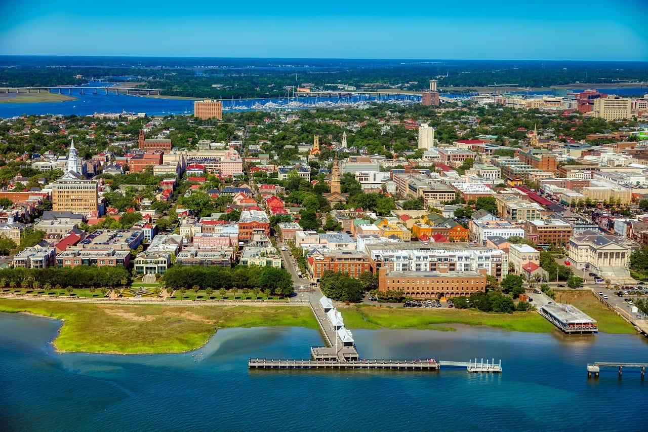
South Carolina has a geography problem.
Not a bad problem.
A ridiculously good one.
Start in the northwest and you’re standing beneath waterfalls in the Blue Ridge Mountains.
Drive toward the center and you’ll find Revolutionary War battlefields, lakes, rivers and one of America’s most remarkable old-growth floodplain forests.
Keep going and eventually Spanish moss appears, tidal creeks spread across the landscape and somebody hands you a plate of shrimp and grits.
Welcome to South Carolina.
The best day trips in South Carolina range from famous destinations like Charleston and Myrtle Beach to mountain overlooks, forgotten ruins, barrier islands, historic towns and waterfalls hiding just beyond the highway.
Let’s take the interesting roads.
Jump to a South Carolina Region
Upstate & Mountains
Waterfalls, Greenville, Lake Jocassee, Blue Ridge scenery and mountain towns.
Midlands
Columbia, Congaree, Revolutionary War sites, lakes and historic towns.
Lowcountry & Coast
Charleston, Beaufort, beaches, barrier islands, Gullah Geechee culture and coastal marshes.
Or jump directly to:
Waterfalls | Beaches | Small Towns | Scenic Drives | Hidden Gems | History | Family Trips
Upstate South Carolina Day Trips
South Carolina’s northwest corner doesn’t look much like the beach brochures.
The Blue Ridge Escarpment rises above forests, lakes and waterfalls.
This is hiking country.
But it’s also home to Greenville, Clemson, historic towns and some wonderfully strange roadside stops.
Greenville
Location: Greenville, South Carolina
Map: Open in Google Maps
Planning: Visit Greenville SC
Greenville has transformed itself into one of the South’s most enjoyable small cities.
Restaurants, public art, trails and a waterfall right downtown make it an easy day trip.
Yes.
A waterfall.
Downtown.
South Carolina is showing off.
Falls Park on the Reedy
Location: Downtown Greenville
Map: Open in Google Maps
The Reedy River tumbles through the middle of downtown beneath the curved Liberty Bridge.
Walk the surrounding trails before exploring Main Street.
Best for: Couples, families, photography and easy walking.
Swamp Rabbit Trail
Location: Greenville County
Map: Open in Google Maps
This popular multi-use trail connects Greenville with communities and parks throughout the region.
Rent bicycles and turn Greenville into a pedal-powered day trip.
Travelers Rest
Location: Travelers Rest
Map: Open in Google Maps
The appropriately named town sits between Greenville and the mountains.
Restaurants, shops and access to the Swamp Rabbit Trail make it a natural stop.
Caesars Head State Park
Location: Cleveland, South Carolina
Map: Open in Google Maps
A dramatic overlook provides sweeping views across the Blue Ridge Escarpment.
Fall is especially beautiful.
But don’t assume every mountain trail is easy because South Carolina also has beaches.
The mountains did not receive that memo.
Raven Cliff Falls
Location: Mountain Bridge Wilderness Area
Map: Open in Google Maps
This impressive waterfall drops through the mountains near Caesars Head.
Different trails provide different experiences and difficulty levels.
Check current trail conditions before heading out.
Jones Gap State Park
Location: Marietta
Map: Open in Google Maps
Mountain streams, forest trails and waterfalls make Jones Gap one of the Upstate’s premier hiking destinations.
Parking capacity can be limited during busy periods.
Plan ahead.
Table Rock State Park
Location: Pickens
Map: Open in Google Maps
Table Rock Mountain dominates the landscape.
The summit hike rewards experienced hikers with broad views across the Upstate.
Want something easier?
The park has lakeside recreation and shorter trails too.
Sassafras Mountain
Location: Pickens County
Map: Open in Google Maps
At 3,553 feet, Sassafras Mountain is South Carolina’s highest point.
An observation tower near the summit provides expansive mountain views.
And unlike some state high points, reaching this one doesn’t require expedition gear and a goodbye letter.
Lake Jocassee
Location: Salem
Map: Open in Google Maps
Deep blue water surrounded by forested mountains makes Lake Jocassee one of South Carolina’s most beautiful natural destinations.
Several waterfalls spill toward the lake and are best reached from the water.
Best for: Boating, kayaking, swimming and photography.
Devils Fork State Park
Location: Lake Jocassee
Map: Open in Google Maps
This is the primary public gateway to Lake Jocassee.
Summer weekends become busy.
Arrive early and check current park capacity information.
Stumphouse Tunnel
Location: Walhalla
Map: Open in Google Maps
Now we’re getting properly City Unknown.
Workers began carving this railroad tunnel through Stumphouse Mountain during the 19th century.
The railroad project failed.
The unfinished tunnel remained.
Naturally, we’re going inside.
Bring appropriate footwear and check current access conditions.
Issaqueena Falls
Location: Walhalla
Map: Open in Google Maps
The waterfall is conveniently located near Stumphouse Tunnel.
Tunnel plus waterfall?
That’s efficient road-tripping.
Walhalla
Location: Walhalla
Map: Open in Google Maps
This small mountain town makes a good base for waterfall country.
Oconee Station State Historic Site
Location: Walhalla area
Map: Open in Google Maps
Historic structures preserve part of the region’s frontier history.
The nearby trail to Station Cove Falls is particularly beautiful during spring wildflower season.
Poinsett Bridge
Location: Near Travelers Rest
Map: Open in Google Maps
Built in 1820, this stone bridge is often identified as South Carolina’s oldest surviving bridge.
Its Gothic-style arch looks remarkably mysterious surrounded by forest.
Yes.
There are ghost stories.
We’ll save those for Halloween.
Campbell’s Covered Bridge
Location: Landrum area
Map: Open in Google Maps
South Carolina’s only remaining historic covered bridge makes a wonderful quick detour.
Cowpens National Battlefield
Location: Chesnee
Map: Open in Google Maps
Official Site: National Park Service
American forces won an important Revolutionary War victory here on January 17, 1781.
Walking trails and exhibits help explain the battle.
Gaffney Peachoid
Location: Gaffney
Map: Open in Google Maps
It’s a giant water tower shaped like a peach.
Do you need to structure an entire vacation around it?
Probably not.
Are we stopping?
Obviously.
Midlands South Carolina Day Trips
The middle of South Carolina gets less attention than Charleston and the mountains.
That works in our favor.
You’ll find the state capital, enormous lakes, Revolutionary War sites, horse country and Congaree National Park.
Columbia
Location: Columbia, South Carolina
Map: Open in Google Maps
Planning: Experience Columbia SC
South Carolina’s capital sits where the Broad and Saluda Rivers meet to form the Congaree.
Museums, riverfront trails and restaurants make Columbia a good year-round destination.
South Carolina State House
Location: Columbia
Map: Open in Google Maps
Walk the grounds and look closely at the building.
Bronze stars mark locations where Union artillery struck the State House during the Civil War.
Riverbanks Zoo & Garden
Location: Columbia
Map: Open in Google Maps
The zoo and botanical garden make this one of the Midlands’ strongest family destinations.
South Carolina State Museum
Location: Columbia
Map: Open in Google Maps
History, science and cultural exhibits occupy a former textile mill beside the Congaree River.
Congaree National Park
Location: Hopkins
Map: Open in Google Maps
Official Site: National Park Service
Congaree protects an extraordinary old-growth bottomland hardwood forest.
Enormous trees rise from a landscape shaped by the Congaree and Wateree Rivers.
Start with the boardwalk.
Then go farther.
Trails and paddling routes reveal an ecosystem unlike anywhere else in South Carolina.
Best for: Hiking, paddling, birding, photography and nature.
City Unknown Tip: Congaree isn’t technically a swamp in the simplistic sense people often imagine. It’s a dynamic floodplain forest, and water levels change dramatically.
Check current flooding and trail conditions before visiting.
And bring insect repellent.
The mosquitoes have no respect for national-park boundaries.
Congaree Fireflies
For a short period in late spring, synchronous fireflies create one of the park’s most famous natural events.
The timing changes from year to year.
Access during the peak event may be controlled through a special visitor system.
Never plan around an exact date from an old article.
Nature does not use WordPress editorial calendars.
Lake Murray
Location: West of Columbia
Map: Open in Google Maps
This enormous reservoir provides boating, fishing and waterfront recreation close to Columbia.
Dreher Island State Park
Location: Lake Murray
Map: Open in Google Maps
Three islands provide shoreline, trails and excellent access to Lake Murray.
Newberry
Location: Newberry
Map: Open in Google Maps
A beautifully preserved downtown makes Newberry one of the Midlands’ best small-town stops.
Newberry Opera House
Location: Newberry
Map: Open in Google Maps
The restored historic theater remains an active performance venue.
Check the calendar before visiting.
Aiken
Location: Aiken
Map: Open in Google Maps
Horse culture defines much of Aiken’s identity.
Historic streets, gardens and equestrian traditions make it unlike most other South Carolina towns.
Hopelands Gardens
Location: Aiken
Map: Open in Google Maps
Walking paths wind beneath enormous trees on a former private estate.
Camden
Location: Camden
Map: Open in Google Maps
One of South Carolina’s oldest inland communities played an important role during the Revolutionary War.
Historic Camden
Location: Camden
Map: Open in Google Maps
Historic structures and exhibits interpret colonial and Revolutionary-era life.
Landsford Canal State Park
Location: Catawba River
Map: Open in Google Maps
Remnants of a historic canal sit beside the Catawba River.
The park becomes especially famous when Rocky Shoals spider lilies bloom.
Bloom timing varies.
Bishopville
Location: Bishopville
Map: Open in Google Maps
Bishopville gives City Unknown two very different reasons to stop.
Topiary.
And a swamp monster.
That’s quite a tourism portfolio.
Pearl Fryar Topiary Garden
Location: Bishopville
Map: Open in Google Maps
Artist Pearl Fryar transformed plants into elaborate living sculptures.
Check current visitor information before making a special trip.
The Lizard Man of Scape Ore Swamp
Local legend tells of a mysterious creature reportedly encountered around Lee County beginning in the late 1980s.
Evidence?
We’ll let you decide.
Fun story?
Absolutely.
Every road-trip state deserves at least one swamp monster.
Lowcountry & South Carolina Coast Day Trips
Now the landscape changes completely.
Live oaks spread across historic streets.
Salt marshes stretch toward the horizon.
Barrier islands line the Atlantic.
And South Carolina’s history becomes deeply intertwined with African American and Gullah Geechee history.
Charleston
Location: Charleston
Map: Open in Google Maps
Planning: Explore Charleston
Charleston is one of America’s great walking cities.
Historic architecture, churches, markets, waterfront parks and restaurants can easily fill several days.
For a day trip, focus on one part of the city rather than attempting everything.
The Battery
Location: Charleston
Map: Open in Google Maps
Historic homes overlook Charleston Harbor from this famous waterfront promenade.
Rainbow Row
Location: Charleston
Map: Open in Google Maps
Colorful historic houses make this one of Charleston’s most photographed streets.
Take the photo.
Then keep exploring.
Charleston contains considerably more history than one Instagram block.
Charleston City Market
Location: Charleston
Map: Open in Google Maps
Vendors fill this historic market complex.
Look for authentic sweetgrass basket traditions connected with Gullah Geechee artisans.
Fort Sumter
Location: Charleston Harbor
Map: Open in Google Maps
Official Site: National Park Service
Confederate forces fired on Fort Sumter in April 1861, beginning the Civil War.
Reaching the fort requires a boat trip.
Plan around ferry schedules.
Sullivan’s Island
Location: Charleston County
Map: Open in Google Maps
Beaches and historic sites combine on this barrier island near Charleston.
Fort Moultrie
Location: Sullivan’s Island
Map: Open in Google Maps
Fortifications here span a remarkable period of American military history.
The site also has important connections to the transatlantic slave trade and the history of enslaved Africans brought through Charleston.
Give those stories the attention they deserve.
Shem Creek
Location: Mount Pleasant
Map: Open in Google Maps
Restaurants and boardwalks overlook shrimp boats and marsh.
Watch for dolphins.
And pelicans.
The pelicans behave as though they own the place.
They may have a point.
Folly Beach
Location: Folly Island
Map: Open in Google Maps
Surf culture and a relaxed beach-town atmosphere make Folly one of Charleston’s favorite coastal escapes.
Morris Island Lighthouse View
Location: Lighthouse Inlet Heritage Preserve
Map: Open in Google Maps
Walk toward the inlet for distant views of the lighthouse offshore.
Do not attempt to reach the lighthouse across dangerous tidal waters.
Beaufort
Location: Beaufort
Map: Open in Google Maps
Historic homes, waterfront scenery and enormous live oaks make Beaufort one of South Carolina’s most beautiful small cities.
But Beaufort is more than scenery.
The region contains important African American history stretching from slavery through Reconstruction.
Reconstruction Era National Historical Park
Location: Beaufort County
Map: Open in Google Maps
Official Site: National Park Service
This national historical park preserves and interprets places connected with Reconstruction following the Civil War.
It adds essential context to any serious exploration of the Lowcountry.
Hunting Island State Park
Location: Near Beaufort
Map: Open in Google Maps
Maritime forest meets an Atlantic beach on one of South Carolina’s most beautiful barrier islands.
Storms and erosion continually reshape the coastline.
Check current access conditions.
Edisto Island
Location: Edisto Island
Map: Open in Google Maps
Edisto offers a slower Lowcountry experience.
Historic landscapes, beaches, creeks and rural roads make it ideal for travelers escaping Charleston’s crowds.
Botany Bay Heritage Preserve
Location: Edisto Island
Map: Open in Google Maps
The preserve protects a remarkable coastal landscape that also contains significant plantation history.
Sea Island cotton was once cultivated here through the forced labor of enslaved people.
Today visitors can explore historic landscape features and walk toward a wild beach.
Beach access depends on tides.
Check current South Carolina DNR information before visiting.
Hilton Head Island
Location: Hilton Head Island
Map: Open in Google Maps
Beaches and bicycle trails make Hilton Head one of South Carolina’s most famous resort destinations.
But there’s another story worth exploring.
Gullah Heritage
Gullah Geechee culture developed among descendants of enslaved Africans throughout the coastal regions and Sea Islands of South Carolina and neighboring states.
On Hilton Head and elsewhere in the Lowcountry, seek out community-led museums, tours and cultural organizations.
Treat Gullah Geechee communities as living cultures—not historical attractions frozen in time.
Mitchelville Freedom Park
Location: Hilton Head Island
Map: Open in Google Maps
Mitchelville became a self-governed community established by formerly enslaved people during the Civil War era.
Its story deserves far more attention than it receives.
Myrtle Beach
Location: Myrtle Beach
Map: Open in Google Maps
Yes, it’s touristy.
That’s not necessarily an insult.
Beaches, entertainment and family attractions make Myrtle Beach enormously popular.
Sometimes you want an isolated marsh.
Sometimes you want a giant Ferris wheel.
South Carolina provides both.
Murrells Inlet
Location: Murrells Inlet
Map: Open in Google Maps
Seafood restaurants and marsh scenery make this a natural stop south of Myrtle Beach.
Brookgreen Gardens
Location: Murrells Inlet
Map: Open in Google Maps
Official Site: Brookgreen Gardens
Sculpture gardens, Lowcountry landscapes and historical interpretation make Brookgreen far more than a botanical garden.
Allow several hours.
Huntington Beach State Park
Location: Murrells Inlet
Map: Open in Google Maps
Beach, marsh and excellent birding make this one of the Grand Strand’s best natural escapes.
Atalaya Castle
Location: Huntington Beach State Park
Map: Open in Google Maps
This unusual Moorish-style winter residence once belonged to Archer and Anna Hyatt Huntington.
A castle.
Beside the beach.
We are absolutely stopping.
Best Waterfall Day Trips in South Carolina
Most visitors don’t associate South Carolina with waterfalls.
Their mistake.
Try:
Raven Cliff Falls
Issaqueena Falls
Station Cove Falls
King Creek Falls
Yellow Branch Falls
Twin Falls
Brasstown Falls
Spoonauger Falls
Falls Creek Falls
Reedy River Falls
Laurel Fork Falls
Lower Whitewater Falls
Some require substantial hikes.
Others are relatively easy.
Water levels change with rainfall.
Never assume a waterfall will look exactly like the photo you saw online.
Best Beach Day Trips in South Carolina
Try:
Folly Beach
Sullivan’s Island
Isle of Palms
Hunting Island
Edisto Beach
Hilton Head
Myrtle Beach
Huntington Beach State Park
Pawleys Island
Surfside Beach
Kiawah Island public beach areas
Cherry Grove
Beach access, parking and fees vary considerably.
Check current local rules before heading out.
Best Small-Town Day Trips in South Carolina
Put these on the road-trip list:
Beaufort
Georgetown
Camden
Newberry
Aiken
Walhalla
Pendleton
Travelers Rest
Landrum
Abbeville
York
Edgefield
Bishopville
McClellanville
Pawleys Island
Cheraw
The City Unknown strategy applies:
Park downtown.
Walk.
Find lunch.
Read the historic markers.
Then investigate whatever strange side road caught your attention.
Hidden Gems Worth the South Carolina Detour
Stumphouse Tunnel
An abandoned railroad tunnel beside a waterfall.
Enough said.
Poinsett Bridge
An old stone bridge hidden in the Upstate forest.
Pearl Fryar Topiary Garden
One man’s extraordinary living artwork.
Old Sheldon Church Ruins
Location: Yemassee area
Map: Open in Google Maps
Historic brick ruins stand among enormous live oaks.
Quiet.
Atmospheric.
And almost suspiciously photogenic.
Angel Oak
Location: Johns Island
Map: Open in Google Maps
This enormous live oak has become one of the Lowcountry’s most recognizable natural landmarks.
Cypress Gardens
Location: Moncks Corner
Map: Open in Google Maps
Boardwalks and boat routes explore a blackwater cypress swamp.
UFO Welcome Center
Location: Bowman
Map: Open in Google Maps
A homemade flying-saucer structure in rural South Carolina.
Is it an official intergalactic arrival terminal?
We have been unable to confirm.
Is it City Unknown material?
One hundred percent.
South of the Border
Location: Dillon
Map: Open in Google Maps
Drivers on I-95 see the billboards long before arriving.
It’s enormous.
It’s kitschy.
It’s strange.
Roadside America at its finest.
South Carolina History Road Trips
South Carolina’s history is complicated and enormously important.
Build trips around:
Charleston
Fort Sumter
Fort Moultrie
Cowpens National Battlefield
Kings Mountain National Military Park
Historic Camden
Ninety Six National Historic Site
Reconstruction Era National Historical Park
Mitchelville Freedom Park
Penn Center
Old Exchange and Provost Dungeon
Middleton Place
Drayton Hall
Hampton Plantation
Charles Pinckney National Historic Site
Historic Brattonsville
Plantation sites deserve particular care.
These were not simply beautiful houses surrounded by gardens.
Their wealth was built through enslaved labor.
Choose sites that interpret the lives and experiences of enslaved people alongside architecture and landowners.
Best Scenic Drives in South Carolina
Cherokee Foothills Scenic Highway — SC 11
This is South Carolina’s signature mountain road.
Waterfalls, parks and mountain views line the route.
Edisto Island National Scenic Byway
Live oaks, marshes and historic landscapes lead toward the coast.
Savannah River Scenic Byway
Explore western South Carolina near the Georgia border.
Western York Scenic Byway
Rolling countryside and historic communities.
Hilton Head Island Backroads
Explore beyond the resort entrances.
ACE Basin Roads
Some of South Carolina’s best Lowcountry scenery appears between Charleston and Beaufort.
Slow down.
Watch for wildlife.
Best South Carolina Day Trips for Families
Try:
Riverbanks Zoo
Myrtle Beach
South Carolina State Museum
Greenville
Falls Park
Lake Jocassee
Huntington Beach State Park
Brookgreen Gardens
Congaree
Charleston
Hilton Head
Edisto
South of the Border
Beech Mountain—
Wrong Carolina.
Let’s replace that with:
Patriots Point Naval & Maritime Museum
After enough state guides, the Carolinas occasionally try to swap attractions when nobody is looking.
Not today.
Romantic South Carolina Day Trips
For couples:
Charleston
Beaufort
Greenville
Lake Jocassee
Edisto Island
Pawleys Island
Aiken
Sullivan’s Island
Georgetown
Hilton Head
Brookgreen Gardens
Caesars Head sunset
Charleston is the obvious choice.
But Beaufort is what you choose when you’d like Charleston scenery with considerably less Charleston traffic.
Budget-Friendly South Carolina Day Trips
Build inexpensive trips around:
Congaree National Park
Downtown Greenville
Falls Park
National battlefields
Scenic Highway 11
Historic downtowns
Wildlife management areas
State forests
Public beaches
Historic walking districts
Waterfall trails
State House grounds
Scenic overlooks
Wildlife refuges
Avoid relying on old articles that promise specific admission or parking prices.
Those change.
Check the current official site.
Best South Carolina Spring Day Trips
Spring is fantastic here.
Try:
Lake Jocassee
Station Cove Falls
Congaree
Brookgreen Gardens
Aiken
Charleston
Edisto
Huntington Beach
Falls Park
Swan Lake Iris Gardens
Wildflowers and stronger waterfall flow make the Upstate especially rewarding.
Best South Carolina Summer Day Trips
Summer means:
Beaches
Lake Jocassee
Hilton Head
Edisto
Myrtle Beach
Folly Beach
Hunting Island
Lake Murray
But South Carolina summer also means heat and humidity.
For hiking:
Start early.
Carry water.
And don’t underestimate the heat simply because the trail isn’t very long.
Best South Carolina Fall Day Trips
Head northwest.
Try:
Caesars Head
Table Rock
Sassafras Mountain
Lake Jocassee
Highway 11
Greenville
Walhalla
Oconee County waterfalls
Peak color varies by elevation and weather.
The mountains generally change before the Lowcountry.
Best South Carolina Winter Day Trips
Winter is one of the best times to explore:
Charleston
Beaufort
Congaree
Huntington Beach
Brookgreen Gardens
Hilton Head
Greenville
Aiken
Cooler temperatures make historic-city walking far more pleasant.
Summer Charleston is beautiful.
Winter Charleston doesn’t make you question whether humans were intended to contain that much sweat.
South Carolina Food Road Trips
You cannot properly explore South Carolina without eating.
This is non-negotiable.
Look for:
Shrimp and grits
Lowcountry boil
She-crab soup
Barbecue
Mustard-based barbecue sauce
Frogmore stew
Fresh oysters
Peaches
Boiled peanuts
Pimento cheese
Gullah Geechee cuisine
Fresh seafood
South Carolina barbecue deserves its own road trip.
Possibly several.
This is serious research.
South Carolina Road-Trip Combinations
Good combinations include:
Greenville → Travelers Rest → Poinsett Bridge
Greenville → Caesars Head → Table Rock
Walhalla → Stumphouse Tunnel → Issaqueena Falls
Lake Jocassee → Devils Fork
Cowpens → Gaffney
Columbia → Congaree
Columbia → Lake Murray
Camden → Historic Camden
Charleston → Sullivan’s Island
Charleston → Folly Beach
Charleston → Edisto Island
Beaufort → Hunting Island
Hilton Head → Bluffton
Myrtle Beach → Brookgreen Gardens → Huntington Beach
Could you drive Greenville to Charleston for a day trip?
Yes.
Would I build the statewide page around pretending they’re next door?
No.
South Carolina is compact compared with Texas.
It’s still a state.
South Carolina Road-Trip Safety
Watch for:
Summer heat
Thunderstorms
Hurricanes and tropical storms
Flash flooding
Mountain trail conditions
Alligators
Snakes
Ticks
Strong ocean currents
Rip currents
Tides
Limited cell coverage in mountain areas
Seasonal hunting activity
Wildfire restrictions
On the coast, understand tides.
In the mountains, understand trail difficulty.
At Congaree, understand flooding.
Around alligators, understand that “closer for the picture” is not a legitimate wildlife strategy.
More South Carolina Adventures from City Unknown
Continue exploring the Palmetto State:
South Carolina Hidden Gems — Discover forgotten ruins, waterfalls and unusual roadside stops.
Ultimate South Carolina Waterfall Road Trip — Chase waterfalls through the Upstate.
South Carolina Small-Town Road Trip — Explore Beaufort, Aiken, Newberry, Walhalla and more.
Ultimate South Carolina Coast Road Trip — Follow the Atlantic from the Grand Strand to the Lowcountry.
South Carolina Lighthouse Road Trip — Explore historic lights along the coast.
South Carolina Revolutionary War Road Trip — Follow battlefields and historic sites across the state.
South Carolina Gullah Geechee Heritage Road Trip — Explore community-led cultural and historic sites throughout the Lowcountry.
South Carolina Weird & Unusual Places — Find giant peaches, swamp monsters, tunnels and roadside oddities.
South Carolina BBQ Road Trip — Follow the state’s different barbecue traditions.
South Carolina Fall Color Road Trip — Explore Highway 11 and the Blue Ridge foothills.
Best Day Trips from Charleston
Best Day Trips from Greenville
Best Day Trips from Columbia
Best Day Trips from Myrtle Beach
Find Your Next South Carolina Adventure
Walk Charleston.
See Greenville’s waterfall.
Visit Congaree.
Spend a day at the beach.
Those belong on the list.
Then keep going.
Drive into the Blue Ridge foothills.
Walk through an unfinished railroad tunnel.
Find a stone bridge hiding in the forest.
Kayak toward a waterfall.
Visit a Revolutionary War battlefield.
Eat barbecue somewhere that doesn’t look remotely famous.
Drive beneath live oaks.
Learn the stories of Gullah Geechee communities.
Stand inside old church ruins.
Watch dolphins from a marsh boardwalk.
Find a giant peach.
Investigate a swamp-monster legend.
South Carolina’s famous places get most of the attention.
The backroads provide most of the surprises.
City Unknown Tip
Don’t treat South Carolina as one destination.
Take one trip for the mountains.
One for Charleston.
One for the Midlands.
One for the beaches.
One for Revolutionary War history.
One for Lowcountry culture.
And at least one where the only plan is:
“Let’s see where this road goes.”
Because somewhere between the waterfalls and the salt marshes, South Carolina gets wonderfully weird.
That’s usually where City Unknown likes it best.