
Nevada has been keeping secrets.
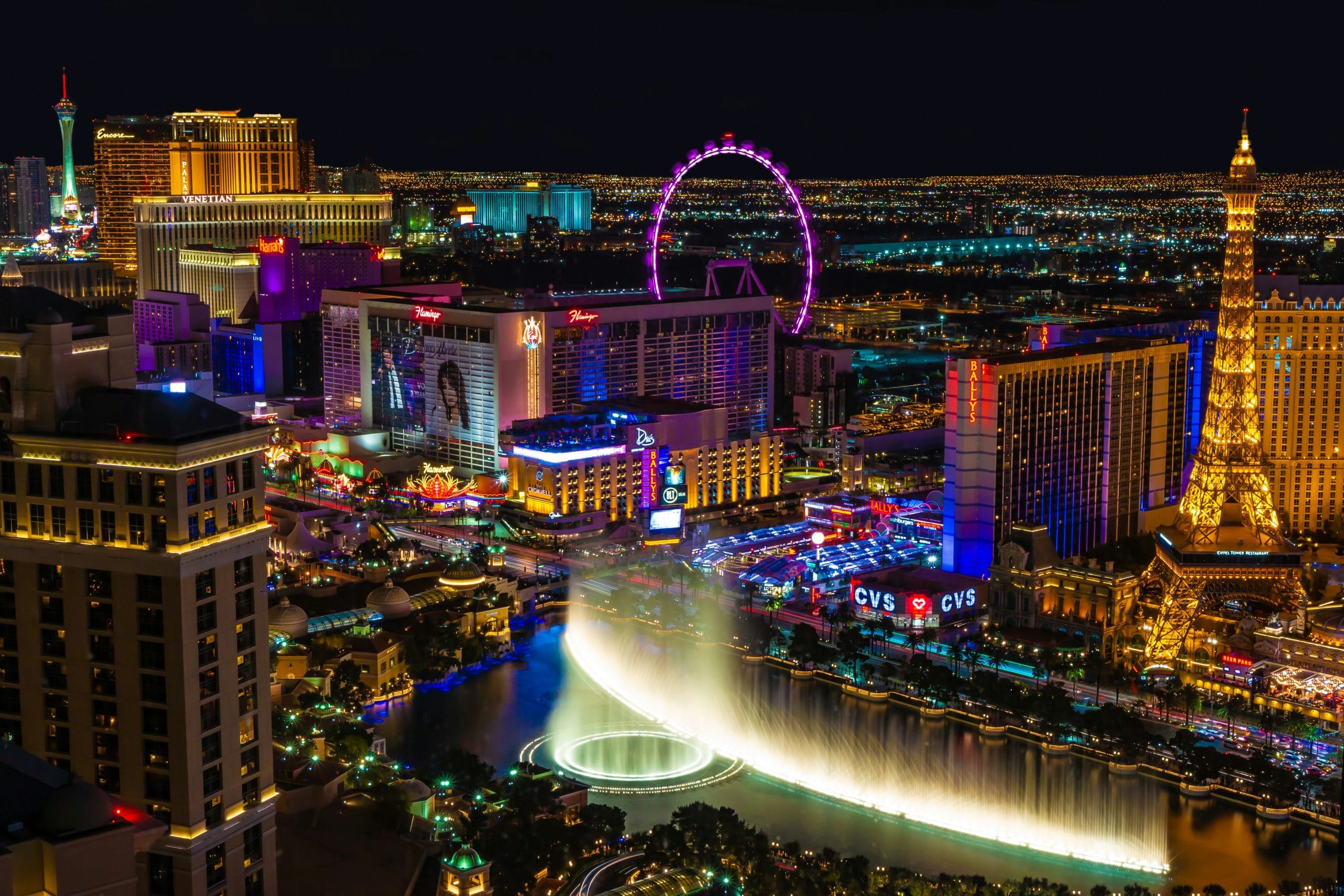
Las Vegas gets the neon.
Reno gets the Biggest Little City nickname.
But drive beyond Nevada’s cities and things get considerably stranger—and much more interesting.
We’re talking ghost towns slowly disappearing into the desert.
Alpine lakes beneath snow-covered mountains.
Wild horses.
Ancient bristlecone pines.
Hot springs.
Petroglyphs.
Mining towns.
Volcanic craters.
A highway dedicated to extraterrestrials.
And enough empty highway to make you wonder whether your GPS has quietly abandoned you.
The best day trips in Nevada reveal a state far more diverse than casinos and desert.
For easier trip planning, we’ve divided this guide into Nevada’s major travel regions.
Jump to a Nevada Region
Las Vegas Territory
Red rocks, Hoover Dam, Lake Mead, ghost towns and desert adventures.
Reno-Tahoe Territory
Lake Tahoe, Virginia City, Carson City, Pyramid Lake and mountain escapes.
Cowboy Country
Elko, the Ruby Mountains, Lamoille Canyon and Nevada’s ranching country.
Pony Express Territory
Great Basin, Highway 50, Ely, Austin and the Loneliest Road in America.
Pioneer Territory
Tonopah, Rhyolite, Goldfield, Area 51 country and wonderfully weird Nevada.
Then keep going for:
Nevada Ghost Towns | Scenic Drives | Hidden Gems | Family Trips | Budget Trips
Las Vegas Territory Day Trips
Vegas may be famous for what happens indoors.
Some of Nevada’s greatest attractions are waiting outside.
Red sandstone, desert mountains, the Colorado River and enormous engineering projects surround the city.
Red Rock Canyon National Conservation Area
Location: Las Vegas, Nevada
Map: Open in Google Maps
Official Site: Bureau of Land Management
Just west of Las Vegas, towering red and cream sandstone cliffs rise from the Mojave Desert.
A 13-mile scenic drive provides access to overlooks, hiking trails and climbing areas.
Best for: Hiking, scenic drives, photography and quick escapes from Vegas.
Planning tip: Timed-entry reservations are required for the Scenic Drive during certain peak-season hours from October through May.
Check current requirements before going.
Valley of Fire State Park
Location: Overton, Nevada
Map: Open in Google Maps
Official Site: Nevada State Parks
Valley of Fire looks like somebody turned the saturation setting up on the Mojave Desert.
Brilliant sandstone formations twist through a landscape containing arches, narrow passages, scenic overlooks and ancient petroglyphs.
Best for: Hiking, photography and geology.
City Unknown Tip: Summer heat here is serious.
Plan desert hiking for cooler months or early mornings and carry more water than you think you’ll need.
Hoover Dam
Location: Boulder City, Nevada
Map: Open in Google Maps
Few engineering projects define the American Southwest quite like Hoover Dam.
The massive concrete structure holds back the Colorado River between Nevada and Arizona.
Walk across the dam, visit overlooks or take a tour when available.
Best for: Engineering, history and families.
Mike O’Callaghan-Pat Tillman Memorial Bridge
Location: Hoover Dam
Map: Open in Google Maps
For one of the best views of Hoover Dam, walk onto the pedestrian section of the enormous bridge downstream.
If heights aren’t your thing?
Maybe don’t look straight down.
Boulder City
Location: Boulder City, Nevada
Map: Open in Google Maps
Built during Hoover Dam construction, Boulder City offers historic streets, museums, restaurants and easy access to Lake Mead.
Best for: History, couples and relaxed day trips.
Lake Mead National Recreation Area
Location: Boulder City, Nevada
Map: Open in Google Maps
Desert mountains surrounding enormous blue water make Lake Mead one of southern Nevada’s most dramatic landscapes.
Boating, paddling, fishing and scenic drives are popular.
Best for: Water recreation and desert scenery.
Historic Railroad Trail
Location: Boulder City/Lake Mead
Map: Open in Google Maps
The trail follows an old railroad grade through several tunnels originally constructed during the Hoover Dam era.
It’s one of the area’s best combinations of scenery and history.
Seven Magic Mountains
Location: South of Las Vegas
Map: Open in Google Maps
Brightly colored stacks of enormous boulders rise unexpectedly from the desert.
Subtle?
Not remotely.
Fun roadside stop?
Absolutely.
Best for: Photography and roadside art.
Mount Charleston
Location: Spring Mountains, Nevada
Map: Open in Google Maps
When Las Vegas feels like somebody left the oven door open, head uphill.
Higher elevations around Mount Charleston offer cooler temperatures, forest trails and mountain scenery.
Winter can bring snow.
Best for: Hiking, picnics and escaping desert heat.
Springs Preserve
Location: Las Vegas, Nevada
Map: Open in Google Maps
Gardens, museums, trails and exhibits explore the natural and cultural history of Las Vegas.
Best for: Families and Nevada history.
Neon Museum
Location: Las Vegas, Nevada
Map: Open in Google Maps
Retired signs from casinos, hotels and businesses preserve pieces of Las Vegas history.
This is where old Vegas neon goes when its Strip days are over.
Best for: Photography and Las Vegas history.
Gold Butte National Monument
Location: Northeast of Las Vegas
Map: Open in Google Maps
Red sandstone formations, cultural sites and rugged desert backcountry make Gold Butte one of southern Nevada’s wildest destinations.
Best for: Remote exploring and photography.
Planning tip: Many roads are rough and services are extremely limited.
Come prepared.
Reno-Tahoe Territory Day Trips
Northwestern Nevada swaps Mojave Desert scenery for alpine lakes, historic mining towns, mountains and high desert.
Reno
Location: Reno, Nevada
Map: Open in Google Maps
The Biggest Little City makes a convenient base for exploring western Nevada.
Walk the Truckee River, explore museums and then start heading toward the mountains.
National Automobile Museum
Location: Reno, Nevada
Map: Open in Google Maps
Classic automobiles and historic vehicles fill one of Reno’s standout museums.
Best for: Car enthusiasts and families.
Lake Tahoe
Location: Nevada-California border
Map: Open in Google Maps
Few alpine lakes have scenery quite like Tahoe.
Clear blue water sits beneath the Sierra Nevada with beaches, hiking trails, overlooks and ski areas surrounding the shoreline.
Best for: Beaches, hiking, skiing, kayaking and photography.
City Unknown Tip: Tahoe traffic and parking can become part of the adventure during busy summer weekends.
Start early.
Sand Harbor
Location: Lake Tahoe, Nevada
Map: Open in Google Maps
Clear water, giant granite boulders and mountain views make Sand Harbor one of Tahoe’s most recognizable Nevada beaches.
Best for: Swimming, kayaking and photography.
Carson City
Location: Carson City, Nevada
Map: Open in Google Maps
Nevada’s capital mixes government history with museums and easy access to Tahoe.
Explore the Capitol grounds and historic downtown.
Nevada State Museum
Location: Carson City, Nevada
Map: Open in Google Maps
Mining, natural history and Nevada culture come together in the former Carson City Mint building.
Best for: History and families.
Virginia City
Location: Virginia City, Nevada
Map: Open in Google Maps
The Comstock Lode transformed Virginia City into one of the richest mining communities in the West.
Historic buildings, wooden sidewalks and museums preserve the town’s boom-era character.
Best for: Old West history and ghost stories.
Pyramid Lake
Location: Pyramid Lake Paiute Reservation
Map: Open in Google Maps
Visitor Information: Pyramid Lake Paiute Tribe
Pyramid Lake rises from Nevada’s desert north of Reno.
The lake is entirely within the Pyramid Lake Paiute Reservation and is culturally significant to the Pyramid Lake Paiute Tribe.
Visitors must follow Tribal access rules and permit requirements.
Some culturally and environmentally sensitive areas are closed to public access.
Best for: Scenery, fishing and photography.
City Unknown Tip: Don’t rely on an old blog telling you a particular shoreline area is open.
Check current Tribal regulations before visiting.
Fort Churchill State Historic Park
Location: Silver Springs, Nevada
Map: Open in Google Maps
Adobe ruins remain from a 19th-century U.S. Army fort.
Nearby trails and Carson River scenery make it an interesting historic stop.
Washoe Lake State Park
Location: Washoe Valley, Nevada
Map: Open in Google Maps
Wide-open lake views sit beneath the Sierra Nevada and Virginia Range.
Best for: Birding, picnics and photography.
Cowboy Country Day Trips
Northern Nevada is ranching country.
But it’s also Basque country, mountain country and some of Nevada’s most spectacular alpine scenery.
Elko
Location: Elko, Nevada
Map: Open in Google Maps
Elko is the cultural center of northeastern Nevada and an excellent base for exploring the Ruby Mountains.
Cowboy culture and Basque heritage both remain important parts of the city’s identity.
Best for: Western culture, food and mountain adventures.
Northeastern Nevada Museum
Location: Elko, Nevada
Map: Open in Google Maps
Regional history, wildlife and cultural exhibits make this a worthwhile introduction to northeastern Nevada.
Lamoille Canyon
Location: Ruby Mountains, Nevada
Map: Open in Google Maps
A spectacular road climbs into a glacier-carved canyon surrounded by rugged peaks.
Wildflowers fill alpine meadows during summer.
Fall brings bursts of yellow from aspen.
Best for: Scenic drives, hiking and photography.
Ruby Mountains
Location: Near Elko, Nevada
Map: Open in Google Maps
Nevada doesn’t get enough credit for its mountains.
The Rubies fix that quickly.
Alpine lakes, hiking trails and dramatic peaks create one of Nevada’s most beautiful mountain landscapes.
Jarbidge
Location: Jarbidge, Nevada
Map: Open in Google Maps
Remote doesn’t begin to describe Jarbidge.
The tiny historic community sits deep in rugged northeastern Nevada near wilderness and mountain scenery.
Best for: Serious back-road explorers.
Planning tip: Check road conditions and fuel availability.
This isn’t the place to discover your gas light has been on for 40 miles.
Pony Express Territory Day Trips
Central Nevada is where the road trip becomes the adventure.
U.S. Highway 50 crosses mountain range after mountain range through what became famous as the Loneliest Road in America.
Lonely?
Maybe.
Boring?
Not even close.
Highway 50: The Loneliest Road in America
Location: Central Nevada
Map: Open in Google Maps
Highway 50 crosses Nevada through huge valleys, mountain passes, mining towns and historic Pony Express country.
Best for: Classic road trips, photography and people who enjoy empty highways.
Ely
Location: Ely, Nevada
Map: Open in Google Maps
Ely combines mining history, murals and one of America’s great historic railroads.
It also makes an excellent base for Great Basin National Park.
Nevada Northern Railway
Location: Ely, Nevada
Map: Open in Google Maps
Historic locomotives still operate from this remarkably preserved railroad complex.
Best for: Trains, history and families.
Great Basin National Park
Location: Baker, Nevada
Map: Open in Google Maps
Official Site: National Park Service
Great Basin National Park protects an extraordinary slice of Nevada.
Ancient bristlecone pines.
Mountain lakes.
Dark skies.
Wheeler Peak.
And an entire underground world.
Best for: Hiking, stargazing, caves and mountain scenery.
City Unknown Tip: Great Basin deserves more than a rushed stop.
It may look close to something on the Nevada map.
It isn’t.
Nothing is.
Lehman Caves
Location: Great Basin National Park
Map: Open in Google Maps
Guided tours explore a spectacular limestone cave beneath Great Basin National Park.
Planning tip: Cave tours require reservations and can fill well in advance.
Book before making the long drive.
Wheeler Peak Scenic Drive
Location: Great Basin National Park
Map: Open in Google Maps
The road climbs from desert terrain into high-elevation forest and mountain country.
Snow makes the upper road seasonal.
Ward Charcoal Ovens State Historic Park
Location: Near Ely, Nevada
Map: Open in Google Maps
Six enormous beehive-shaped stone ovens remain from Nevada’s mining era.
They’re among the state’s most photogenic historic oddities.
Cave Lake State Park
Location: Near Ely, Nevada
Map: Open in Google Maps
Mountain scenery, hiking and fishing make Cave Lake a relaxing companion trip to Ely and Great Basin country.
Eureka
Location: Eureka, Nevada
Map: Open in Google Maps
Historic buildings from Nevada’s mining era line this tiny Highway 50 community.
It’s exactly the kind of place worth stopping when the itinerary says:
“Drive another three hours.”
Austin
Location: Austin, Nevada
Map: Open in Google Maps
Austin clings to the side of the Toiyabe Range along Highway 50.
Historic buildings, mountain scenery and nearby hot springs make it one of Nevada’s great little road-trip towns.
Spencer Hot Springs
Location: Near Austin, Nevada
Map: Open in Google Maps
Natural hot springs sit amid enormous Basin and Range scenery.
Important: Conditions at undeveloped hot springs can change.
Water may be dangerously hot, roads can become rough and facilities may be nonexistent.
Test water carefully and pack out everything you bring.
Sand Mountain Recreation Area
Location: Near Fallon, Nevada
Map: Open in Google Maps
An enormous sand dune rises dramatically from the desert east of Fallon.
Best for: Off-highway recreation, photography and unusual landscapes.
Pioneer Territory Day Trips
This is the Nevada for travelers who think normal road trips could use more ghosts, aliens, mining ruins and strange desert art.
We agree.
Tonopah
Location: Tonopah, Nevada
Map: Open in Google Maps
Once one of Nevada’s great mining boomtowns, Tonopah preserves its history through historic buildings and mining sites.
Then there’s the clown motel.
We’ll get there.
Tonopah Historic Mining Park
Location: Tonopah, Nevada
Map: Open in Google Maps
Old mining structures overlook Tonopah from the hills where silver discoveries helped launch the town.
Best for: Mining history.
Clown Motel
Location: Tonopah, Nevada
Map: Open in Google Maps
Imagine a motel.
Now add hundreds of clowns.
Then place it beside an old cemetery in the Nevada desert.
There.
That’s the Clown Motel.
Sleep well.
Best for: Weird Nevada and questionable bedtime decisions.
Goldfield
Location: Goldfield, Nevada
Map: Open in Google Maps
Historic buildings and mining remnants survive from Goldfield’s boom years.
Best for: Ghost-town enthusiasts and photography.
International Car Forest of the Last Church
Location: Goldfield, Nevada
Map: Open in Google Maps
Cars and buses rise vertically from the desert, many covered in artwork.
It’s part junkyard.
Part outdoor gallery.
Part “What exactly am I looking at?”
Perfect Nevada.
Rhyolite Ghost Town
Location: Beatty, Nevada
Map: Open in Google Maps
Ruins from an early-20th-century mining boom sit abandoned near Death Valley.
The remains include old walls, railroad infrastructure and the famous Bottle House.
Best for: Ghost towns and photography.
Goldwell Open Air Museum
Location: Rhyolite, Nevada
Map: Open in Google Maps
Outdoor sculptures rise from the desert beside Rhyolite.
Ghostly figures and surreal artwork make Goldwell one of Nevada’s strangest cultural stops.
Beatty
Location: Beatty, Nevada
Map: Open in Google Maps
Beatty is a classic Nevada desert town and a useful base for Rhyolite and Death Valley.
And yes.
Wild burros occasionally wander around.
They remain wild animals.
Don’t feed them.
Extraterrestrial Highway
Location: Nevada State Route 375
Map: Open in Google Maps
State Route 375 became famous for its proximity to Area 51 and decades of UFO folklore.
The highway crosses an exceptionally empty section of Nevada.
Best for: Roadside weirdness and road-trip bragging rights.
Rachel
Location: Rachel, Nevada
Map: Open in Google Maps
Tiny Rachel became the unofficial center of Nevada’s UFO tourism.
Stop for alien-themed roadside attractions and continue along the Extraterrestrial Highway.
Important: Area 51 itself is an active military installation.
Do not cross restricted boundaries.
No photograph is worth meeting federal security personnel.
Lunar Crater
Location: Central Nevada
Map: Open in Google Maps
An enormous volcanic crater sits amid a landscape so barren NASA once used the general area for astronaut training.
Best for: Geology, photography and very lonely road trips.
Berlin-Ichthyosaur State Park
Location: Gabbs area, Nevada
Map: Open in Google Maps
This is peak Nevada.
On one side:
A historic mining ghost town.
On the other:
Fossils of enormous marine reptiles that lived when much of the region was covered by ocean.
Ghost town plus prehistoric sea monsters.
Good luck topping that.
Best for: Fossils, history and hidden gems.
Best Nevada Ghost Town Day Trips
Nevada has hundreds of abandoned or semi-abandoned mining settlements.
Some of the best road-trip options include:
Rhyolite
Berlin
Goldfield
Belmont
Nelson
Silver City
Gold Hill
But remember:
“Ghost town” does not automatically mean public property.
Respect signs, fences and private land.
Never enter unstable mine shafts or collapsing structures.
Ghost towns are considerably less charming when the road trip ends with a rescue operation.
Best Nevada Scenic Drives
Extraterrestrial Highway
Aliens optional.
Empty desert guaranteed.
Highway 50
Cross mountain ranges and enormous valleys on the Loneliest Road in America.
Lamoille Canyon Scenic Byway
Drive into the Ruby Mountains.
Lake Tahoe Scenic Drive
Alpine water and Sierra Nevada views.
Valley of Fire Scenic Drive
Brilliant sandstone landscapes northeast of Las Vegas.
Great Basin Highway
Explore eastern Nevada between Las Vegas and Great Basin country.
Hidden Gems Worth the Nevada Detour
Nevada gets delightfully strange once you leave the main highways.
Try:
Goldwell Open Air Museum
Surreal desert artwork beside a ghost town.
International Car Forest
Automobiles turned into desert sculpture.
Lunar Crater
Volcanic Nevada at its loneliest.
Ward Charcoal Ovens
Massive stone ovens left behind by mining history.
Berlin-Ichthyosaur
Ghost town meets prehistoric sea monsters.
Jarbidge
A tiny historic town surrounded by wilderness.
Spencer Hot Springs
Remote soaking beneath Nevada’s enormous sky.
Ash Meadows National Wildlife Refuge
Location: Amargosa Valley, Nevada
Map: Open in Google Maps
Bright desert springs and extraordinarily rare wildlife survive in an unexpected Mojave oasis.
Best for: Wildlife, photography and nature.
Best Nevada Day Trips for Families
Try:
Hoover Dam
Springs Preserve
Red Rock Canyon
Valley of Fire
Lake Tahoe
Nevada Northern Railway
Great Basin National Park
Berlin-Ichthyosaur State Park
Nevada State Museum
National Automobile Museum
Nevada Day Trips for Couples
Try:
Lake Tahoe for alpine scenery.
Virginia City for history.
Boulder City for a relaxed small-town afternoon.
Valley of Fire for sunset scenery.
Great Basin for stargazing.
Lamoille Canyon for mountains.
Highway 50 for the ultimate empty-road adventure.
Budget-Friendly Nevada Day Trips
Nevada can be surprisingly inexpensive once you get away from the casino floor.
Consider:
- Scenic highways
- Ghost towns
- Historic downtowns
- Public lands
- Desert overlooks
- Hiking trails
- Roadside art
- Stargazing
- Wildlife areas
- Mountain drives
Avoid relying on old articles promising “$5 admission” or “$10 per car.”
Entrance fees, permits and reservation requirements change.
Check current information before traveling.
Best Nevada Stargazing Day Trips
Nevada’s low population and enormous stretches of public land create extraordinary night skies.
Excellent areas include:
Great Basin National Park
Tonopah
Highway 50
Extraterrestrial Highway
Berlin-Ichthyosaur country
Black Rock Desert
Lunar Crater
Just remember:
A stargazing day trip becomes a night drive home.
Watch for wildlife and fatigue.
Nevada Desert Safety
Nevada’s landscapes are beautiful because they’re wild.
They’re also unforgiving.
Before exploring remote areas:
Carry plenty of water.
Keep the fuel tank comfortably above empty.
Download offline maps.
Tell someone where you’re going.
Check road conditions.
Carry a spare tire.
Watch weather forecasts.
Don’t depend on cell service.
Never enter abandoned mines.
Don’t drive across flooded desert washes.
And don’t assume a dirt road shown on a map is suitable for your vehicle.
Nevada Heat Safety
Summer temperatures in southern Nevada can become dangerous.
For desert hikes:
Start early.
Avoid strenuous midday activity.
Carry more water than you expect to use.
Protect yourself from the sun.
Know the signs of heat illness.
And turn around before you’re in trouble.
The desert will still be there tomorrow.
When Is the Best Time for a Nevada Day Trip?
Spring
One of the best seasons for southern Nevada.
Desert temperatures are pleasant and wildflowers may appear after favorable winter moisture.
Summer
Head north or uphill.
Lake Tahoe, the Ruby Mountains and higher elevations become excellent destinations.
Low-elevation southern Nevada can be dangerously hot.
Fall
Excellent statewide road-trip weather.
Crowds begin thinning and mountain landscapes start changing color.
Winter
Southern Nevada becomes prime hiking territory.
Northern and mountain destinations shift toward snow sports and winter recreation.
Always check mountain-road conditions.
How to Plan a Better Nevada Day Trip
Nevada is huge.
And Nevada roads have a habit of looking deceptively short on maps.
Good combinations include:
Las Vegas → Red Rock Canyon
Las Vegas → Valley of Fire
Las Vegas → Hoover Dam → Boulder City
Reno → Virginia City
Reno → Lake Tahoe
Reno → Pyramid Lake
Elko → Lamoille Canyon
Ely → Great Basin
Ely → Ward Charcoal Ovens
Tonopah → Goldfield
Beatty → Rhyolite → Goldwell
Rachel → Extraterrestrial Highway
Don’t try:
Las Vegas → Great Basin → Las Vegas as a casual little outing.
Can you drive it?
Sure.
Would we call that relaxing?
Absolutely not.
One Nevada Road-Trip Rule Worth Remembering
Never pass a gas station in remote Nevada while thinking:
“I’ll just stop at the next one.”
You may eventually find the next one.
Eventually.
Nevada rewards people who plan ahead.
Fill the tank.
Grab water.
Download your map.
Then go find the weird stuff.
Find Your Next Nevada Adventure
See Hoover Dam.
Explore Lake Tahoe.
Hike Red Rock Canyon.
Drive through Valley of Fire.
Those are the classics.
Then start looking for Nevada’s stranger side.
Find the ghost town.
Drive the Loneliest Road.
Visit the clown motel.
See the cars sticking out of the desert.
Stand beneath ancient bristlecone pines.
Look for stars over Great Basin.
Drive the Extraterrestrial Highway.
And if something unusual appears in the night sky?
We’re travel bloggers.
You’re going to have to handle that investigation yourself.
More Nevada Adventures from City Unknown
Continue exploring the Silver State:
Nevada Hidden Gems — Discover ghost towns, hot springs, desert art and unusual landscapes.
Nevada Local Eats — Find Basque restaurants, small-town diners and local favorites.
Nevada Ghost Town Road Trip — Explore Rhyolite, Berlin, Goldfield, Belmont and more.
Nevada Highway 50 Road Trip — Drive the Loneliest Road in America.
Nevada Extraterrestrial Highway Road Trip — Follow UFO history through Rachel and central Nevada.
Nevada Small Towns — Discover Virginia City, Ely, Tonopah, Austin, Beatty and more.
Nevada Scenic Drives — Explore Lake Tahoe, Lamoille Canyon and Nevada’s empty highways.
Nevada Weird & Unusual Places — Find aliens, clowns, ghost sculptures and cars standing in the desert.
City Unknown Tip
Nevada’s famous attractions are famous for a reason.
See Lake Tahoe.
See Hoover Dam.
Drive through Valley of Fire.
But don’t stop there.
Nevada gets better when the traffic disappears.
Take Highway 50.
Explore the old mining town.
Pull over for the weird roadside art.
Watch the sunset in a valley where you can’t see another building.
Stay long enough for the stars.
And when you see a highway sign that says:
NEXT SERVICES 100+ MILES
Check the gas gauge.
Then keep exploring.