
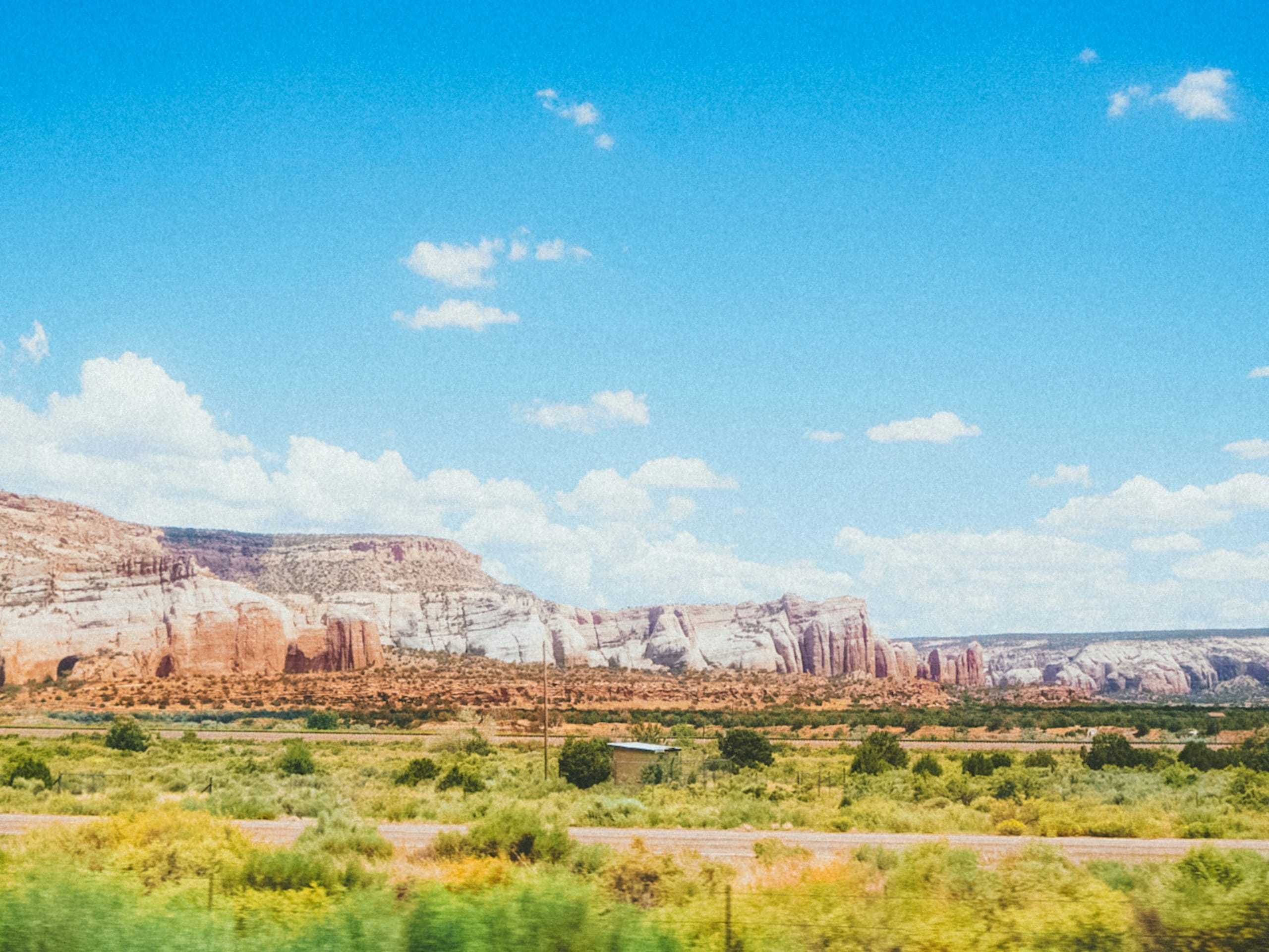
New Mexico doesn’t exactly ease you into things.
One minute you’re driving across an enormous desert.
The next you’re standing beneath a 13,000-foot mountain.
Then somebody points you toward an ancient Pueblo community, a volcanic crater, an alien museum, a turquoise-colored swimming hole, an underground cavern or a highway where the sunset appears to stretch halfway to Texas.
Welcome to the Land of Enchantment.
The best day trips in New Mexico aren’t simply sightseeing excursions. They’re journeys through thousands of years of human history, living Native cultures, Spanish colonial communities, Old West towns, Route 66 nostalgia and some of the strangest geology in America.
And yes.
There are aliens.
We’ll get there.
For easier trip planning, we’ve divided this guide into New Mexico’s six travel regions.
Jump to a New Mexico Region
Northwest New Mexico
Chaco Canyon, Gallup, El Malpais, El Morro and Indigenous culture.
North Central New Mexico
Santa Fe, Taos, Bandelier, Los Alamos, mountain villages and the Rio Grande Gorge.
Northeast New Mexico
Santa Fe Trail history, Las Vegas, Tucumcari, Capulin Volcano and wide-open plains.
Central New Mexico
Albuquerque, Sandia Mountains, Jemez Springs, petroglyphs and Route 66.
Southwest New Mexico
Las Cruces, Gila Cliff Dwellings, Silver City, hot springs and volcanic landscapes.
Southeast New Mexico
White Sands, Carlsbad Caverns, Roswell, Ruidoso and Billy the Kid country.
Or jump directly to:
Scenic Drives | Hot Springs | Ghost Towns | Hidden Gems | Family Trips | Budget Trips
Northwest New Mexico Day Trips
Northwest New Mexico is a landscape of enormous skies, sandstone cliffs, volcanic terrain and places of deep cultural significance.
This is also a region where visitors need to remember something important:
Many destinations are not simply historic attractions.
They are part of living Indigenous cultures and communities.
Travel respectfully.
Chaco Culture National Historical Park
Location: Nageezi area, New Mexico
Map: Open in Google Maps
Official Site: National Park Service
Chaco Canyon preserves one of the most extraordinary concentrations of ancestral Puebloan architecture in the Southwest.
Between roughly 850 and 1250 CE, Chaco became an important cultural center connected to communities across a vast region.
Massive great houses such as Pueblo Bonito still rise from the canyon floor.
Best for: Archaeology, history, photography and stargazing.
City Unknown Tip: Chaco is not a casual roadside stop.
Access requires miles of unpaved road, conditions can become difficult or impassable after rain, services are limited and cell coverage is poor.
Check current road conditions before leaving.
Aztec Ruins National Monument
Location: Aztec, New Mexico
Map: Open in Google Maps
Official Site: National Park Service
Despite the name given to the site by 19th-century settlers, these structures were built by ancestral Pueblo people—not the Aztecs of Mexico.
A self-guided trail leads through a remarkable ancestral Pueblo great house.
Best for: Archaeology and history.
Farmington
Location: Farmington, New Mexico
Map: Open in Google Maps
Farmington makes a useful base for exploring the Four Corners region.
The surrounding landscape includes rivers, badlands, cultural sites and access to northwestern New Mexico adventures.
Bisti/De-Na-Zin Wilderness
Location: South of Farmington
Map: Open in Google Maps
Hoodoos, eroded badlands and bizarre rock formations create one of New Mexico’s strangest landscapes.
There are few developed trails.
That’s part of the attraction.
It’s also why navigation matters.
Best for: Photography, geology and experienced hikers.
Bring water, sun protection and offline navigation.
Gallup
Location: Gallup, New Mexico
Map: Open in Google Maps
Gallup sits along historic Route 66 and serves as an important gateway to the region’s Native communities.
Explore local galleries, trading posts, restaurants and cultural attractions.
Best for: Route 66, art and regional culture.
El Morro National Monument
Location: Near Ramah, New Mexico
Map: Open in Google Maps
Official Site: National Park Service
A dependable water source attracted travelers to this sandstone bluff for centuries.
Ancestral Pueblo petroglyphs and later inscriptions document generations of people passing through the landscape.
Best for: History, hiking and archaeology.
El Malpais National Monument
Location: Grants, New Mexico
Map: Open in Google Maps
Official Site: National Park Service
Vast lava flows, lava tubes, sandstone cliffs and volcanic features cover this remarkable landscape.
Best for: Geology, hiking and photography.
Grants
Location: Grants, New Mexico
Map: Open in Google Maps
Route 66 history and the surrounding volcanic landscape make Grants a useful base for El Malpais and Mount Taylor country.
Acoma Pueblo
Location: West of Albuquerque
Map: Open in Google Maps
Acoma Pueblo is a living Pueblo community with centuries of history atop a dramatic mesa.
Visits should be approached as visits to a living community—not as wandering through an archaeological attraction.
Follow current Pueblo rules regarding tours, access and photography.
Best for: Cultural learning and history.
North Central New Mexico Day Trips
If New Mexico has a greatest-hits region, this might be it.
Santa Fe.
Taos.
Bandelier.
Georgia O’Keeffe country.
Mountain villages.
The Rio Grande Gorge.
Historic churches.
Hot springs.
And roads where pulling over for “one quick picture” becomes an all-day activity.
Santa Fe
Location: Santa Fe, New Mexico
Map: Open in Google Maps
Adobe architecture, museums, galleries, restaurants and centuries of layered history make Santa Fe one of America’s most distinctive small cities.
Explore the Plaza, Canyon Road and the city’s museums.
Best for: Art, history, food and couples.
Meow Wolf Santa Fe
Location: Santa Fe, New Mexico
Map: Open in Google Maps
The House of Eternal Return mixes immersive art, hidden passages and interactive storytelling.
Explaining it beforehand is difficult.
That’s kind of the point.
Best for: Families, art and people who enjoy opening suspicious-looking doors.
Bandelier National Monument
Location: Near Los Alamos
Map: Open in Google Maps
Official Site: National Park Service
Trails wind through Frijoles Canyon past ancestral Pueblo structures, petroglyphs and dwellings built into volcanic cliffs.
Best for: Hiking, archaeology and families.
Planning tip: Parking and seasonal shuttle operations can change with visitation levels.
Check current transportation information before arriving.
Los Alamos
Location: Los Alamos, New Mexico
Map: Open in Google Maps
Los Alamos is closely associated with the Manhattan Project and the development of the first atomic weapons.
Museums and historic sites explore the scientific, military and human history surrounding the project.
The history deserves thoughtful treatment—including the consequences of nuclear weapons and the communities affected by the project.
Valles Caldera National Preserve
Location: Jemez Mountains
Map: Open in Google Maps
Official Site: National Park Service
An enormous volcanic caldera spreads across the Jemez Mountains.
Elk herds, mountain meadows, forests and volcanic landscapes make this one of northern New Mexico’s most beautiful destinations.
Best for: Wildlife, hiking and photography.
Jemez Springs
Location: Jemez Springs, New Mexico
Map: Open in Google Maps
Red rock, hot springs and mountain scenery surround this little community along the Jemez Mountain Trail.
Best for: Scenic drives and relaxation.
Taos
Location: Taos, New Mexico
Map: Open in Google Maps
Taos combines art, mountain scenery and a complex cultural history shaped by Indigenous, Hispano and Anglo communities.
Explore galleries, museums and the historic district before heading toward the mountains.
Taos Pueblo
Location: Taos, New Mexico
Map: Open in Google Maps
Taos Pueblo is a living Indigenous community and UNESCO World Heritage Site.
Its multistory adobe buildings are among the most recognizable structures in the Southwest.
Visitors should follow current Pueblo rules concerning access, ceremonies and photography.
City Unknown Tip: Don’t treat Pueblo communities as museum exhibits.
People live here.
Respect privacy, closures, cultural rules and photography restrictions.
Rio Grande Gorge Bridge
Location: Near Taos
Map: Open in Google Maps
The bridge spans a dramatic gorge carved by the Rio Grande.
Overlooks provide some of northern New Mexico’s most impressive roadside views.
Best for: Photography and scenic drives.
High Road to Taos
Location: Santa Fe to Taos
Map: Open in Google Maps
This scenic route winds through historic mountain communities including Chimayó and Truchas.
Churches, galleries and enormous Sangre de Cristo Mountain views turn the drive itself into the destination.
Chimayó
Location: Chimayó, New Mexico
Map: Open in Google Maps
The community is famous for traditional weaving, regional food and the Santuario de Chimayó, an important pilgrimage destination.
Visit respectfully, particularly during religious observances.
Abiquiú
Location: Abiquiú, New Mexico
Map: Open in Google Maps
Colorful cliffs and high-desert landscapes surround the area famously associated with artist Georgia O’Keeffe.
Ghost Ranch
Location: Abiquiú, New Mexico
Map: Open in Google Maps
Red and yellow cliffs rise dramatically above this famous northern New Mexico landscape.
Hiking and educational programs provide ways to explore the property.
Best for: Photography, art lovers and geology.
Enchanted Circle Scenic Byway
Location: Taos area
Map: Open in Google Maps
The loop connects Taos with mountain communities including Red River, Eagle Nest and Angel Fire.
Best for: Fall foliage, mountain scenery and road trips.
Northeast New Mexico Day Trips
Northeastern New Mexico is where the Rocky Mountains begin giving way to the Great Plains.
The result?
Volcanoes.
Old Santa Fe Trail towns.
Route 66 neon.
Mountain drives.
And enough open sky to make your car feel very small.
Las Vegas, New Mexico
Location: Las Vegas, New Mexico
Map: Open in Google Maps
No.
Not that Las Vegas.
This one predates Nevada’s casino city and contains an impressive collection of historic architecture.
The Plaza, railroad district and surrounding buildings make it one of New Mexico’s most underrated historic towns.
Best for: Architecture, history and small-town exploring.
Pecos National Historical Park
Location: Pecos, New Mexico
Map: Open in Google Maps
Official Site: National Park Service
Pecos preserves a landscape shaped by Pueblo communities, Spanish colonization, the Santa Fe Trail and Civil War history.
Best for: History and archaeology.
Fort Union National Monument
Location: Watrous, New Mexico
Map: Open in Google Maps
Adobe ruins rise from the plains along the historic Santa Fe Trail.
The surrounding landscape gives the site an enormous sense of scale.
Capulin Volcano National Monument
Location: Capulin, New Mexico
Map: Open in Google Maps
Official Site: National Park Service
A road climbs the slopes of this extinct cinder-cone volcano.
Trails explore the rim and crater while overlooks stretch across northeastern New Mexico.
Best for: Geology, families and panoramic views.
Sugarite Canyon State Park
Location: Raton, New Mexico
Map: Open in Google Maps
Lakes, forest and mountain trails make Sugarite Canyon a beautiful contrast to the surrounding plains.
Tucumcari
Location: Tucumcari, New Mexico
Map: Open in Google Maps
Neon signs, murals and surviving motels make Tucumcari one of New Mexico’s classic Route 66 stops.
Best for: Roadside Americana and photography.
Stay until the neon comes on.
That’s when Tucumcari starts showing off.
Santa Rosa
Location: Santa Rosa, New Mexico
Map: Open in Google Maps
Route 66 history and natural springs make Santa Rosa worth more than a fuel stop.
Blue Hole
Location: Santa Rosa, New Mexico
Map: Open in Google Maps
Deep, remarkably clear blue water rises from an artesian spring.
The site is especially popular with scuba divers.
Best for: Swimming, diving and photography.
Follow current access and safety rules before entering the water.
Central New Mexico Day Trips
Albuquerque anchors central New Mexico, but this region quickly transitions from city streets to volcanoes, petroglyphs, mountain forests and historic Route 66 communities.
Albuquerque
Location: Albuquerque, New Mexico
Map: Open in Google Maps
Old Town, museums, Route 66, local restaurants and the Sandia Mountains give Albuquerque plenty to fill an entire day.
And yes.
There are places associated with Breaking Bad.
Please remember they’re real businesses and homes.
Behave yourself.
Sandia Peak Tramway
Location: Albuquerque, New Mexico
Map: Open in Google Maps
The tram climbs from the edge of Albuquerque toward the crest of the Sandia Mountains.
Views stretch across the Rio Grande Valley and surrounding desert.
Best for: Families, couples and photography.
Weather can affect operations.
Check before leaving.
Petroglyph National Monument
Location: Albuquerque, New Mexico
Map: Open in Google Maps
Official Site: National Park Service
Thousands of images carved into volcanic rock preserve cultural expressions created by Native peoples and later Spanish settlers.
Many hold ongoing cultural and spiritual importance.
Best for: Hiking, archaeology and history.
Look.
Learn.
Photograph respectfully where permitted.
Don’t touch.
Old Town Albuquerque
Location: Albuquerque
Map: Open in Google Maps
Historic adobe buildings, restaurants, galleries and museums surround the plaza.
It’s touristy.
It’s also worth exploring.
Both things can be true.
Corrales
Location: Corrales, New Mexico
Map: Open in Google Maps
Farms, wineries and quiet roads give Corrales a rural feel just outside Albuquerque.
Best for: Food, couples and relaxed afternoons.
Madrid
Location: Madrid, New Mexico
Map: Open in Google Maps
This former mining town reinvented itself as an arts community filled with galleries, shops and colorful characters.
Best for: Art, food and quirky road trips.
Turquoise Trail
Location: Albuquerque to Santa Fe
Map: Open in Google Maps
The scenic route through Madrid and Cerrillos makes a much more interesting alternative to simply racing up the interstate.
Tinkertown Museum
Location: Sandia Park, New Mexico
Map: Open in Google Maps
Hand-carved miniature scenes, folk art and collections of wonderfully strange objects fill this unusual roadside museum.
Best for: Families and lovers of weird roadside attractions.
Salinas Pueblo Missions National Monument
Location: Central New Mexico
Map: Open in Google Maps
Official Site: National Park Service
The monument preserves Pueblo communities and Spanish mission sites at Abó, Gran Quivira and Quarai.
The story here includes Indigenous life, Spanish colonization, religion, conflict and cultural change.
It’s more complicated—and more interesting—than simply “old mission ruins.”
Southwest New Mexico Day Trips
Southwestern New Mexico is road-trip country.
Volcanic formations.
Old mining towns.
Hot springs.
Mountain wilderness.
Ancient dwellings.
Chile fields.
And stretches of highway where your playlist may run out before the scenery does.
Las Cruces
Location: Las Cruces, New Mexico
Map: Open in Google Maps
Las Cruces sits beneath the jagged Organ Mountains and makes an excellent base for southern New Mexico adventures.
Best for: Food, hiking and history.
Historic Mesilla
Location: Mesilla, New Mexico
Map: Open in Google Maps
Adobe buildings surround a historic plaza filled with shops and restaurants.
The town’s history includes the territorial era and stories associated with Billy the Kid.
Best for: Food, architecture and history.
Organ Mountains–Desert Peaks National Monument
Location: Las Cruces area
Map: Open in Google Maps
Jagged mountain peaks rise dramatically from the Chihuahuan Desert.
Hiking, archaeological sites and historic landscapes make this one of southern New Mexico’s great outdoor destinations.
Dripping Springs Natural Area
Location: Las Cruces
Map: Open in Google Maps
A trail leads toward historic ruins beneath the Organ Mountains.
Best for: Hiking, history and mountain views.
Truth or Consequences
Location: Truth or Consequences, New Mexico
Map: Open in Google Maps
Yes.
That’s really the name.
The town was originally called Hot Springs before famously changing its name in 1950 after a radio program.
Today its mineral baths remain the main attraction.
Best for: Hot springs and couples.
Elephant Butte Lake State Park
Location: Elephant Butte, New Mexico
Map: Open in Google Maps
New Mexico’s largest reservoir provides boating, fishing and shoreline recreation.
Water levels vary.
Check current conditions.
Spaceport America
Location: Near Truth or Consequences
Map: Open in Google Maps
Commercial spaceflight facilities rise unexpectedly from the Jornada del Muerto desert.
Public access is controlled, so arrange tours through authorized operators rather than simply driving toward the facility.
Best for: Space enthusiasts.
City of Rocks State Park
Location: Faywood, New Mexico
Map: Open in Google Maps
Volcanic rock formations create natural corridors resembling streets through a stone city.
Best for: Families, geology and stargazing.
Silver City
Location: Silver City, New Mexico
Map: Open in Google Maps
Historic buildings, art galleries and access to the Gila wilderness make Silver City one of southwestern New Mexico’s best bases.
Gila Cliff Dwellings National Monument
Location: Gila National Forest
Map: Open in Google Maps
Official Site: National Park Service
Mogollon people built dwellings inside natural caves here during the late 1200s.
A trail climbs into the canyon toward the archaeological site.
Best for: Archaeology, hiking and history.
City Unknown Tip: The drive is beautiful.
It is also slow and winding.
Gila Cliff Dwellings looks much closer on a map than it feels behind the steering wheel.
Give yourself time.
Gila Wilderness
Location: Southwestern New Mexico
Map: Open in Google Maps
Designated in 1924, the Gila became America’s first administratively designated wilderness.
It remains a vast landscape of mountains, forest, rivers and remote trails.
Lake Valley Ghost Town
Location: Near Hillsboro, New Mexico
Map: Open in Google Maps
Remnants of a silver-mining settlement survive along a lonely desert road.
Best for: Ghost towns and photography.
Follow current access rules and stay out of closed structures and mine workings.
Southeast New Mexico Day Trips
Southeastern New Mexico apparently couldn’t decide on one personality.
So it chose:
White dunes.
Enormous caves.
Mountain forests.
Old West outlaws.
Bottomless-looking lakes.
And extraterrestrials.
Seems reasonable.
White Sands National Park
Location: Near Alamogordo
Map: Open in Google Maps
Official Site: National Park Service
Brilliant gypsum dunes stretch across the Tularosa Basin, creating one of America’s most surreal landscapes.
Walk the dunes.
Bring a sled.
Stay for sunset.
Then spend three weeks finding white sand in your car.
Best for: Families, photography and hiking.
Planning tip: Missile testing at nearby White Sands Missile Range can occasionally cause temporary road or park closures.
Check current conditions before leaving.
Alamogordo
Location: Alamogordo, New Mexico
Map: Open in Google Maps
Alamogordo makes the natural base for White Sands and Cloudcroft.
The New Mexico Museum of Space History adds a completely different dimension to the trip.
Cloudcroft
Location: Cloudcroft, New Mexico
Map: Open in Google Maps
Climb from desert into cool mountain forest in surprisingly little time.
At roughly 8,600 feet in elevation, Cloudcroft provides hiking, mountain scenery and an escape from summer heat.
Best for: Hiking and summer escapes.
Three Rivers Petroglyph Site
Location: Near Tularosa
Map: Open in Google Maps
Thousands of petroglyphs cover volcanic rocks along the trail.
These cultural resources deserve protection.
Look.
Photograph respectfully.
Never touch, trace, chalk or alter petroglyphs.
Valley of Fires Recreation Area
Location: Carrizozo, New Mexico
Map: Open in Google Maps
A vast lava flow spreads across the desert west of Carrizozo.
A developed trail provides an easy introduction to the volcanic landscape.
Ruidoso
Location: Ruidoso, New Mexico
Map: Open in Google Maps
Pine forest and mountain scenery make Ruidoso feel worlds away from the desert below.
Best for: Mountain getaways, hiking and winter trips.
Always check current wildfire, weather and road conditions before traveling into mountain areas.
Lincoln Historic Site
Location: Lincoln, New Mexico
Map: Open in Google Maps
Historic buildings preserve the setting of the Lincoln County War and stories associated with Billy the Kid.
Best for: Old West history.
Roswell
Location: Roswell, New Mexico
Map: Open in Google Maps
Roswell has embraced its extraterrestrial reputation with impressive enthusiasm.
Alien murals.
Alien streetlights.
Alien gift shops.
Alien museums.
Probably alien coffee mugs.
The city also offers museums, regional history and nearby wildlife destinations.
Best for: Families, roadside weirdness and UFO enthusiasts.
International UFO Museum and Research Center
Location: Roswell, New Mexico
Map: Open in Google Maps
Exhibits explore the famous 1947 Roswell incident and the broader history of UFO culture.
Whether you leave convinced is entirely between you and the universe.
Bitter Lake National Wildlife Refuge
Location: Roswell, New Mexico
Map: Open in Google Maps
Wetlands surrounded by desert provide habitat for birds and other wildlife.
Best for: Birding and photography.
Bottomless Lakes State Park
Location: Roswell, New Mexico
Map: Open in Google Maps
Deep sinkholes filled with water create a series of striking lakes east of Roswell.
They’re not actually bottomless.
Sorry.
Still pretty cool.
Carlsbad Caverns National Park
Location: Carlsbad, New Mexico
Map: Open in Google Maps
Official Site: National Park Service
Carlsbad Caverns contains an enormous underground landscape of chambers, stalactites, stalagmites and other cave formations.
Walking through the Natural Entrance into the cavern is one of the Southwest’s unforgettable experiences.
Best for: Families, geology and bucket-list trips.
Planning tip: Timed-entry reservations are required to enter Carlsbad Cavern.
Reserve before making the drive.
Carlsbad Caverns Bat Flight
During the warmer season, large numbers of Brazilian free-tailed bats may emerge from the natural entrance around sunset.
The exact timing and number of bats are determined by nature.
Not our editorial calendar.
Check current park information before planning specifically around the flight.
Fort Sumner
Location: Fort Sumner, New Mexico
Map: Open in Google Maps
Fort Sumner is closely associated with Billy the Kid.
But the area’s history goes much deeper.
Nearby Bosque Redondo Memorial addresses the forced removal and incarceration of thousands of Diné (Navajo) and Mescalero Apache people during the 1860s.
That history deserves far more than a quick roadside mention.
Bosque Redondo Memorial
Location: Fort Sumner, New Mexico
Map: Open in Google Maps
The memorial tells the story of the Long Walk and forced confinement of Diné and Mescalero Apache people at Bosque Redondo.
Visit respectfully and give the exhibits the time they deserve.
Best Scenic Drives in New Mexico
New Mexico may be one of America’s best states for driving without caring much about the destination.
High Road to Taos
Historic villages, churches and mountain scenery.
Enchanted Circle Scenic Byway
Taos, Red River, Eagle Nest and Sangre de Cristo Mountain views.
Turquoise Trail
Take the scenic road between Albuquerque and Santa Fe through Madrid and Cerrillos.
Jemez Mountain Trail
Red cliffs, hot springs, Valles Caldera and mountain forests.
Trail of the Mountain Spirits
Explore Silver City and Gila country.
Billy the Kid Scenic Byway
Mountain towns and Old West history around Lincoln County.
Route 66
Follow neon, motels, diners and roadside Americana across New Mexico.
New Mexico Hot Springs Day Trips
New Mexico has a long tradition of soaking in geothermal waters.
Popular areas include:
Truth or Consequences
Jemez Springs
Ojo Caliente
Faywood Hot Springs
Gila country
Some springs are developed commercial facilities.
Others are remote natural pools.
Never assume a hot spring is safe or legally accessible simply because somebody geotagged it online.
Check current access.
Respect private property.
Test water temperatures.
And don’t leave trash behind.
Best New Mexico Ghost Town Day Trips
Mining, railroads and shifting highways left abandoned communities scattered across New Mexico.
Interesting stops include:
Lake Valley
Mogollon
Shakespeare
Chloride
Madrid — very much alive today, but with mining-town roots.
Kelly
Cuervo
Ghost towns can include private property, unstable structures and abandoned mines.
Stay on legal access routes.
Never enter old mine shafts.
Ghost hunting is significantly less entertaining when search and rescue gets involved.
Hidden Gems Worth the New Mexico Detour
Bisti/De-Na-Zin Wilderness
Otherworldly badlands in northwestern New Mexico.
Tinkertown Museum
One man’s wonderfully eccentric collection in the Sandia Mountains.
City of Rocks
A natural maze of volcanic stone.
Valley of Fires
An enormous lava flow in the middle of the desert.
Lake Valley
Old mining history on a lonely desert road.
El Morro
Centuries of travelers left their marks beside an ancient water source.
Ojito Wilderness
Colorful badlands and hoodoos northwest of Albuquerque.
Pie Town
Location: Pie Town, New Mexico
Map: Open in Google Maps
It’s a town.
Famous for pie.
Sometimes travel really is that straightforward.
Very Large Array
Location: Plains of San Agustin
Map: Open in Google Maps
Enormous radio antennas spread across the high desert.
Best for: Science, photography and space enthusiasts.
And no, they aren’t listening for Roswell aliens.
Probably.
Best New Mexico Day Trips for Families
Try:
White Sands National Park
Carlsbad Caverns
Meow Wolf Santa Fe
Sandia Peak Tramway
Bandelier National Monument
New Mexico Museum of Space History
Roswell
City of Rocks State Park
Petroglyph National Monument
Capulin Volcano
Tinkertown Museum
City Unknown Tip: New Mexico elevations can surprise visitors.
Santa Fe sits above 7,000 feet, and many mountain destinations climb considerably higher.
Drink water, use sunscreen and give yourself time to adjust.
Romantic New Mexico Day Trips
For couples, try:
Santa Fe for art and food.
Taos for mountain scenery.
Abiquiú for dramatic desert landscapes.
Truth or Consequences for hot springs.
Turquoise Trail for a slow road trip.
Jemez Springs for mountain relaxation.
Silver City for galleries and historic streets.
Ojo Caliente for a soak.
Budget-Friendly New Mexico Day Trips
New Mexico’s enormous public landscapes make it possible to build excellent trips without spending heavily.
Consider:
- Scenic drives
- Historic downtowns
- Route 66 stops
- Hiking trails
- National monuments
- Wildlife refuges
- Public lands
- Petroglyph sites
- Ghost towns
- Volcanic landscapes
- Scenic overlooks
- Picnic areas
Fees and access policies change.
Avoid planning around old “$5 admission” or “free entry” claims without checking the destination first.
Native American Cultural Sites in New Mexico
Some of New Mexico’s most meaningful destinations are associated with Pueblo, Diné, Apache and other Native communities.
That requires a different kind of travel mindset.
These are not simply ancient cultures frozen in time.
They’re living communities.
When visiting:
Follow community-specific rules.
Respect closures.
Ask before photographing people.
Never photograph ceremonies unless explicitly permitted.
Don’t enter restricted areas.
Don’t remove pottery fragments, stones or artifacts.
Respect religious and cultural sites.
And don’t assume every Pueblo has the same visitor policies.
A respectful traveler gets a much richer experience.
New Mexico Route 66 Day Trips
Historic Route 66 once carried travelers across New Mexico between Chicago and Los Angeles.
Today you can still find traces in:
Tucumcari
Santa Rosa
Albuquerque
Grants
Gallup
Look for neon signs, old motels, diners, murals and roadside architecture.
The best time to photograph Route 66?
Right around sunset when the neon begins glowing.
Best New Mexico Fall Day Trips
Fall brings golden aspens to New Mexico’s mountains.
Try:
Enchanted Circle
Taos Ski Valley
Red River
Santa Fe National Forest
Jemez Mountains
Chama
Cloudcroft
Gila Mountains
Peak color varies by elevation and weather.
Check current foliage reports rather than relying on a fixed calendar date.
Best New Mexico Winter Day Trips
Winter completely changes northern New Mexico.
Try:
Santa Fe
Taos
Red River
Angel Fire
Ruidoso
Cloudcroft
Meanwhile, lower desert destinations such as White Sands can be much more comfortable than during summer.
Mountain roads may require winter driving preparation.
New Mexico Desert Safety
The landscape looks empty.
That doesn’t mean it’s harmless.
Before heading into remote New Mexico:
Carry plenty of water.
Keep your fuel tank comfortably above empty.
Download offline maps.
Carry sun protection.
Check weather forecasts.
Watch for flash-flood conditions.
Tell someone your route.
Don’t depend on cell service.
Stay out of abandoned mines.
Don’t drive across flooded roads.
And don’t blindly follow GPS onto an unmaintained road.
Your phone does not care whether your rental car has six inches of ground clearance.
New Mexico Altitude Safety
This one surprises people.
Much of New Mexico is high.
Albuquerque is around a mile above sea level.
Santa Fe is higher.
Many mountain destinations climb well above 8,000 feet.
Visitors coming from low elevations may notice headaches, fatigue or shortness of breath.
Drink water.
Take it easy initially.
And don’t schedule your hardest mountain hike 45 minutes after stepping off the airplane.
When Is the Best Time for a New Mexico Day Trip?
Spring
Excellent for desert exploration.
Wind can be strong, particularly in open areas.
Summer
Head toward higher elevations when possible.
Desert temperatures can become intense.
Monsoon storms can create flash-flood risks.
Fall
One of New Mexico’s best seasons.
Mountain aspens turn gold while desert temperatures become more comfortable.
Winter
Excellent for skiing and mountain towns in the north while southern desert destinations remain accessible during many periods.
Weather still matters.
How to Plan a Better New Mexico Day Trip
New Mexico is much larger than it appears on a map.
Good combinations include:
Santa Fe → Bandelier
Santa Fe → High Road to Taos → Taos
Taos → Rio Grande Gorge
Los Alamos → Valles Caldera → Jemez Springs
Albuquerque → Turquoise Trail → Madrid
Albuquerque → Petroglyph National Monument
Grants → El Malpais → El Morro
Las Cruces → Mesilla → Organ Mountains
Truth or Consequences → Elephant Butte
Alamogordo → White Sands → Cloudcroft
Roswell → Bottomless Lakes
Ruidoso → Lincoln
Carlsbad → Carlsbad Caverns
Don’t try:
Santa Fe → Carlsbad Caverns → Santa Fe
That’s not a day trip.
That’s a cry for help.
One New Mexico Road-Trip Rule Worth Remembering
If the sign says:
NEXT SERVICES 90 MILES
Believe it.
New Mexico has huge stretches of beautiful emptiness.
That’s part of the magic.
It’s considerably less magical when the fuel light comes on.
Fill up.
Carry water.
Download the map.
Then head into the Land of Enchantment.
Find Your Next New Mexico Adventure
Walk across White Sands.
Explore Carlsbad Caverns.
See Santa Fe.
Drive to Taos.
Those are the classics.
Then go farther.
Drive Route 66 after dark.
Find the old mining town.
Walk across a volcanic landscape.
Stand beneath radio telescopes in the middle of nowhere.
Follow a mountain road into the aspens.
Visit a place where people have lived for generations beyond easy counting.
And stop occasionally.
New Mexico isn’t a state that rewards rushing.
Some places need a little silence.
More New Mexico Adventures from City Unknown
Continue exploring the Land of Enchantment:
New Mexico Hidden Gems — Discover badlands, hot springs, ghost towns and strange roadside stops.
New Mexico Local Eats — Explore green chile, red chile, regional dishes and unforgettable local restaurants.
New Mexico Route 66 Road Trip — Follow neon signs and historic motels across the state.
New Mexico Ghost Town Road Trip — Explore mining towns, abandoned settlements and Old West history.
New Mexico Scenic Drives — Drive the High Road to Taos, Enchanted Circle, Turquoise Trail and more.
New Mexico Hot Springs Road Trip — Find developed mineral baths and remote soaking destinations.
New Mexico Small Towns — Discover Madrid, Mesilla, Silver City, Tucumcari and more.
New Mexico Weird & Unusual Places — Aliens, radio telescopes, volcanic landscapes and roadside oddities.
City Unknown Tip
New Mexico rewards curiosity.
See the famous places.
Absolutely.
But when the pavement gets quieter, keep going.
Take the scenic road.
Stop in the tiny town.
Walk toward the strange rock formation.
Order the chile.
Look at the stars.
And when somebody asks:
Red or green?
There’s only one answer for the traveler who refuses to choose.
Christmas.