
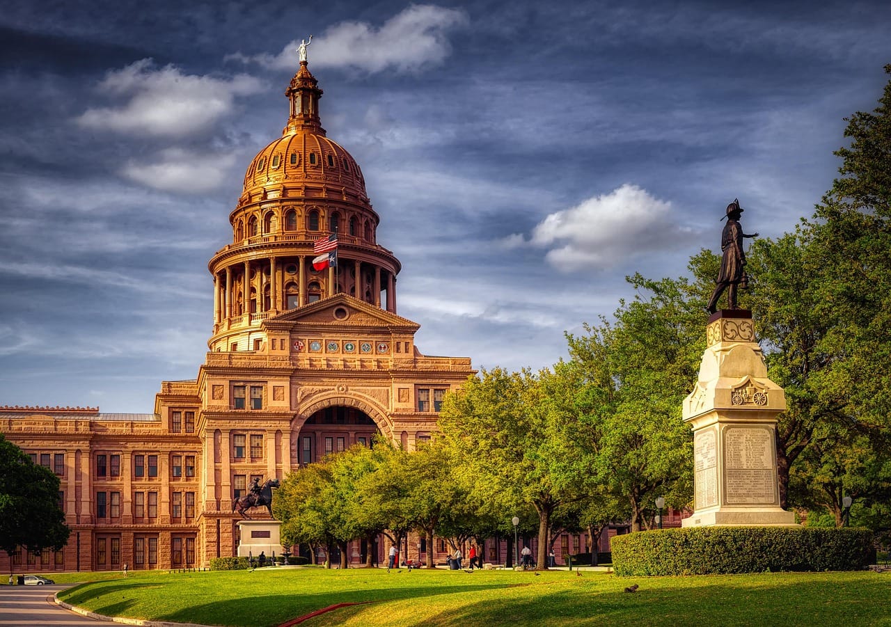
Texas has a small problem when it comes to day trips.
It’s enormous.
Really enormous.
You can leave one Texas city in the morning, drive all day and—surprise—still be in Texas.
That means the best day trips in Texas aren’t about racing from one end of the state to another. They’re about choosing a region and exploring it properly.
And what regions they are.
Texas has mountains and desert in the west, pine forests in the east, beaches along the Gulf Coast, spring-fed swimming holes in Hill Country, wide-open Panhandle plains, cypress swamps, historic missions, German towns, barbecue destinations, ghost towns and enough strange roadside attractions to keep City Unknown busy for years.
So fill the tank.
Texas requires commitment.
Jump to a Texas Region
Hill Country
Fredericksburg, Enchanted Rock, Wimberley, New Braunfels and spring-fed rivers.
Prairies & Lakes
Dallas, Fort Worth, Waco, dinosaur tracks, lakes and historic towns.
Piney Woods
Caddo Lake, Jefferson, Tyler, Nacogdoches and East Texas forests.
Gulf Coast
Galveston, Corpus Christi, Port Aransas, beaches and coastal wildlife.
South Texas Plains
San Antonio, Rio Grande Valley, historic missions, birding and ranch country.
Big Bend Country
Big Bend, Guadalupe Mountains, Marfa, Fort Davis, Terlingua and desert highways.
Panhandle Plains
Palo Duro Canyon, Amarillo, Route 66, Caprock country and wide-open prairie.
Or jump directly to:
Small Towns | Swimming Holes | Scenic Drives | Ghost Towns | Hidden Gems | Family Trips
Texas Hill Country Day Trips
Texas Hill Country is road-trip country.
Rolling limestone hills surround spring-fed rivers, vineyards, barbecue towns and German communities.
Spring brings wildflowers.
Summer sends everyone looking for water.
Fall brings cooler hiking weather.
And practically every backroad seems capable of producing another small town worth stopping for.
Fredericksburg
Location: Fredericksburg
Map: Open in Google Maps
Planning: Visit Fredericksburg
German immigrants founded Fredericksburg in the 1840s, and the town still celebrates that heritage.
Historic Main Street is filled with shops, restaurants and galleries.
The surrounding countryside has become one of Texas’ major wine regions.
But don’t reduce Fredericksburg to wine tasting.
History, architecture and the surrounding Hill Country make it worthwhile even if you’re not drinking anything stronger than sweet tea.
National Museum of the Pacific War
Location: Fredericksburg
Map: Open in Google Maps
This outstanding museum examines the Pacific theater of World War II.
Fredericksburg was the hometown of Fleet Admiral Chester W. Nimitz.
Give the museum several hours.
Enchanted Rock State Natural Area
Location: Near Fredericksburg
Map: Open in Google Maps
Official Site: Texas Parks & Wildlife
A massive pink granite dome rises above the Hill Country.
The climb to the summit isn’t terribly long, but Texas heat can make it considerably more serious than the mileage suggests.
Bring water.
Reservations are highly recommended—and during busy periods may be essential because the park reaches capacity.
Best for: Hiking, geology, views and stargazing.
Luckenbach
Location: Luckenbach
Map: Open in Google Maps
This tiny community became famous through Texas music.
There isn’t much here.
That’s the point.
Listen to music.
Sit beneath the trees.
Take the picture.
Try not to spend the rest of the afternoon humming Waylon Jennings.
Johnson City
Location: Johnson City
Map: Open in Google Maps
Johnson City combines Hill Country scenery with presidential history.
Lyndon B. Johnson National Historical Park
Location: Johnson City and Stonewall
Map: Open in Google Maps
Official Site: National Park Service
Explore places associated with America’s 36th president, including his boyhood community and ranch country.
Check current tour access before visiting individual buildings.
Pedernales Falls State Park
Location: Johnson City area
Map: Open in Google Maps
The Pedernales River tumbles across broad slabs of limestone.
Hiking trails explore the surrounding Hill Country.
Swimming is prohibited in the falls area itself, so follow designated swimming rules elsewhere in the park.
Flash flooding can occur rapidly.
Wimberley
Location: Wimberley
Map: Open in Google Maps
Wimberley is practically the poster child for Hill Country weekends.
Shops, galleries, swimming holes and cypress-lined waterways surround the little downtown.
Blue Hole Regional Park
Location: Wimberley
Map: Open in Google Maps
Towering cypress trees shade one of Texas’ best-known swimming areas.
Swimming access is seasonal and reservations may be required.
Check before making the drive.
Jacob’s Well Natural Area
Location: Wimberley
Map: Open in Google Maps
Jacob’s Well is an artesian spring feeding Cypress Creek.
Water conditions have varied dramatically in recent years.
Do not plan a trip around swimming unless current local information specifically confirms it is available.
The natural area itself remains worth exploring.
New Braunfels
Location: New Braunfels
Map: Open in Google Maps
German heritage meets Texas river culture.
The Comal and Guadalupe rivers make this one of the state’s favorite warm-weather destinations.
Gruene Historic District
Location: New Braunfels
Map: Open in Google Maps
Historic buildings, shops and restaurants surround one of Texas’ legendary music venues.
Gruene Hall
Location: Gruene
Map: Open in Google Maps
Texas’ oldest continuously operating dance hall has hosted generations of musicians.
Check the music calendar.
Then stay awhile.
Lockhart
Location: Lockhart
Map: Open in Google Maps
Welcome to serious barbecue country.
Lockhart has several legendary barbecue restaurants.
Trying to determine which is “best” is an excellent way to start an argument with Texans.
So don’t.
Try more than one.
Call it research.
San Marcos
Location: San Marcos
Map: Open in Google Maps
The spring-fed San Marcos River gives the city an outdoor personality.
Paddling and tubing are popular when conditions allow.
Longhorn Cavern State Park
Location: Burnet
Map: Open in Google Maps
Guided tours explore an unusual Hill Country cave shaped by ancient water.
It’s also an excellent answer to:
“What should we do when Texas is approximately the temperature of the sun?”
Go underground.
Prairies & Lakes Day Trips
North-central Texas contains Dallas, Fort Worth and dozens of smaller destinations.
Cowboy history sits beside modern cities.
Dinosaur tracks sit in riverbeds.
Small courthouse towns surround huge reservoirs.
Texas contains multitudes.
Fort Worth Stockyards
Location: Fort Worth
Map: Open in Google Maps
Planning: Fort Worth Stockyards
Historic livestock buildings now contain restaurants, shops and entertainment.
The cattle drive gets the attention, but spend time learning why Fort Worth became known as “Cowtown.”
Fort Worth Water Gardens
Location: Downtown Fort Worth
Map: Open in Google Maps
This unusual architectural park creates a dramatic urban stop.
Dinosaur Valley State Park
Location: Glen Rose
Map: Open in Google Maps
Official Site: Texas Parks & Wildlife
Actual dinosaur tracks survive in and around the Paluxy River.
Track visibility depends on water levels.
Which means the dinosaurs are always there.
They simply don’t always cooperate with your vacation schedule.
Glen Rose
Location: Glen Rose
Map: Open in Google Maps
Pair Dinosaur Valley with this pleasant small town.
Waco
Location: Waco
Map: Open in Google Maps
Waco has reinvented itself as a major Texas road-trip stop.
Magnolia Market gets plenty of attention, but there’s much more here.
Waco Mammoth National Monument
Location: Waco
Map: Open in Google Maps
Official Site: National Park Service
Fossils of Columbian mammoths and other Ice Age animals were discovered here.
A climate-controlled shelter protects part of the fossil site.
Dr Pepper Museum
Location: Waco
Map: Open in Google Maps
Yes.
There’s an entire museum about Dr Pepper.
Texas understood the assignment.
Canton
Location: Canton
Map: Open in Google Maps
First Monday Trade Days transforms Canton into a massive shopping destination around designated weekends.
Despite the name, don’t simply show up on a random Monday.
Check the calendar.
Denton
Location: Denton
Map: Open in Google Maps
Historic downtown Denton mixes live music, restaurants, shops and university-town personality.
McKinney
Location: McKinney
Map: Open in Google Maps
Historic buildings surround one of North Texas’ most walkable downtowns.
Grapevine
Location: Grapevine
Map: Open in Google Maps
Historic Main Street, tasting rooms, restaurants and seasonal festivals make Grapevine an easy Dallas-Fort Worth excursion.
Mineral Wells Fossil Park
Location: Mineral Wells
Map: Open in Google Maps
Visitors can search for ancient marine fossils in exposed rock.
Check current collecting rules before taking anything home.
Because “I found it” and “I’m legally allowed to keep it” are two different sentences.
Piney Woods Day Trips
East Texas does not look like the Texas in Western movies.
Pine forests replace desert.
Bayous and wetlands appear between wooded hills.
Spanish moss hangs above dark water.
This is one of the state’s most underrated regions.
Caddo Lake
Location: East Texas near Louisiana
Map: Open in Google Maps
Bald cypress trees rise from dark water beneath curtains of Spanish moss.
Kayak.
Take a boat tour.
Watch for wildlife.
And bring a camera.
Caddo Lake can look downright prehistoric on a misty morning.
Caddo Lake State Park
Location: Karnack
Map: Open in Google Maps
Paddling trails provide one of the best ways to explore the maze of waterways.
Jefferson
Location: Jefferson
Map: Open in Google Maps
Historic buildings, antique shops and old hotels give Jefferson an atmosphere completely different from most Texas towns.
And yes.
It has ghost stories.
Lots of ghost stories.
We’ll be back in October.
Tyler
Location: Tyler
Map: Open in Google Maps
Tyler is famous for roses.
The Tyler Rose Garden is especially impressive during peak bloom periods.
Nacogdoches
Location: Nacogdoches
Map: Open in Google Maps
One of Texas’ oldest communities rewards travelers with historic architecture and East Texas character.
Caddo Mounds State Historic Site
Location: Alto
Map: Open in Google Maps
This important archaeological landscape preserves the history of Caddo peoples whose communities flourished here centuries before Texas existed.
Visit respectfully.
The Caddo story is not simply archaeological history—the Caddo Nation is a living Native nation today.
Palestine
Location: Palestine
Map: Open in Google Maps
Historic architecture and railroad history make Palestine an excellent East Texas stop.
Texas State Railroad
Location: Palestine and Rusk
Map: Open in Google Maps
Vintage train excursions travel through the Piney Woods.
Check schedules well ahead of time.
Texas Gulf Coast Day Trips
Texas has hundreds of miles of Gulf coastline.
Some sections are lined with beach towns.
Others remain remarkably wild.
Galveston
Location: Galveston Island
Map: Open in Google Maps
Historic architecture, beaches and museums make Galveston one of Texas’ classic coastal trips.
Explore the Strand.
Walk the seawall.
Then dig into the city’s remarkable history.
Corpus Christi
Location: Corpus Christi
Map: Open in Google Maps
Corpus Christi combines beaches with major family attractions.
USS Lexington
Location: Corpus Christi
Map: Open in Google Maps
The World War II-era aircraft carrier now operates as a museum.
It’s enormous.
Wear comfortable shoes.
Texas State Aquarium
Location: Corpus Christi
Map: Open in Google Maps
A strong family stop focused on Gulf ecosystems and marine life.
Padre Island National Seashore
Location: Near Corpus Christi
Map: Open in Google Maps
Official Site: National Park Service
One of the world’s longest undeveloped barrier islands protects miles of beaches, dunes and coastal habitat.
Sea turtles nest here.
Bird migration can be spectacular.
Beach driving conditions vary, especially farther down island.
Know your vehicle’s capabilities.
Port Aransas
Location: Mustang Island
Map: Open in Google Maps
Beaches, fishing and seafood make “Port A” one of Texas’ classic beach-town escapes.
Rockport-Fulton
Location: Rockport
Map: Open in Google Maps
Birding, fishing, art galleries and coastal scenery create a quieter alternative to larger beach destinations.
Aransas National Wildlife Refuge
Location: Austwell area
Map: Open in Google Maps
The refuge is internationally known as wintering habitat for endangered whooping cranes.
Wildlife sightings are never guaranteed.
That’s why they’re called wildlife and not scheduled entertainment.
South Texas Plains Day Trips
South Texas blends Mexican American culture, ranch history, subtropical wildlife and some of the oldest Spanish colonial sites in the state.
San Antonio
Location: San Antonio
Map: Open in Google Maps
Few Texas cities can compete with San Antonio for history.
Start with the missions.
Then eat.
Then continue exploring.
This is an important order of operations.
San Antonio Missions National Historical Park
Location: San Antonio
Map: Open in Google Maps
Official Site: National Park Service
Four Spanish colonial missions are preserved within the national historical park.
Together with the Alamo, the missions form a UNESCO World Heritage Site.
Remember that the mission story involves Indigenous communities, Spanish colonialism, religion and cultural change.
It’s considerably more complicated than picturesque stone churches.
The Alamo
Location: San Antonio
Map: Open in Google Maps
Official Site: The Alamo
The 1836 battle made the Alamo internationally famous.
But the site’s history begins long before the Texas Revolution.
Allow time for the broader story.
San Antonio River Walk
Location: San Antonio
Map: Open in Google Maps
Walkways follow the San Antonio River through downtown.
Go beyond the restaurant-heavy central section and explore the Mission Reach too.
King Ranch
Location: Kingsville area
Map: Open in Google Maps
The enormous ranch played a major role in Texas ranching history.
Guided tour options vary.
Reserve ahead.
Rio Grande Valley
South Texas becomes increasingly subtropical as you approach the Rio Grande.
This is one of America’s greatest birding regions.
Bentsen-Rio Grande Valley State Park
Location: Mission
Map: Open in Google Maps
Birders come looking for species difficult to find elsewhere in the United States.
Bring binoculars.
Santa Ana National Wildlife Refuge
Location: Alamo
Map: Open in Google Maps
Trails explore subtropical habitat along the Rio Grande.
Brownsville
Location: Brownsville
Map: Open in Google Maps
Historic architecture, Mexican American culture and wildlife destinations make Brownsville much more than a gateway to South Padre Island.
South Padre Island
Location: South Padre Island
Map: Open in Google Maps
Beaches stretch along the barrier island.
Water sports, birding and wildlife attractions provide plenty beyond sitting in the sand.
Not that sitting in the sand is a bad plan.
Sea Turtle Inc.
Location: South Padre Island
Map: Open in Google Maps
The organization rehabilitates injured sea turtles and supports conservation education.
Big Bend Country Day Trips
Now Texas gets wild.
Big Bend Country contains mountains, desert, canyons, ghost towns and some of the darkest night skies in America.
Distances are enormous.
Cell service can disappear.
Gas stations can be very far apart.
And that’s precisely why this region is extraordinary.
Big Bend National Park
Location: Far West Texas
Map: Open in Google Maps
Official Site: National Park Service
Big Bend protects more than 800,000 acres of Chihuahuan Desert, mountains and Rio Grande canyons.
This is not realistically a casual day trip from Austin, San Antonio or El Paso.
Stay in the region.
Then explore the park as a series of day trips.
Chisos Basin
Location: Big Bend National Park
Map: Open in Google Maps
Mountains surround this spectacular basin.
Several popular trails begin here.
Santa Elena Canyon
Location: Big Bend National Park
Map: Open in Google Maps
Towering canyon walls rise above the Rio Grande.
Road and trail conditions can change rapidly after flooding.
Check current NPS conditions before planning this part of the park.
Terlingua Ghost Town
Location: Terlingua
Map: Open in Google Maps
An old mercury-mining community evolved into one of Texas’ strangest desert destinations.
Ruins surround restaurants, galleries and accommodations.
It’s not entirely a ghost town anymore.
Apparently even ghost towns can gentrify.
Marfa
Location: Marfa
Map: Open in Google Maps
Minimalist art meets West Texas ranch country.
It’s a combination that sounds ridiculous until you arrive.
Then somehow it works.
Marfa Lights
Location: East of Marfa
Map: Open in Google Maps
Mysterious lights have been reported across the desert for generations.
Explanations range from atmospheric effects and distant vehicle lights to considerably more entertaining theories.
Go look.
Decide nothing.
Mysteries are more fun that way.
Fort Davis
Location: Fort Davis
Map: Open in Google Maps
This small mountain community is an ideal West Texas base.
Fort Davis National Historic Site
Location: Fort Davis
Map: Open in Google Maps
Official Site: National Park Service
The preserved frontier military post helps tell the story of westward expansion, Buffalo Soldiers and conflicts between the United States and Native peoples.
McDonald Observatory
Location: Davis Mountains
Map: Open in Google Maps
West Texas darkness makes this one of America’s great astronomy destinations.
Reserve popular programs well ahead.
Guadalupe Mountains National Park
Location: Far West Texas
Map: Open in Google Maps
Official Site: National Park Service
Texas’ highest point rises here.
Guadalupe Peak reaches 8,751 feet.
The summit hike is strenuous.
Don’t let “Texas” trick you into expecting flat terrain.
El Paso
Location: El Paso
Map: Open in Google Maps
Mountains rise directly behind this border city.
Historic missions, Mexican American culture and desert landscapes provide plenty to explore.
Franklin Mountains State Park
Location: El Paso
Map: Open in Google Maps
Mountain trails sit right inside the metropolitan area.
Hueco Tanks State Park & Historic Site
Location: Near El Paso
Map: Open in Google Maps
Rock basins hold precious desert water.
People have used this landscape for thousands of years, leaving important pictographs and archaeological resources.
Access is carefully managed.
Plan ahead and respect restricted areas.
Panhandle Plains Day Trips
The Texas Panhandle doesn’t whisper.
It gives you enormous skies, dramatic canyons, historic Route 66 and plains stretching toward the horizon.
Palo Duro Canyon State Park
Location: Canyon
Map: Open in Google Maps
Official Site: Texas Parks & Wildlife
Often called the “Grand Canyon of Texas,” Palo Duro cuts dramatically into the surrounding plains.
Hike.
Bike.
Drive scenic roads.
But respect the heat.
Canyon temperatures can become dangerous during summer.
Amarillo
Location: Amarillo
Map: Open in Google Maps
Amarillo combines Route 66 history, cowboy culture and roadside weirdness.
Naturally, we approve.
Cadillac Ranch
Location: Amarillo
Map: Open in Google Maps
Ten Cadillacs are buried nose-first in a field.
Visitors add layers of spray paint.
Is it art?
Is it a roadside attraction?
Is it both?
Yes.
Historic Route 66
Texas’ portion of Route 66 crosses the Panhandle through towns including Shamrock, McLean, Groom, Amarillo and Adrian.
Roadside architecture survives throughout the route.
Route 66 Midpoint
Location: Adrian
Map: Open in Google Maps
Adrian marks the traditional midpoint between Chicago and Los Angeles.
That deserves pie.
Fortunately, this is Route 66.
Pie is generally available.
Caprock Canyons State Park
Location: Quitaque
Map: Open in Google Maps
Red cliffs and rugged canyon country create one of the Panhandle’s greatest landscapes.
The park is also home to the Texas State Bison Herd.
Give the bison space.
They are not oversized cows interested in meeting you.
Texas Swimming Hole Day Trips
Texas heat makes water less of a recreational option and more of a survival strategy.
Popular destinations include:
Barton Springs Pool
Blue Hole Regional Park
Hamilton Pool Preserve
Krause Springs
Balmorhea State Park
Garner State Park
Inks Lake
San Marcos River
Comal River
Guadalupe River
But Texas swimming conditions change.
Drought can reduce water levels.
Flooding can make rivers dangerous.
Some destinations require reservations.
Others temporarily suspend swimming.
Always check current conditions before driving several hours with a swimsuit and unreasonable optimism.
Best Small-Town Day Trips in Texas
Texas could support an entire website devoted solely to small towns.
Start with:
Fredericksburg
Wimberley
Gruene
Lockhart
Jefferson
Marfa
Fort Davis
Alpine
Terlingua
Salado
Granbury
Glen Rose
Waxahachie
McKinney
Denton
Nacogdoches
Palestine
Rockport
Port Isabel
Bandera
Boerne
Luckenbach
Brenham
Shiner
Georgetown
Some have beautiful courthouses.
Some have barbecue.
Some have ghosts.
The really good ones have all three.
Best Scenic Drives in Texas
River Road — Big Bend
FM 170 between Presidio and the Big Bend area is one of America’s great desert drives.
Willow City Loop
Hill Country roads become especially beautiful during wildflower season.
Stay on public roads and respect private property.
Davis Mountains Scenic Loop
High-desert mountains create a completely unexpected Texas landscape.
Ross Maxwell Scenic Drive
Explore western Big Bend National Park.
Devil’s Backbone
Hill Country views surround this famous stretch near Wimberley.
Texas Route 66
Roadside history across the Panhandle.
Bluebonnet Trails
Spring drives can produce spectacular wildflowers.
Never trespass for photographs.
And don’t park in traffic because you saw a particularly photogenic bluebonnet.
Texas Ghost Town Day Trips
Now we’re talking.
Texas has hundreds of abandoned and nearly abandoned communities.
Terlingua
The famous one.
Thurber
Location: West of Fort Worth
Map: Open in Google Maps
Once a major coal-mining town, Thurber declined after railroads converted away from coal.
Lobo
A tiny West Texas ghost town surrounded by desert.
Much of the property is private.
Toyah
Railroad history and abandoned structures give Toyah a wonderfully weathered West Texas atmosphere.
Indianola
Once an important Gulf port, Indianola was devastated by hurricanes during the 19th century.
Little remains today.
Glenrio
An abandoned Route 66 community straddling Texas and New Mexico.
Medicine Mound
A tiny community surrounded by the distinctive Medicine Mounds.
City Unknown Ghost-Town Rule
Ghost town does not mean public property.
Abandoned does not mean available for exploration.
If it’s fenced, posted or privately owned:
Enjoy the view from somewhere legal.
The ghosts don’t need company that badly.
Hidden Gems Worth the Texas Detour
Seminole Canyon State Park & Historic Site
Location: Comstock
Map: Open in Google Maps
Ancient rock art survives in shelters overlooking the Lower Pecos.
Some areas are accessible only on guided tours.
This is an archaeological landscape deserving serious respect.
Monahans Sandhills State Park
Location: Monahans
Map: Open in Google Maps
Rolling dunes create a landscape most travelers don’t expect in Texas.
Bring a sand disk.
Then discover muscles you forgot existed.
Balmorhea State Park
Location: Toyahvale
Map: Open in Google Maps
A huge spring-fed pool in the middle of West Texas desert country feels almost impossible.
Which is precisely why it’s fantastic.
Devils River State Natural Area
Remote.
Rugged.
Beautiful.
And not something to casually attempt without planning.
Big Bend Ranch State Park
Big Bend National Park’s enormous neighbor provides spectacular desert scenery with fewer visitors.
Mineral Wells Fossil Park
Go fossil hunting.
Historic Rugby—
No.
Tennessee was trying to sneak back in.
Texas has enough weirdness of its own.
Best Texas Day Trips for Families
Try:
Dinosaur Valley State Park
Waco Mammoth National Monument
Texas State Aquarium
USS Lexington
Fort Worth Stockyards
Space Center Houston
Dr Pepper Museum
Texas State Railroad
Padre Island National Seashore
Discovery Gardens and museums in Dallas-Fort Worth
Caves in Hill Country
Palo Duro Canyon
Galveston
San Antonio
Texas works especially well for family trips because one day can involve dinosaurs and the next can involve astronauts.
That’s range.
Texas History Day Trips
Build trips around:
San Antonio Missions
The Alamo
Fort Davis
LBJ National Historical Park
Caddo Mounds
Chamizal National Memorial
San Jacinto Battleground
Washington-on-the-Brazos
Buffalo Soldiers history
Galveston
Freedmen’s communities
Spanish missions
Native archaeological landscapes
Texas history is complicated.
Indigenous nations, Spanish colonization, Mexican history, slavery, independence, the Republic of Texas, U.S. annexation, immigration, ranching, oil and Civil Rights history all shaped the state.
Don’t reduce it to cowboys and the Alamo.
They’re part of the story.
Not the whole story.
Best Texas Spring Day Trips
Spring is arguably Texas road-trip season.
Try:
Hill Country wildflowers
Willow City Loop
Enchanted Rock
Fredericksburg
Palo Duro Canyon
Caddo Lake
Big Bend
Guadalupe Mountains
East Texas gardens
Rio Grande Valley birding
Wildflower timing varies with rainfall and temperature.
No website can guarantee the bluebonnets will peak during your vacation.
Flowers remain notoriously uncooperative with hotel reservations.
Best Texas Summer Day Trips
Summer calls for:
Gulf Coast beaches
Balmorhea
Barton Springs
San Marcos River
Comal River
Guadalupe River
Caves
Museums
Aquariums
But be extremely cautious with desert and canyon hiking.
Texas heat kills.
Hike early, carry substantially more water than you think you’ll need and turn around before heat illness becomes a problem.
Best Texas Fall Day Trips
Fall brings better hiking weather.
Try:
Lost Maples State Natural Area
Garner State Park
Guadalupe Mountains
Piney Woods
Davis Mountains
Hill Country
Big Bend
Palo Duro Canyon
Lost Maples can become extremely busy when fall color peaks.
Plan ahead.
Best Texas Winter Day Trips
Winter is one of the best seasons for:
Big Bend
Guadalupe Mountains
Rio Grande Valley
South Padre Island
San Antonio
Galveston
Hill Country
West Texas stargazing
North Texas and the Panhandle can still experience snow and ice.
Because Texas likes to keep everybody guessing.
Texas Food Road Trips
You cannot responsibly explore Texas without allocating significant time to eating.
For research purposes.
Obviously.
Look for:
Central Texas barbecue
Tex-Mex
Breakfast tacos
Kolaches
Czech bakeries
German food
Gulf seafood
Chicken-fried steak
West Texas Mexican food
Rio Grande Valley tacos
East Texas barbecue
Pecan pie
Blue Bell ice cream
And yes:
Barbecue road trips deserve their own City Unknown article.
Possibly several.
Texas Road-Trip Combinations
Try:
Fredericksburg → Enchanted Rock → Luckenbach
Johnson City → LBJ Ranch → Pedernales Falls
Wimberley → San Marcos → Gruene
Lockhart → Luling → Gonzales
Fort Worth → Glen Rose → Dinosaur Valley
Waco → Waco Mammoth → Magnolia
Jefferson → Caddo Lake
Palestine → Texas State Railroad
Corpus Christi → Padre Island
Rockport → Aransas Wildlife Refuge
San Antonio → Missions → Gruene
Brownsville → South Padre Island
Marfa → Fort Davis → McDonald Observatory
Alpine → Terlingua → Big Bend
El Paso → Franklin Mountains → Hueco Tanks
Amarillo → Cadillac Ranch → Palo Duro Canyon
Route 66 → Shamrock → Amarillo → Adrian
Notice what’s missing?
Austin → Big Bend → Austin.
Don’t.
Texas is big.
Respect the map.
Texas Road-Trip Safety
Texas road trips require some extra planning.
Watch for:
Extreme heat
Flash flooding
Severe thunderstorms
Tornadoes
Hurricanes along the Gulf
Wildfires
Rattlesnakes
Long distances between fuel stops
Limited cell service
Desert dehydration
River currents
Beach-driving conditions
Border-area travel restrictions
Mountain weather
Seasonal park closures
And don’t underestimate distances.
Houston to El Paso is roughly the sort of drive that causes people from smaller states to question whether Texas should legally be allowed to remain one state.
More Texas Adventures from City Unknown
Continue exploring the Lone Star State:
Texas Hidden Gems — Discover caves, swimming holes, forgotten towns and strange roadside stops.
Ultimate Texas Hill Country Road Trip — Fredericksburg, Wimberley, Gruene, Enchanted Rock and more.
Texas Ghost Town Road Trip — Explore abandoned mining, railroad and desert communities.
Texas Small-Town Road Trip — Discover courthouse squares, barbecue towns and historic main streets.
Texas BBQ Road Trip — Follow the smoke across the Lone Star State.
Ultimate Big Bend Road Trip — Desert highways, canyons, ghost towns and mountain scenery.
Texas Route 66 Road Trip — Shamrock to Glenrio.
Texas Swimming Hole Road Trip — Springs, rivers and natural pools.
Texas Scenic Drives — Hill Country loops, desert highways and canyon roads.
Texas Wildflower Road Trip — Bluebonnets and spring backroads.
Texas Gulf Coast Road Trip — Galveston to South Padre Island.
Texas Dinosaur Road Trip — Tracks, fossils and prehistoric Texas.
Best Day Trips from Austin
Best Day Trips from Dallas
Best Day Trips from Fort Worth
Best Day Trips from Houston
Best Day Trips from San Antonio
Best Day Trips from El Paso
And after dark:
21 Haunted Places in Texas With a Story to Tell
15 Texas Ghost Towns Worth the Drive
15 Haunted Hotels & Saloons in Texas
The Most Haunted Small Towns in Texas
We may need a bigger Halloween calendar.
Find Your Next Texas Adventure
See the Alamo.
Walk the Fort Worth Stockyards.
Visit Austin.
Those belong on the list.
Then keep driving.
Climb a granite dome.
Kayak beneath cypress trees.
Find dinosaur tracks in a river.
Swim in a desert spring.
Drive an old section of Route 66.
Visit a ghost town.
Stand beneath some of America’s darkest skies.
Eat barbecue in a town you’ve never heard of.
Follow a Hill Country road just because the scenery looks interesting.
Watch the sun disappear behind the Chisos Mountains.
Then look at the map and realize you’ve barely scratched the surface.
That’s Texas.
City Unknown Tip
Don’t plan a Texas road trip by looking at the state map and saying:
“Those look pretty close.”
They aren’t.
Pick a region.
Explore it slowly.
Leave room for courthouse squares, barbecue joints, swimming holes and roadside attractions you didn’t know existed.
Then come back and explore another region.
Texas isn’t really one road trip.
It’s about seven road trips wearing one very large cowboy hat.