
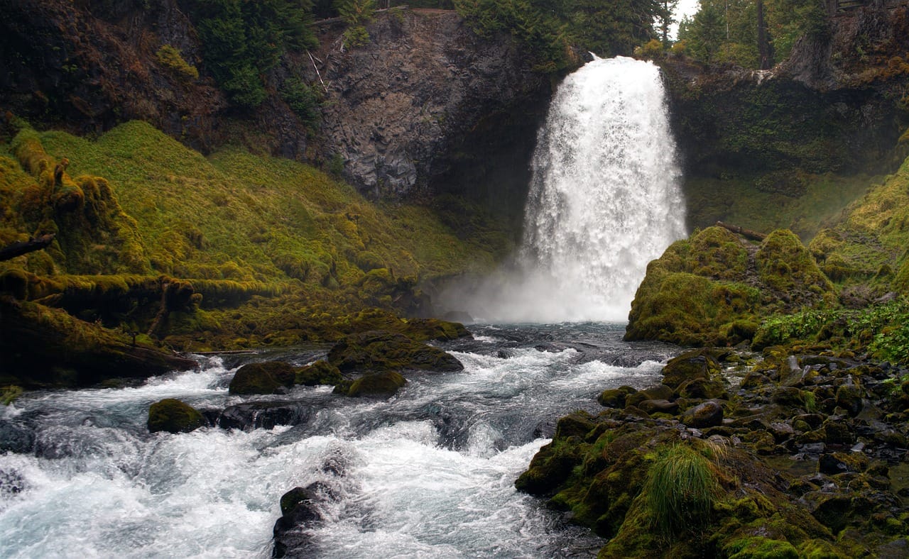
Oregon is almost unfairly good at road trips.
You can stand beside the Pacific Ocean in the morning, walk through a rainforest before lunch, chase waterfalls in the afternoon and finish the day staring at a snow-covered volcano.
And that’s just western Oregon.
Head east and everything changes.
Pine forests give way to high desert.
Colorful fossil beds rise from the landscape.
The Wallowa Mountains appear where you least expect them.
Tiny towns sit beside old mining roads.
And eventually you reach places so remote that your cell phone quietly gives up and accepts its fate.
The best day trips in Oregon include famous places like Multnomah Falls, Cannon Beach and Crater Lake—but some of the state’s greatest adventures happen after you leave the obvious route.
Let’s go find them.
Jump to an Oregon Region
Portland & Columbia River Gorge
Waterfalls, historic highways, Portland neighborhoods and Columbia River views.
Oregon Coast
Beaches, sea stacks, lighthouses, shipwrecks and coastal towns.
Willamette Valley
Waterfalls, wine country, covered bridges, gardens and small towns.
Central Oregon
Bend, Smith Rock, volcanoes, lava fields and alpine lakes.
Eastern Oregon
Wallowas, Painted Hills, ghost towns, Hells Canyon and high desert.
Southern Oregon
Crater Lake, Oregon Caves, Ashland, Rogue Valley and wild coastline.
Or jump directly to:
Waterfalls | Small Towns | Scenic Drives | Hidden Gems | Ghost Towns | Family Trips
Portland & Columbia River Gorge Day Trips
Portland is surrounded by ridiculous amounts of scenery.
Drive east and you’re immediately in waterfall country.
Drive west and the Coast Range leads toward the Pacific.
Drive south and wine country begins.
Drive north and—
Well, that’s Washington.
We’ll save that for another page.
Columbia River Gorge
Location: East of Portland
Map: Open in Google Maps
Planning: Columbia River Gorge National Scenic Area
The Columbia River Gorge is one of America’s great scenic corridors.
Cliffs rise above the river while waterfalls pour from the surrounding mountains.
Historic viewpoints, trails and small towns make this an easy full-day adventure from Portland.
Best for: Waterfalls, scenic drives, hiking and photography.
Multnomah Falls
Location: Columbia River Gorge
Map: Open in Google Maps
At 620 feet, Multnomah Falls is Oregon’s most famous waterfall.
A short walk provides the classic view of the falls and Benson Bridge.
Continue farther if you’re looking for a longer hike.
City Unknown Tip: Don’t make Multnomah your only Gorge waterfall.
It’s the celebrity.
The surrounding waterfalls are the supporting cast that occasionally steal the movie.
Check current seasonal permit and parking requirements before visiting.
Latourell Falls
Location: Columbia River Gorge
Map: Open in Google Maps
A dramatic waterfall plunges over a basalt cliff near the western end of the Historic Columbia River Highway.
Its easy access makes it an excellent first stop.
Bridal Veil Falls
Location: Columbia River Gorge
Map: Open in Google Maps
A short forest trail leads to this two-tier waterfall.
Wahclella Falls
Location: Near Cascade Locks
Map: Open in Google Maps
This beautiful waterfall sits at the end of a relatively short hike through Tanner Creek canyon.
Vista House at Crown Point
Location: Historic Columbia River Highway
Map: Open in Google Maps
The historic Vista House sits high above the Columbia River.
The building is impressive.
The view is better.
Hood River
Location: Hood River, Oregon
Map: Open in Google Maps
Hood River combines Columbia Gorge scenery with restaurants, breweries, wineries and outdoor recreation.
It’s also the gateway to one of Oregon’s best food-and-scenery drives.
Hood River Fruit Loop
Location: Hood River Valley
Map: Open in Google Maps
Orchards, farm stands, wineries and Mount Hood views make this particularly good from summer through fall.
Fruit availability changes with the season.
Which is exactly how farms work.
Mount Hood
Location: Mount Hood National Forest
Map: Open in Google Maps
Oregon’s highest mountain dominates the skyline east of Portland.
Hiking, lakes, skiing and scenic drives make Mount Hood a year-round destination, although road and trail conditions change dramatically with the seasons.
Timberline Lodge
Location: Mount Hood
Map: Open in Google Maps
Official Site: Timberline Lodge
Built during the 1930s, Timberline Lodge is one of Oregon’s architectural landmarks.
Even non-skiers should visit.
Movie fans may recognize the exterior from The Shining.
Thankfully, the actual hotel experience generally involves considerably fewer axe-related complications.
Sauvie Island
Location: Northwest of Portland
Map: Open in Google Maps
Farms, beaches, wildlife areas and seasonal produce make Sauvie Island an easy escape from Portland.
Check parking permit requirements for the areas you plan to visit.
Oregon Coast Day Trips
The Oregon Coast deserves its own vacation.
But we’ll call these day trips anyway.
Oregon’s coastline combines enormous beaches, sea stacks, lighthouses, forests, tide pools and small towns.
And thanks to Oregon’s public beach protections, exploring the coast feels wonderfully open.
Astoria
Location: Astoria, Oregon
Map: Open in Google Maps
History, river views and Victorian architecture make Astoria one of Oregon’s most interesting coastal towns.
Astoria Column
Location: Astoria
Map: Open in Google Maps
Climb the spiral staircase for sweeping views across the Columbia River and surrounding hills.
Fort Stevens State Park
Location: Hammond
Map: Open in Google Maps
Military history, beaches and trails make Fort Stevens an easy full-day destination.
Peter Iredale Shipwreck
Location: Fort Stevens State Park
Map: Open in Google Maps
Rusting remains of the 1906 shipwreck sit directly on the beach.
More than a century of Pacific weather has taken its toll, but enough remains to create one of Oregon’s most recognizable coastal scenes.
Cannon Beach
Location: Cannon Beach, Oregon
Map: Open in Google Maps
Wide beaches, galleries and Haystack Rock make Cannon Beach one of Oregon’s most famous coastal destinations.
Haystack Rock
Location: Cannon Beach
Map: Open in Google Maps
This enormous sea stack rises 235 feet from the shoreline.
At low tide, tide pools reveal marine life around its base.
Observe wildlife responsibly and avoid trampling tide-pool organisms.
Oswald West State Park
Location: Near Manzanita
Map: Open in Google Maps
Forested trails lead toward Short Sand Beach and Cape Falcon.
This is Oregon Coast scenery at its best.
Tillamook
Location: Tillamook, Oregon
Map: Open in Google Maps
Yes, there’s cheese.
There is also considerably more to Tillamook County than cheese.
Although we’re definitely still getting cheese.
Three Capes Scenic Route
Explore:
Cape Meares
Cape Lookout
Cape Kiwanda
Sea cliffs, beaches, forests and viewpoints make this one of Oregon’s classic coastal drives.
Newport
Location: Newport, Oregon
Map: Open in Google Maps
Newport combines working waterfront character with beaches, marine science and lighthouses.
Yaquina Head Outstanding Natural Area
Location: Newport
Map: Open in Google Maps
Oregon’s tallest lighthouse overlooks dramatic coastline and tide pools.
Oregon Coast Aquarium
Location: Newport
Map: Open in Google Maps
Marine exhibits make this one of Oregon’s strongest family destinations.
Cape Perpetua
Location: Near Yachats
Map: Open in Google Maps
Forest meets ocean dramatically here.
Nearby coastal features include Thor’s Well, Spouting Horn and Devil’s Churn.
Keep your distance from surf and cliff edges.
Sneaker waves aren’t called “politely announces itself waves.”
Bandon
Location: Bandon, Oregon
Map: Open in Google Maps
Sea stacks, beaches and a charming old town make Bandon one of southern Oregon’s best coastal stops.
Face Rock Scenic Viewpoint
Location: Bandon
Map: Open in Google Maps
Massive offshore rocks create spectacular sunset scenery.
Samuel H. Boardman State Scenic Corridor
Location: Between Gold Beach and Brookings
Map: Open in Google Maps
This stretch of coastline is outrageously photogenic.
Natural bridges, hidden coves, sea stacks and forest trails appear one after another.
Don’t rush it.
Willamette Valley Day Trips
The Willamette Valley isn’t just the space between Portland and Eugene.
It contains waterfalls, wine country, historic towns, covered bridges and some of Oregon’s richest agricultural landscapes.
Silver Falls State Park
Location: Near Silverton
Map: Open in Google Maps
If you like waterfalls, put this near the top of the Oregon list.
The famous Trail of Ten Falls winds through forest and passes a series of dramatic cascades.
Several trails actually pass behind waterfalls.
Best for: Hiking, waterfalls, families and photography.
Silverton
Location: Silverton, Oregon
Map: Open in Google Maps
Combine Silver Falls with this walkable little town.
Oregon Garden
Location: Silverton
Map: Open in Google Maps
Specialty gardens and walking paths make this an easy addition to a Silverton day.
Willamette Valley Wine Country
Location: Newberg, Dundee, McMinnville and surrounding communities
Map: Open in Google Maps
Oregon’s best-known wine region is particularly famous for Pinot Noir.
Build a trip around two or three wineries rather than trying to collect tasting rooms like Pokémon.
Reservations may be recommended or required.
And designate a driver.
McMinnville
Location: McMinnville, Oregon
Map: Open in Google Maps
Historic downtown McMinnville provides restaurants, shops and wine tasting.
Evergreen Aviation & Space Museum
Location: McMinnville
Map: Open in Google Maps
The enormous Hughes H-4 Hercules, better known as the Spruce Goose, is the star attraction.
It’s difficult to appreciate just how enormous this aircraft is until you’re standing underneath it.
Eugene
Location: Eugene, Oregon
Map: Open in Google Maps
Markets, trails, breweries and University of Oregon culture make Eugene a good southern Willamette Valley base.
Covered Bridge Country
The Cottage Grove area has an impressive collection of historic covered bridges.
Build a leisurely driving loop.
Stop often.
And resist the urge to narrate your entire drive like an old-time documentary.
Or don’t.
Road trips have few rules.
Central Oregon Day Trips
Central Oregon feels like somebody changed states while you weren’t paying attention.
The wet forests west of the Cascades give way to high desert, volcanoes and enormous skies.
Bend
Location: Bend, Oregon
Map: Open in Google Maps
Bend combines outdoor recreation with restaurants, breweries and easy access to some of Oregon’s strangest volcanic landscapes.
High Desert Museum
Location: Bend
Map: Open in Google Maps
Wildlife, Indigenous history, regional culture and natural history make this one of Oregon’s strongest regional museums.
Smith Rock State Park
Location: Terrebonne
Map: Open in Google Maps
Towering rock formations rise above the Crooked River.
Rock climbers know Smith Rock internationally, but hikers have plenty to explore too.
Best for: Hiking, climbing and photography.
Summer can become extremely hot.
Start early.
Newberry National Volcanic Monument
Location: South of Bend
Map: Open in Google Maps
Volcanic landscapes dominate this enormous area.
Explore lava flows, crater lakes, caves and viewpoints.
Lava River Cave
Location: Newberry National Volcanic Monument
Map: Open in Google Maps
Walk through a mile-long lava tube beneath the high desert.
Bring warm clothing and reliable lighting.
Even when Bend is roasting, caves remain impressively uninterested in summer.
Big Obsidian Flow
Location: Newberry Caldera
Map: Open in Google Maps
A trail crosses an enormous landscape of black volcanic glass.
Look.
Photograph.
Don’t start filling your backpack with geological souvenirs.
Paulina Lake
Location: Newberry Caldera
Map: Open in Google Maps
Mountain scenery and volcanic geology make Paulina Lake a beautiful summer destination.
Cascade Lakes Scenic Byway
Location: Near Bend
Map: Open in Google Maps
The route passes alpine lakes beneath volcanic peaks.
Snow closes portions seasonally, so check current road conditions.
Tumalo Falls
Location: West of Bend
Map: Open in Google Maps
This 97-foot waterfall is one of central Oregon’s signature sights.
Seasonal road access and snow can affect how you reach it.
Sisters
Location: Sisters, Oregon
Map: Open in Google Maps
Western-themed architecture, shops and Cascade Mountain views make Sisters a natural stop between Bend and the mountains.
Metolius River
Location: Camp Sherman
Map: Open in Google Maps
Remarkably clear water emerges near the base of Black Butte and becomes one of Oregon’s most beautiful rivers.
Eastern Oregon Day Trips
Eastern Oregon is where “day trip” requires a little interpretation.
Distances are long.
Services become sparse.
And some places are genuinely remote.
But that’s exactly why this region is special.
Painted Hills
Location: John Day Fossil Beds National Monument
Map: Open in Google Maps
Official Site: National Park Service
Bands of red, gold and black ripple across the hills.
Changing light dramatically alters the colors throughout the day.
Stay on designated trails.
These formations took millions of years to create.
Your shortcut isn’t worth it.
Blue Basin
Location: Sheep Rock Unit, John Day Fossil Beds
Map: Open in Google Maps
Blue-green badlands create one of Oregon’s most otherworldly hiking landscapes.
Joseph
Location: Joseph, Oregon
Map: Open in Google Maps
Bronze sculptures, galleries and dramatic Wallowa Mountain scenery make Joseph one of Oregon’s best small towns.
Wallowa Lake
Location: Near Joseph
Map: Open in Google Maps
A beautiful glacial lake sits beneath the Wallowa Mountains.
Wallowa Lake Tramway
Location: Wallowa Lake
Map: Open in Google Maps
Seasonal gondola service climbs high above the valley.
Check operating dates before making the trip.
Hells Canyon
Location: Northeastern Oregon
Map: Open in Google Maps
Hells Canyon forms part of the Oregon-Idaho border and reaches tremendous depths.
The region is enormous.
A map pin labeled “Hells Canyon” does not mean every viewpoint is connected by a convenient 15-minute drive.
Plan carefully.
Baker City
Location: Baker City, Oregon
Map: Open in Google Maps
Historic architecture and Oregon Trail history make Baker City a good base for northeastern Oregon.
National Historic Oregon Trail Interpretive Center
Location: Near Baker City
Map: Open in Google Maps
Exhibits interpret migration along the Oregon Trail and the enormous human impact of westward expansion.
When discussing the Oregon Trail, remember that settlers were traveling through homelands already occupied and used by Indigenous peoples.
Sumpter
Location: Sumpter, Oregon
Map: Open in Google Maps
Mining history remains visible throughout this tiny mountain town.
Sumpter Valley Dredge
Location: Sumpter
Map: Open in Google Maps
The enormous gold-mining dredge provides a fascinating look at Oregon’s mining era—and the massive environmental footprint those operations left behind.
Steens Mountain
Location: Southeastern Oregon
Map: Open in Google Maps
One enormous fault-block mountain rises above Oregon’s high desert.
The seasonal loop road climbs to extraordinary viewpoints.
This is remote country.
Carry water, fuel and supplies.
Alvord Desert
Location: East of Steens Mountain
Map: Open in Google Maps
A vast dry lakebed stretches beneath Steens Mountain.
It feels more Nevada than Oregon.
Which is precisely why it’s so memorable.
Road and playa conditions matter enormously here.
Malheur National Wildlife Refuge
Location: Near Burns
Map: Open in Google Maps
Wetlands surrounded by high desert create critical habitat for migratory birds.
Best for: Birding, wildlife and photography.
Leslie Gulch
Location: Southeastern Oregon
Map: Open in Google Maps
Strange volcanic formations rise from an extremely remote canyon.
Road conditions can vary.
This is not the place to discover your fuel gauge has been “basically empty” for the last 40 miles.
Southern Oregon Day Trips
Southern Oregon gives you one of America’s great national parks, marble caves, Shakespeare, redwoods near the state line and some of Oregon’s wildest coastline.
Crater Lake National Park
Location: Southern Cascades
Map: Open in Google Maps
Official Site: National Park Service
Crater Lake fills the collapsed caldera of Mount Mazama.
At 1,943 feet deep, it is the deepest lake in the United States.
On a clear day, the blue almost looks fake.
It isn’t.
Best for: Everyone.
But don’t assume every park road is open simply because the calendar says summer.
Snow can linger surprisingly late.
Rim Drive
The scenic road circles Crater Lake with overlooks and trail access.
Seasonal snow closures are significant.
Check current NPS road conditions before visiting.
Oregon Caves National Monument & Preserve
Location: Near Cave Junction
Map: Open in Google Maps
Official Site: National Park Service
Unlike many lava caves around Oregon, these caves formed in marble.
Guided tours explore twisting passages and underground chambers.
Reservations are highly recommended during busy periods.
Ashland
Location: Ashland, Oregon
Map: Open in Google Maps
Theater, restaurants and beautiful Lithia Park make Ashland one of Oregon’s strongest cultural day trips.
Oregon Shakespeare Festival
Location: Ashland
Map: Open in Google Maps
One of America’s best-known regional theater companies stages productions throughout its season.
Check the current performance calendar.
Table Rocks
Location: Near Medford
Map: Open in Google Maps
Upper and Lower Table Rock rise dramatically above the Rogue Valley.
Spring wildflowers make this an especially rewarding hike.
Rogue River
Location: Southern Oregon
Map: Open in Google Maps
Rafting, fishing and jet-boat excursions make the Rogue one of southern Oregon’s defining rivers.
Best Waterfall Day Trips in Oregon
You could build an entire Oregon vacation around waterfalls.
Start with:
Multnomah Falls
Latourell Falls
Bridal Veil Falls
Wahclella Falls
South Falls
North Falls
Toketee Falls
Watson Falls
Tumalo Falls
Salt Creek Falls
Proxy Falls
Sahalie Falls
Koosah Falls
White River Falls
Abiqua Falls
Trail and road conditions vary seasonally.
Some waterfalls require significantly more effort than an Instagram photo suggests.
Best Small-Town Day Trips in Oregon
Put these on the list:
Joseph
Sisters
Hood River
Astoria
Cannon Beach
Yachats
Bandon
Jacksonville
Silverton
McMinnville
Florence
Baker City
Sumpter
Brownsville
Oakland
Manzanita
The City Unknown method works particularly well here:
Park.
Walk.
Find lunch.
Browse whatever weird little shop appears.
Ask a local what’s worth seeing.
That’s usually how the better stories begin.
Hidden Gems Worth the Oregon Detour
Bayocean Peninsula
Location: Near Tillamook
Map: Open in Google Maps
Once a resort community promoted as the “Atlantic City of the West,” Bayocean gradually disappeared as erosion and changing coastal conditions consumed much of the town.
Today, trails cross the former townsite.
Oregon ghost town.
On the coast.
We’re obviously going.
Fort Rock
Location: Central Oregon
Map: Open in Google Maps
A huge volcanic formation rises abruptly from the high desert like a natural fortress.
Crack in the Ground
Location: Near Christmas Valley
Map: Open in Google Maps
A volcanic fissure creates an unusual hike through a narrow trench in the desert.
Hart Mountain National Antelope Refuge
Location: Southeastern Oregon
Map: Open in Google Maps
Remote roads lead toward high-desert wildlife habitat, mountain scenery and primitive recreation.
Come prepared.
This is genuine backcountry.
Owyhee Canyonlands
Location: Far southeastern Oregon
Map: Open in Google Maps
Deep canyons cut through one of Oregon’s least-populated landscapes.
It’s spectacular.
It’s remote.
And “we’ll just use Google Maps when we get there” is not a serious backcountry plan.
Oregon Ghost Town Day Trips
Oregon’s mining, railroad and timber history left dozens of abandoned or nearly abandoned communities.
Some of the best include:
Shaniko
Sumpter
Bayocean
Golden
Bodie
Greenhorn
Granite
Whitney
Friend
Antelope
Some remain inhabited.
Some are nearly gone.
Some contain private property.
Never assume “ghost town” means “public playground.”
Respect signs, fences and historic structures.
And if a floor looks like it hasn’t supported a human since 1897, perhaps don’t make yourself the structural engineer who tests it.
Best Scenic Drives in Oregon
Historic Columbia River Highway
Waterfalls, viewpoints and historic engineering.
Mount Hood Scenic Byway
Mountain views, forests and Hood River Valley.
Three Capes Scenic Route
Classic Oregon Coast scenery.
Cascade Lakes Scenic Byway
Volcanic peaks and alpine lakes.
McKenzie Pass–Santiam Pass Scenic Byway
Volcanic landscapes and Cascade scenery.
Hells Canyon Scenic Byway
Mountains, rivers and remote northeastern Oregon.
Journey Through Time Scenic Byway
Fossil beds, small towns and eastern Oregon landscapes.
Rogue-Coquille Scenic Byway
Forests, rivers and southern Oregon scenery.
Steens Mountain Loop Road
One of Oregon’s ultimate remote drives when seasonal conditions allow.
Oregon Hot Springs Day Trips
Oregon’s volcanic geology creates numerous hot springs.
But hot-spring conditions change constantly.
Sites can close because of wildfire, landslides, sanitation issues, road damage or excessive use.
Before visiting any natural hot spring:
Check current land-management information.
Know whether permits or fees apply.
Pack out everything.
Avoid glass.
Respect closures.
And please don’t be the reason the next person finds a pile of trash beside what used to be a beautiful spring.
Best Oregon Day Trips for Families
Try:
Oregon Coast Aquarium
Evergreen Aviation & Space Museum
High Desert Museum
Silver Falls
Columbia River Gorge
Tillamook Creamery
Newberry National Volcanic Monument
Crater Lake
Oregon Caves
Fort Stevens
John Day Fossil Beds
Mount Hood
Newport
Oregon makes it unusually easy to sneak education into a road trip without anybody noticing.
Romantic Oregon Day Trips
For couples:
Cannon Beach
Hood River
Willamette Valley
Joseph
Ashland
Bandon
Yachats
Sisters
McMinnville
Crater Lake
Samuel H. Boardman Scenic Corridor
Sunset on the coast works particularly well.
Unless it’s foggy.
Then congratulations.
You’ve received the authentic Oregon Coast experience.
Budget-Friendly Oregon Day Trips
Some of Oregon’s greatest experiences require little more than transportation and whatever current parking or recreation pass applies.
Build affordable trips around:
Beaches
Waterfall hikes
Scenic highways
National wildlife refuges
Historic downtowns
State parks
National forests
Fossil-bed landscapes
Wildlife viewing
Covered bridges
Public viewpoints
Hiking trails
Don’t hardcode old parking and admission prices into your plans.
Check the current official site before leaving.
Best Oregon Fall Day Trips
Try:
Columbia River Gorge
Mount Hood
Hood River Fruit Loop
Silver Falls
Willamette Valley
McKenzie River
Bend
Joseph
Wallowa Mountains
Talimena Scenic Drive—
Nope.
That’s Oklahoma.
We’ve been writing a lot of states.
Let’s replace that with:
Hells Canyon Scenic Byway
Oregon’s fall colors tend to be more subtle than New England’s, but the combination of golden foliage, evergreen forest and mountain scenery can be spectacular.
Best Oregon Winter Day Trips
Try:
Mount Hood
Timberline Lodge
Oregon Coast storm watching
Bend
High Desert Museum
Evergreen Aviation Museum
Newport
Ashland
Columbia Gorge waterfalls
Winter weather can create road closures, snow and ice in mountain areas.
Carry appropriate equipment and check TripCheck before leaving.
Best Oregon Spring Day Trips
Spring means waterfalls.
Lots of waterfalls.
Try:
Columbia River Gorge
Silver Falls
McKenzie River
Willamette Valley
Table Rocks
Painted Hills
Smith Rock
Wildlife refuges
Wildflowers begin appearing throughout different elevations as the season progresses.
Best Oregon Summer Day Trips
Summer opens access to some of Oregon’s higher elevations.
Try:
Crater Lake
Cascade Lakes
Wallowa Mountains
Steens Mountain
Mount Hood
Oregon Coast
Newberry
Oregon Caves
Joseph
Hells Canyon
But summer also brings wildfire risk.
Check fire restrictions, smoke conditions and road closures before traveling.
Oregon Road-Trip Planning
Good combinations include:
Portland → Columbia River Gorge → Hood River
Hood River → Fruit Loop → Mount Hood
Astoria → Fort Stevens
Cannon Beach → Oswald West → Manzanita
Tillamook → Three Capes
Newport → Yachats → Cape Perpetua
Silverton → Silver Falls
McMinnville → Wine Country
Bend → Smith Rock → Sisters
Bend → Newberry National Volcanic Monument
Painted Hills → Blue Basin
Joseph → Wallowa Lake
Baker City → Sumpter
Ashland → Jacksonville
Crater Lake → Rogue River
Bandon → Samuel H. Boardman → Brookings
What shouldn’t you do?
Portland → Crater Lake → Painted Hills → Cannon Beach in one day.
That’s not a road trip.
That’s an endurance test.
Oregon is much larger than visitors expect.
One Oregon Road-Trip Rule Worth Remembering
Never assume the road is open.
Snow closes high-elevation roads.
Wildfires close forests.
Rockslides affect coastal highways.
Storms damage trails.
Some scenic routes don’t fully open until well into summer.
And remote eastern Oregon roads can become very different experiences depending on weather.
Check conditions before leaving.
Download offline maps.
Keep fuel in the tank.
Carry water.
Then go exploring.
More Oregon Adventures from City Unknown
Continue exploring the Beaver State:
Oregon Hidden Gems — Find waterfalls, forgotten places and unusual roadside stops.
Ultimate Oregon Coast Road Trip — Explore beaches, lighthouses and coastal towns.
Oregon Waterfall Road Trip — Chase cascades from the Gorge to Southern Oregon.
Oregon Ghost Town Road Trip — Explore mining towns, abandoned settlements and forgotten places.
Oregon Small-Town Road Trip — Discover Joseph, Sisters, Yachats, Bandon and more.
Oregon Hot Springs Road Trip — Find geothermal escapes around the state.
Oregon Weird & Unusual Places — Discover volcanic oddities, ghost towns and roadside curiosities.
Oregon Fall Color Road Trip — Explore mountains, forests and river valleys in autumn.
Oregon Lighthouse Road Trip — Follow the Pacific Coast from beacon to beacon.
Oregon Volcanic Road Trip — Explore Crater Lake, Newberry, lava fields and volcanic landscapes.
Best Day Trips from Portland
Best Day Trips from Bend
Best Day Trips from Eugene
Best Day Trips from Medford
Find Your Next Oregon Adventure
See Multnomah Falls.
Walk Cannon Beach.
Visit Crater Lake.
Those places deserve their fame.
Then keep going.
Find the ghost town disappearing beneath coastal sand.
Walk through an ancient lava tube.
Stand beneath a waterfall.
Drive into the high desert.
Watch bighorn sheep from a canyon road.
Visit a mining town with more buildings than residents.
Stand beside a lake beneath the Wallowa Mountains.
Watch the Pacific pound against sea stacks while fog rolls across the cliffs.
Oregon’s famous places will get you here.
The places between them are what make you want to come back.
City Unknown Tip
Don’t try to “do Oregon.”
Pick a landscape.
Spend one trip chasing waterfalls.
Another exploring the coast.
Another wandering through high desert.
Another visiting ghost towns.
Another driving into the Wallowas.
And another following whatever strange little road appears on the map.
Oregon rewards travelers who leave room for curiosity.
Sometimes the best stop isn’t the one you planned.
It’s the one that makes you hit the brakes and say:
“Wait.
What is THAT?”