
South Dakota is one of those states that likes to keep its best secrets far apart.
In the west, granite peaks rise above pine forests while bison wander through Custer State Park.
Drive east and the landscape opens into enormous prairie.
The Missouri River slices through the middle of the state.
Then somewhere along the way you’ll encounter mammoth fossils, Wild West towns, caves, waterfalls, Native American cultural sites, a palace decorated with corn and enough roadside oddities to keep any respectable road trip slightly weird.
And then there are the Badlands.
They look like somebody accidentally dropped another planet into South Dakota.
The best day trips in South Dakota include famous landmarks such as Mount Rushmore and Badlands National Park, but the Palmetto State—
Nope.
Wrong state.
That’s South Carolina trying to sneak back into our road trip.
The Mount Rushmore State also rewards travelers who venture beyond its famous attractions into ghost towns, prairie preserves, small towns, scenic highways and overlooked corners of the Black Hills.
Let’s hit the road.
Jump to a South Dakota Region
Black Hills & Badlands
Mount Rushmore, Badlands, Custer State Park, Deadwood, caves and scenic drives.
Missouri River
Pierre, Chamberlain, Lake Oahe, Native American heritage and prairie.
Glacial Lakes & Prairies
Watertown, Aberdeen, De Smet, lakes, wildlife refuges and wide-open prairie.
Southeast South Dakota
Sioux Falls, Palisades State Park, Vermillion, Mitchell and Missouri River recreation.
Or jump directly to:
Scenic Drives | Native American Heritage | Ghost Towns | Hidden Gems | Family Trips | Small Towns
Black Hills & Badlands Day Trips
If you’ve never visited western South Dakota, prepare to have your expectations rearranged.
Badlands rise from prairie.
Granite spires pierce pine forests.
Bison wander across roads.
Historic mining towns hide in narrow valleys.
And beneath the surface are some of the world’s great cave systems.
You could spend an entire vacation here without running out of road-trip material.
Badlands National Park
Location: Southwestern South Dakota
Map: Open in Google Maps
Official Site: National Park Service
Jagged formations rise abruptly from mixed-grass prairie at one of America’s strangest landscapes.
Drive Badlands Loop Road.
Stop at the overlooks.
Walk the Door Trail.
Try the Window Trail.
Experienced hikers can tackle the more adventurous Notch Trail.
And keep watching the prairie.
Bison, bighorn sheep, prairie dogs and pronghorn are among the wildlife you may encounter.
Best for: Photography, hiking, wildlife and families.
City Unknown Tip: Sunrise and sunset completely transform the Badlands.
Midday reveals the geology.
Golden hour makes the entire place look like Mars hired a professional lighting crew.
Badlands Loop Road
Location: Badlands National Park
Map: Open in Google Maps
South Dakota Highway 240 winds through the park past overlooks, trailheads and wildlife habitat.
Don’t rush it.
The mileage is modest.
The stopping is not.
Wall Drug
Location: Wall
Map: Open in Google Maps
Official Site: Wall Drug
You’ve probably seen the signs.
Then another sign.
Then 47 more signs.
Wall Drug began as a small pharmacy and became one of America’s great roadside attractions.
Today you’ll find restaurants, shops, Western art, giant roadside-photo opportunities and the famous free ice water that helped launch the attraction.
Is it touristy?
Spectacularly.
Should you stop?
Absolutely.
This is an American road trip.
We have responsibilities.
Minuteman Missile National Historic Site
Location: Near Badlands National Park
Map: Open in Google Maps
Official Site: National Park Service
South Dakota once sat at the center of America’s Cold War nuclear-defense network.
This national historic site preserves facilities associated with Minuteman missiles that stood ready beneath the Great Plains.
It’s one of the state’s most fascinating—and sobering—historic destinations.
Mount Rushmore National Memorial
Location: Keystone
Map: Open in Google Maps
Official Site: National Park Service
Mount Rushmore depicts George Washington, Thomas Jefferson, Theodore Roosevelt and Abraham Lincoln carved into Black Hills granite.
Walk the Presidential Trail for different perspectives on the sculpture.
Visit the museum and Sculptor’s Studio when available.
Evening programs are offered seasonally.
Mount Rushmore itself doesn’t charge an entrance fee, but the concession-operated parking facility does.
The Black Hills Story Goes Far Beyond Mount Rushmore
There’s an important piece of context every Black Hills visitor should understand.
The Black Hills—Paha Sapa in Lakota—are sacred to the Lakota and other Indigenous peoples.
The United States recognized Lakota rights to the Black Hills in the 1868 Treaty of Fort Laramie, but gold discoveries and subsequent U.S. actions led to the seizure of the region.
Visiting Mount Rushmore without understanding the larger Indigenous history gives you only part of the story.
Make time for Native-led cultural sites and interpretation during your trip.
Custer State Park
Location: Black Hills
Map: Open in Google Maps
Official Site: Custer State Park
This is one of America’s great state parks.
Seriously.
If Custer State Park were managed by the National Park Service, nobody would question it.
Granite peaks, mountain lakes, scenic highways and an enormous bison herd create an extraordinary landscape.
Give it an entire day.
Preferably more.
Wildlife Loop Road
Location: Custer State Park
Map: Open in Google Maps
This scenic road crosses rolling prairie where bison, pronghorn, deer and other wildlife are frequently seen.
And then there are the famous begging burros.
They have developed a sophisticated economic system based primarily on looking adorable beside stopped vehicles.
Remember:
Bison are wild animals.
Stay inside your vehicle when appropriate and maintain substantial distance.
A bison weighing roughly a ton does not care that you need a better Instagram angle.
Needles Highway
Location: Custer State Park
Map: Open in Google Maps
Granite spires surround this spectacular mountain road.
Narrow tunnels were carved through solid rock.
Take your time.
Large vehicles need to verify tunnel dimensions before attempting the route.
The road is seasonal.
Sylvan Lake
Location: Custer State Park
Map: Open in Google Maps
Granite formations rise around one of the Black Hills’ most recognizable lakes.
Walk the shoreline trail or use the lake as a starting point for a longer hike.
Black Elk Peak
Location: Black Hills
Map: Open in Google Maps
At 7,242 feet, Black Elk Peak is the highest point in South Dakota.
The summit hike is substantial but rewards hikers with enormous views.
The peak is named for Black Elk, the Oglala Lakota holy man.
Iron Mountain Road
Location: Black Hills
Map: Open in Google Maps
This legendary stretch of Highway 16A uses curves, tunnels and spiral “pigtail” bridges to wind through the mountains.
Several tunnels were intentionally positioned to frame Mount Rushmore in the distance.
This is not the road for anyone who believes scenic drives should involve driving quickly.
Crazy Horse Memorial
Location: Near Custer
Map: Open in Google Maps
Official Site: Crazy Horse Memorial
The enormous mountain carving honoring Lakota leader Crazy Horse remains a work in progress.
The complex also includes cultural and educational exhibits.
Because perspectives on the memorial vary among Lakota people, approach it as one institution’s interpretation rather than treating it as representing every Native viewpoint.
Wind Cave National Park
Location: Near Hot Springs
Map: Open in Google Maps
Official Site: National Park Service
Wind Cave is famous for its complex cave system and rare boxwork formations.
But don’t make the mistake of treating the surface as a waiting room for the cave.
Prairie and ponderosa pine landscapes support bison, elk, pronghorn and prairie dogs.
Cave access is through ranger-guided tours.
Tour availability changes seasonally.
Check the current schedule before driving out.
Jewel Cave National Monument
Location: Near Custer
Map: Open in Google Maps
Official Site: National Park Service
Jewel Cave contains hundreds of miles of mapped passages and remains one of the world’s longest known cave systems.
All cave entry is by guided tour.
Reservations are strongly recommended because tours frequently fill.
Even without a cave tour, surface trails provide another reason to stop.
Hot Springs
Location: Hot Springs
Map: Open in Google Maps
Historic sandstone buildings give Hot Springs a distinctive appearance.
The town makes an excellent southern Black Hills base.
The Mammoth Site
Location: Hot Springs
Map: Open in Google Maps
Official Site: The Mammoth Site
An ancient sinkhole became a trap for mammoths thousands of years ago.
Today the fossil site is preserved beneath a building where visitors can see the excavation.
It’s part museum.
Part archaeological site.
Part “wow, that’s a lot of mammoths.”
Excellent family stop.
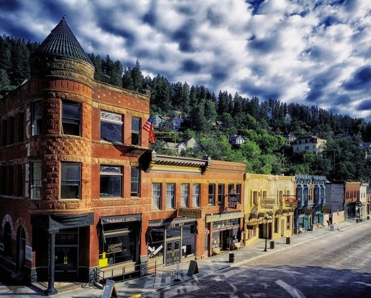
Deadwood
Location: Deadwood
Map: Open in Google Maps
Planning: Deadwood
Gold-rush history transformed this Black Hills settlement into one of America’s most famous Wild West towns.
Historic buildings, museums, gaming and seasonal reenactments keep the story alive.
Some of it is serious history.
Some of it is wonderfully theatrical.
That’s Deadwood.
Mount Moriah Cemetery
Location: Deadwood
Map: Open in Google Maps
Wild Bill Hickok and Calamity Jane are among the famous figures buried here.
The hillside also provides excellent views over Deadwood.
Lead
Location: Lead
Map: Open in Google Maps
Mining shaped this Black Hills town.
The enormous Homestake Mine became one of the most important gold mines in American history.
Today the underground site also plays a role in cutting-edge scientific research.
Gold miners left.
Particle physicists moved in.
That’s quite a neighborhood transition.
Spearfish Canyon
Location: Northern Black Hills
Map: Open in Google Maps
Limestone cliffs rise above a winding creek along one of South Dakota’s most beautiful drives.
Stop for waterfalls and short hikes.
Fall color makes the canyon especially spectacular.
Bridal Veil Falls
Location: Spearfish Canyon
Map: Open in Google Maps
A convenient roadside viewpoint makes this one of the canyon’s easiest waterfall stops.
Roughlock Falls
Location: Spearfish Canyon area
Map: Open in Google Maps
A beautiful series of cascades makes this one of the northern Black Hills’ best short excursions.
Belle Fourche
Location: Belle Fourche
Map: Open in Google Maps
The town promotes its connection to the geographic center of the United States when Alaska and Hawaii are included.
Visit the monument.
Take the photo.
Congratulations.
You are standing approximately in the middle of everything.
Missouri River Day Trips
The Missouri River region is South Dakota’s wide-open middle.
The landscape here is less about granite mountains and more about prairie, enormous reservoirs, Native American culture and skies that appear to have no intention of ending.
Pierre
Location: Pierre
Map: Open in Google Maps
South Dakota’s capital sits along the Missouri River.
It’s compact, historic and considerably quieter than most state capitals.
South Dakota State Capitol
Location: Pierre
Map: Open in Google Maps
The impressive Capitol building and surrounding grounds make an easy starting point.
Check current tour availability before visiting.
LaFramboise Island Nature Area
Location: Pierre
Map: Open in Google Maps
Trails wind through cottonwood forest beside the Missouri River.
It’s an unexpectedly peaceful escape within the capital.
Fort Pierre
Location: Fort Pierre
Map: Open in Google Maps
Cross the Missouri from Pierre and explore one of the state’s oldest communities.
The surrounding grasslands provide a very different landscape from the Black Hills.
Oahe Dam & Lake Oahe
Location: North of Pierre
Map: Open in Google Maps
Oahe Dam created one of the country’s largest reservoirs.
Fishing, boating and enormous prairie views define the area.
Chamberlain
Location: Chamberlain
Map: Open in Google Maps
The Missouri River widens dramatically around Chamberlain.
It’s one of the best places to stop while crossing the state.
And not simply because you’ve been driving through prairie for several hours.
Dignity of Earth and Sky
Location: Chamberlain
Map: Open in Google Maps
The towering stainless-steel sculpture depicts an Indigenous woman wrapped in a star quilt.
The overlook provides expansive views across the Missouri River.
Akta Lakota Museum & Cultural Center
Location: Chamberlain
Map: Open in Google Maps
Official Site: Akta Lakota Museum
The museum presents Lakota culture, history and contemporary life.
It’s an important addition to any trip through central South Dakota.
Mobridge
Location: Mobridge
Map: Open in Google Maps
This Missouri River community makes a useful base for exploring Lake Oahe and north-central South Dakota.
Sitting Bull Memorial Area
The history surrounding Sitting Bull, his death and burial is complex and contested.
Rather than reducing it to a roadside photo stop, travelers should seek Indigenous perspectives and current information when exploring sites connected with Tatanka Iyotake—Sitting Bull.
Glacial Lakes & Prairies Day Trips
Northeastern South Dakota is lake country.
Glaciers shaped the landscape, leaving lakes, wetlands and rolling prairie behind.
This is one of the quieter parts of the state.
Which is exactly why we like it.
Watertown
Location: Watertown
Map: Open in Google Maps
Watertown provides a good base for northeastern South Dakota.
Terry Redlin Art Center
Location: Watertown
Map: Open in Google Maps
Works by South Dakota artist Terry Redlin celebrate wildlife and rural American landscapes.
Redlin Art Center Grounds
Even visitors who aren’t dedicated art-museum travelers can enjoy the landscaped grounds.
This is an easy road-trip stop.
Aberdeen
Location: Aberdeen
Map: Open in Google Maps
Aberdeen anchors the northeastern portion of the state and provides access to lakes and prairie destinations.
Storybook Land
Location: Aberdeen
Map: Open in Google Maps
Fairy-tale characters and whimsical displays make this a wonderfully quirky family stop.
Children will love it.
Adults may discover childhood memories they weren’t expecting.
Sand Lake National Wildlife Refuge
Location: Near Columbia
Map: Open in Google Maps
Wetlands and prairie provide important habitat for migratory birds.
Spring and fall migration can be spectacular.
Waubay National Wildlife Refuge
Location: Northeastern South Dakota
Map: Open in Google Maps
Prairie wetlands attract waterfowl and other wildlife.
Bring binoculars.
De Smet
Location: De Smet
Map: Open in Google Maps
Readers of Laura Ingalls Wilder’s books will recognize De Smet as one of the most important places connected with her family’s story.
Laura Ingalls Wilder Historic Homes
Location: De Smet
Map: Open in Google Maps
Historic buildings help connect the author’s life with the landscapes that inspired her books.
Ingalls Homestead
Location: De Smet
Map: Open in Google Maps
The homestead provides another way to explore the Ingalls family’s South Dakota story.
Remember that pioneer history is only one layer of this landscape.
Indigenous peoples lived on and maintained relationships with these lands long before homesteaders arrived.
Southeast South Dakota Day Trips
Eastern South Dakota contains the state’s largest city, quartzite cliffs, prairie history, museums and Missouri River recreation.
And corn.
A surprising amount of decorative corn.
Sioux Falls
Location: Sioux Falls
Map: Open in Google Maps
Planning: Experience Sioux Falls
South Dakota’s largest city makes an excellent weekend base.
Restaurants, museums, trails and public art surround its signature waterfall.
Falls Park
Location: Sioux Falls
Map: Open in Google Maps
The Big Sioux River tumbles across pink Sioux quartzite in the middle of the city.
Historic structures and walking paths surround the falls.
This is one of those attractions where the city’s name tells you exactly what you’re getting.
Refreshing honesty.
SculptureWalk
Location: Downtown Sioux Falls
Map: Open in Google Maps
Outdoor sculptures line downtown streets.
Combine the walk with restaurants and Falls Park.
Good Earth State Park at Blood Run
Location: Near Sioux Falls
Map: Open in Google Maps
This landscape preserves part of an important Indigenous cultural site along the Big Sioux River.
For centuries, Native peoples gathered and lived in this area.
Trails and interpretive exhibits help visitors understand a history that reaches far beyond South Dakota statehood.
Palisades State Park
Location: Garretson
Map: Open in Google Maps
Pink Sioux quartzite cliffs rise dramatically along Split Rock Creek.
Hike.
Paddle.
Photograph the cliffs.
And wonder why more people outside South Dakota don’t know this place exists.
Exactly our kind of park.
Devil’s Gulch
Location: Garretson
Map: Open in Google Maps
Local legend says outlaw Jesse James escaped pursuers by jumping his horse across the gulch.
Did it happen exactly as the legend says?
That’s considerably harder to prove.
Does the story make the stop more entertaining?
Absolutely.
Mitchell Corn Palace
Location: Mitchell
Map: Open in Google Maps
Official Site: Corn Palace
Every year, murals on this unusual building are decorated using corn and other grains.
You may begin the day wondering:
“Do I really need to see a building decorated with corn?”
Then you’re standing in front of it taking pictures.
Road trips change people.
Vermillion
Location: Vermillion
Map: Open in Google Maps
Home to the University of South Dakota, Vermillion combines museums, history and Missouri River country.
National Music Museum
Location: Vermillion
Map: Open in Google Maps
Official Site: National Music Museum
The collection contains remarkable musical instruments from around the world.
You don’t need to be a musician to appreciate it.
Spirit Mound Historic Prairie
Location: Near Vermillion
Map: Open in Google Maps
Lewis and Clark visited this prominent prairie hill in 1804 after hearing Indigenous accounts connected with the place.
The Indigenous history predates the expedition by generations.
Walk the prairie trail and look across the landscape.
Yankton
Location: Yankton
Map: Open in Google Maps
Once the capital of Dakota Territory, Yankton sits along the Missouri River.
Historic architecture and river recreation make it an excellent southeastern destination.
Lewis & Clark Recreation Area
Location: Near Yankton
Map: Open in Google Maps
Lewis and Clark Lake provides beaches, boating, fishing and trails.
Best Scenic Drives in South Dakota
South Dakota is one of America’s great driving states.
Try these.
Needles Highway
Granite spires, tunnels and mountain scenery.
Iron Mountain Road
Pigtail bridges and tunnels framing Mount Rushmore.
Spearfish Canyon Scenic Byway
Waterfalls and limestone cliffs.
Badlands Loop Road
Otherworldly geology and prairie wildlife.
Wildlife Loop Road
Bison country in Custer State Park.
Peter Norbeck Scenic Byway
Combine several famous Black Hills roads into one extraordinary loop.
Native American Scenic Byway
Follow portions of the Missouri River through landscapes rich in Indigenous history and culture.
City Unknown Tip: Don’t try to combine every famous Black Hills scenic road into a rushed half-day.
You’ll spend the entire trip staring through a windshield instead of actually experiencing the Black Hills.
Native American Heritage in South Dakota
South Dakota cannot be understood without Indigenous history.
The state is home to nine tribal nations, and Lakota, Dakota and Nakota cultures remain living and vital parts of South Dakota today.
Consider including:
Akta Lakota Museum
Good Earth State Park at Blood Run
Dignity of Earth and Sky
Oglala Lakota College Historical Center
Pine Ridge Reservation
Cheyenne River Reservation
Standing Rock region
Sisseton Wahpeton cultural sites
Mitchell Prehistoric Indian Village
Crazy Horse Memorial
But remember:
Reservations are communities.
Not tourist attractions.
Travel respectfully, use Native-owned businesses when possible, follow local rules and seek tribal or Native-led interpretation rather than treating Indigenous history as something that ended in the 1800s.
South Dakota Ghost Town Day Trips
Now we’re entering City Unknown territory.
Mining booms left abandoned communities scattered across western South Dakota.
Tinton
Location: Northern Black Hills
Once a mining community near the Wyoming border, Tinton declined after mining operations faded.
Much surrounding land is private.
Do not trespass.
Spokane Ghost Town
Location: Black Hills near Custer
Remnants of this former mining community hide among the trees.
Check current legal access before exploring.
Mystic
An old Black Hills mining and railroad community with remnants scattered through the forest.
Galena
Mining history survives around this quiet Black Hills area.
Some structures and surrounding property are private.
Ardmore
Near the Nebraska border, this abandoned community represents a completely different kind of South Dakota ghost town.
Ghost-Town Rule
Abandoned does not mean public.
Old building does not mean open.
“No Trespassing” does not mean “unless you’re writing a travel blog.”
Respect private property.
Hidden Gems Worth the South Dakota Detour
Roughlock Falls
Beautiful waterfalls near Spearfish Canyon.
Devil’s Gulch
Outlaw legend and quartzite scenery.
Pactola Reservoir
Location: Black Hills
Map: Open in Google Maps
A mountain reservoir surrounded by Black Hills National Forest.
Bear Butte State Park
Location: Near Sturgis
Map: Open in Google Maps
This striking geological formation is sacred to multiple Indigenous nations.
Visitors should respect ceremonies, prayer materials and posted guidelines.
This is not simply another hiking mountain.
Black Hills Wild Horse Sanctuary Area
The southern Black Hills contain wide-open prairie landscapes that feel remarkably remote.
Verify current tour availability before planning around any private sanctuary.
Termesphere Gallery
Location: Spearfish area
Artist Dick Termes paints extraordinary scenes on spherical canvases.
It’s strange.
It’s clever.
It’s completely appropriate for City Unknown.
Geographic Center Monument
Belle Fourche’s monument celebrates the approximate geographic center of the 50 United States.
Because every road trip needs at least one geographical technicality.
Best Small-Town Day Trips in South Dakota
Add these to the road-trip list:
Deadwood
Lead
Custer
Hill City
Keystone
Hot Springs
Spearfish
Wall
De Smet
Yankton
Vermillion
Chamberlain
Mitchell
Belle Fourche
Garretson
Sturgis
Some are famous.
Others are places you’ll discover because you stopped for coffee and accidentally spent two hours wandering around.
Those are often the better stops.
Best South Dakota Day Trips for Families
Try:
Mount Rushmore
Badlands National Park
Custer State Park
Mammoth Site
Jewel Cave
Wind Cave
Wall Drug
Falls Park
Palisades State Park
Corn Palace
Storybook Land
De Smet
National Music Museum
Minuteman Missile National Historic Site
South Dakota is especially good for families because many attractions combine sightseeing with genuinely unusual stories.
Dinosaurs?
Check.
Mammoths?
Check.
Giant presidential heads?
Check.
Corn-covered palace?
Also check.
Children may begin to suspect South Dakota has no rules.
Budget-Friendly South Dakota Day Trips
Some of the state’s best experiences involve scenic drives, public landscapes and historic communities.
Build affordable trips around:
Falls Park
Downtown Deadwood
Spearfish Canyon
Dignity sculpture
Wildlife refuges
National grasslands
Historic downtowns
Scenic overlooks
Prairie walks
State Capitol grounds
Wall Drug
Public lands
Don’t build the permanent article around exact admission and parking prices.
Those change.
For example, Mount Rushmore does not charge an entrance fee, but its concession-operated parking facility does.
Always check current official information before leaving.
Best South Dakota Spring Day Trips
Try:
Badlands
Wind Cave prairie
Palisades
Good Earth
Falls Park
Wildlife refuges
Missouri River
Custer State Park
Spring can bring rapidly changing weather.
Snow isn’t finished simply because your calendar says it should be.
Best South Dakota Summer Day Trips
Summer opens the largest number of possibilities.
Try:
Black Hills
Custer State Park
Mount Rushmore
Jewel Cave
Wind Cave
Deadwood
Lake Oahe
Lewis & Clark Lake
Badlands
But summer heat in the Badlands can become intense.
Hike early.
Carry plenty of water.
Best South Dakota Fall Day Trips
Fall belongs to the Black Hills.
Try:
Spearfish Canyon
Needles Highway
Custer State Park
Deadwood
Black Hills backroads
Pactola Reservoir
Badlands
Missouri River
Spearfish Canyon is the obvious fall favorite.
Drive it early in the day before peak-season traffic arrives.
Best South Dakota Winter Day Trips
Winter completely changes the state.
Consider:
Deadwood
Spearfish
Sioux Falls
Badlands overlooks when roads are safe
Black Hills scenic areas
Museums
Mammoth Site
Jewel Cave
Wind Cave
Winter road conditions can change quickly.
Some scenic roads close seasonally.
Check current conditions before leaving.
South Dakota Road-Trip Combinations
Try:
Badlands → Wall Drug → Minuteman Missile
Mount Rushmore → Iron Mountain Road → Custer State Park
Custer → Crazy Horse → Sylvan Lake
Hot Springs → Mammoth Site → Wind Cave
Jewel Cave → Custer → Needles Highway
Deadwood → Lead → Spearfish Canyon
Spearfish → Belle Fourche → Bear Butte
Pierre → Oahe Dam → Fort Pierre
Chamberlain → Dignity → Akta Lakota Museum
Sioux Falls → Palisades → Devil’s Gulch
Vermillion → Spirit Mound → Yankton
Mitchell → Corn Palace → Chamberlain
The western attractions look close together on a map.
Mountain roads make distances deceptive.
Give yourself time.
South Dakota Road-Trip Safety
Watch for:
Bison
Summer heat
Thunderstorms
Hail
Winter storms
Wildfire conditions
Mountain-road closures
Narrow tunnels
Prairie rattlesnakes
Ticks
Limited cell service
Long distances between fuel stops in rural areas
Flash flooding
Rapid weather changes
And again:
Do not approach bison.
A Yellowstone-style wildlife traffic jam is unnecessary.
If the bison owns the road…
the bison owns the road.
More South Dakota Adventures from City Unknown
Continue exploring the Mount Rushmore State:
South Dakota Hidden Gems — Discover waterfalls, abandoned places and overlooked prairie destinations.
Ultimate Black Hills Road Trip — Mount Rushmore, Custer, caves, scenic highways and mountain towns.
South Dakota Ghost Town Road Trip — Explore the remnants of mining communities across the Black Hills.
Ultimate Badlands Road Trip — Badlands National Park, Wall and Minuteman Missile.
South Dakota Native American Heritage Road Trip — Explore Native-led cultural and historic destinations.
South Dakota Small-Town Road Trip — Discover Deadwood, Custer, Hot Springs, De Smet and more.
South Dakota Scenic Drives — Needles Highway, Iron Mountain Road, Spearfish Canyon and beyond.
South Dakota Weird & Unusual Places — Find giant roadside attractions, legends and unexpected museums.
South Dakota Fall Color Road Trip — Explore Spearfish Canyon and the Black Hills.
Best Day Trips from Rapid City
Best Day Trips from Sioux Falls
Best Day Trips from Deadwood
Best Day Trips from Pierre
And for the spooky side of City Unknown:
15 South Dakota Ghost Towns With Stories to Tell
21 Haunted Places in South Dakota
Deadwood alone should keep that department busy.
Find Your Next South Dakota Adventure
See Mount Rushmore.
Drive through the Badlands.
Watch bison in Custer State Park.
Those belong on the list.
Then keep going.
Drive into Spearfish Canyon.
Walk through an old mining town.
Explore a cave.
Stand beside a mammoth excavation.
Follow the Missouri River.
Learn the stories of Lakota, Dakota and Nakota communities.
Visit a Cold War missile site.
Walk through prairie grass.
Find Jesse James’ legendary escape route.
Visit a palace decorated with corn.
Stop at Wall Drug even though you promised yourself you wouldn’t.
Then take the backroad.
South Dakota is famous for four enormous faces carved into a mountain.
But some of its best stories aren’t carved into anything.
You have to go looking for them.
City Unknown Tip
Don’t make the classic South Dakota mistake:
Flying into Rapid City, photographing Mount Rushmore and assuming you’ve seen the state.
Give the Black Hills several days.
Give the Badlands their own sunrise or sunset.
Spend time along the Missouri River.
Explore eastern South Dakota.
And leave room for roadside stops you didn’t plan.
Because South Dakota is one of those places where a sign reading:
HISTORIC SITE — 6 MILES
can completely destroy your schedule.
That’s usually a good thing.