
Virginia is one of those states that makes road trips dangerously easy.
Start the morning watching fog lift from the Blue Ridge Mountains.
Spend lunch wandering through a town older than the United States.
Explore a cavern in the afternoon.
Then somehow end up eating seafood beside the Chesapeake Bay.
The best day trips in Virginia cover an extraordinary amount of ground: mountain trails, waterfalls, colonial history, small towns, wild ponies, beaches, caverns, scenic drives and some wonderfully strange roadside discoveries.
And unlike some enormous states where a “day trip” requires three tanks of gas and an emotional support cooler, Virginia’s geography makes many adventures surprisingly manageable.
Pick a region.
Take the backroads.
And leave room for detours.
Jump to a Virginia Region
Northern Virginia
Alexandria, Mount Vernon, Great Falls, Manassas, Middleburg and Hunt Country.
Shenandoah Valley
Shenandoah National Park, Skyline Drive, Luray Caverns, Winchester and Staunton.
Virginia Mountains & Blue Ridge
Natural Bridge, Roanoke, waterfalls, mountain trails and the Blue Ridge Parkway.
Central Virginia & Piedmont
Charlottesville, Richmond, Monticello, Appomattox and James River country.
Southwest Virginia
Abingdon, Bristol, Grayson Highlands, the Crooked Road and Appalachian culture.
Coastal Virginia & Hampton Roads
Williamsburg, Jamestown, Yorktown, Norfolk and Virginia Beach.
Chesapeake Bay & Eastern Shore
Chincoteague, Cape Charles, barrier islands and quiet coastal towns.
Southern Virginia
Danville, Martinsville, South Boston, lakes, racing history and backroads.
Or jump directly to:
Scenic Drives | Waterfalls | Small Towns | Hidden Gems | History Trips | Family Trips | Fall Trips
Northern Virginia Day Trips
Northern Virginia sits beside Washington, D.C., but it doesn’t take long to escape the Beltway.
Cobblestone streets, waterfalls, Civil War landscapes, wineries, horse country and tiny historic towns begin surprisingly close to the capital.
Old Town Alexandria
Location: Alexandria
Map: Open in Google Maps
Planning: Visit Alexandria
Brick sidewalks and historic buildings lead toward the Potomac River in one of Virginia’s most walkable historic districts.
Explore King Street.
Walk the waterfront.
Duck down the side streets.
Then stay for dinner.
Alexandria rewards wandering.
Best for: History, couples, food and walkable day trips.
George Washington’s Mount Vernon
Location: Mount Vernon
Map: Open in Google Maps
Official Site: Mount Vernon
George Washington’s estate overlooks the Potomac River.
The mansion gets much of the attention, but the broader property helps tell a considerably more complicated story.
Take time to learn about the enslaved people who lived and worked at Mount Vernon as well as Washington’s life and presidency.
History becomes more useful when we tell all of it.
Great Falls Park
Location: McLean
Map: Open in Google Maps
Official Site: National Park Service
The Potomac River crashes through a narrow rocky gorge just outside Washington.
Several overlooks make the dramatic rapids surprisingly easy to see.
Trails continue along the river and through surrounding woodland.
City Unknown Tip
The water at Great Falls is extremely powerful.
Enjoy it from approved overlooks and trails.
This is not a swimming hole.
Manassas National Battlefield Park
Location: Manassas
Map: Open in Google Maps
Official Site: National Park Service
Two major Civil War battles were fought across this landscape.
Walking trails and interpretive stops help visitors understand the battles and the larger conflict that surrounded them.
Remember that Civil War history cannot be separated from slavery and the political struggle over its expansion and preservation.
Middleburg
Location: Middleburg
Map: Open in Google Maps
Horse farms and stone walls surround this tiny historic town.
Middleburg makes a particularly good destination when you want scenery, shops and lunch rather than an ambitious hiking expedition.
Leesburg
Location: Leesburg
Map: Open in Google Maps
Historic downtown Leesburg is surrounded by Loudoun County countryside.
It’s an easy jumping-off point for exploring northern Virginia’s farms, historic sites and backroads.
Occoquan
Location: Occoquan
Map: Open in Google Maps
This tiny riverfront town packs galleries, restaurants and historic buildings into a wonderfully walkable center.
Shenandoah Valley Day Trips
Mountains rise on both sides of the Shenandoah Valley.
Between them you’ll find caverns, farms, historic towns, hiking trails and one of America’s great scenic roads.
This is road-trip territory.
Shenandoah National Park
Location: Blue Ridge Mountains
Map: Open in Google Maps
Official Site: National Park Service
Shenandoah National Park protects more than 100 miles of Blue Ridge mountain country.
Hiking trails lead to waterfalls, rocky summits and forest overlooks.
Black bears live throughout the park.
Give them space.
Your picnic is not worth becoming an NPS incident report.
Best for: Hiking, wildlife, scenic drives and fall color.
Skyline Drive
Location: Shenandoah National Park
Map: Open in Google Maps
Skyline Drive runs 105 miles along the crest of the Blue Ridge Mountains.
Dozens of overlooks make it possible to have a spectacular day without tackling a major hike.
Driving the entire road takes considerably longer than the mileage suggests.
That’s intentional.
Slow down.
Old Rag Mountain
Location: Shenandoah National Park
Map: Open in Google Maps
Old Rag is one of Virginia’s legendary hikes.
Rock scrambling and steep terrain make this considerably more demanding than an ordinary walk through the woods.
Seasonal day-use ticket requirements apply during much of the main hiking season.
Check current NPS requirements before leaving.
Luray Caverns
Location: Luray
Map: Open in Google Maps
Official Site: Luray Caverns
Huge underground rooms filled with stalactites and stalagmites have made Luray one of America’s best-known commercial caverns.
It’s also a useful summer strategy.
Virginia: 93 degrees.
Underground: considerably more civilized.
Winchester
Location: Winchester
Map: Open in Google Maps
Historic architecture, museums and Shenandoah Valley scenery make Winchester a strong northern gateway to the valley.
Staunton
Location: Staunton
Map: Open in Google Maps
Planning: Visit Staunton
Staunton has one of Virginia’s best historic downtowns.
Restaurants, shops and impressive architecture make it worth exploring on foot.
American Shakespeare Center
Location: Staunton
Map: Open in Google Maps
Performances at the Blackfriars Playhouse recreate aspects of Shakespeare’s indoor theater environment.
Check the performance calendar before visiting.
Natural Chimneys
Location: Mount Solon
Map: Open in Google Maps
Towering limestone formations rise unexpectedly from the Shenandoah Valley countryside.
It’s exactly the kind of geological oddity City Unknown likes finding.
Virginia Mountains & Blue Ridge Day Trips
Western Virginia gets wonderfully rugged.
Mountain ridges, waterfalls, rivers and old railroad towns fill the region.
Natural Bridge State Park
Location: Natural Bridge
Map: Open in Google Maps
Official Site: Virginia State Parks
A massive limestone arch rises about 200 feet above Cedar Creek.
But don’t take the picture and leave.
Trails continue beneath the bridge through the gorge toward Lace Falls.
The park also offers mountain views and dark-sky programs.
Best for: Geology, hiking, families and photography.
Roanoke
Location: Roanoke
Map: Open in Google Maps
Planning: Visit Virginia’s Blue Ridge
Roanoke sits directly in Virginia’s Blue Ridge.
The city combines railroad history, museums and easy access to mountain recreation.
Roanoke Star
Location: Mill Mountain
Map: Open in Google Maps
The enormous illuminated star overlooks Roanoke from Mill Mountain.
The viewpoint is especially good near sunset.
Blue Ridge Parkway
Location: Western Virginia
Map: Open in Google Maps
Official Site: National Park Service
The Blue Ridge Parkway begins where Skyline Drive ends and continues south toward North Carolina.
Overlooks, hiking trails and mountain communities make even a short section worthwhile.
Check current road conditions before traveling, particularly after storms or during winter.
Peaks of Otter
Location: Blue Ridge Parkway
Map: Open in Google Maps
Sharp Top and surrounding peaks rise beside Abbott Lake.
Hiking options range from relaxed lakeside walks to much steeper climbs.
Falling Spring Falls
Location: Near Covington
Map: Open in Google Maps
One of Virginia’s most beautiful waterfalls is visible from a roadside overlook.
Enjoy the designated viewpoint.
Do not attempt to climb down toward the falls.
McAfee Knob
Location: Near Roanoke
Map: Open in Google Maps
This famous Appalachian Trail overlook provides one of Virginia’s signature mountain views.
It’s a substantial hike.
Treat it accordingly.
Central Virginia & Piedmont Day Trips
Central Virginia mixes presidential history, mountain foothills, rivers, farms and two of the state’s most interesting cities.
Charlottesville
Location: Charlottesville
Map: Open in Google Maps
Planning: Visit Charlottesville
Charlottesville combines university-town energy with Blue Ridge scenery and major historic sites.
Monticello
Location: Charlottesville
Map: Open in Google Maps
Official Site: Monticello
Thomas Jefferson designed Monticello and lived here for decades.
But understanding the property means understanding the lives of the hundreds of enslaved people who lived and worked there as well.
Give yourself enough time for the complete story rather than treating Monticello as simply an architectural tour.
Richmond
Location: Richmond
Map: Open in Google Maps
Planning: Visit Richmond
Virginia’s capital combines museums, neighborhoods, food, Civil War and Civil Rights history, and surprisingly adventurous outdoor recreation.
James River Park System
Location: Richmond
Map: Open in Google Maps
Trails and river recreation run directly through the city.
Richmond is one of those places where you can visit a museum and then find yourself scrambling across rocks beside a river twenty minutes later.
We approve.
Virginia Museum of Fine Arts
Location: Richmond
Map: Open in Google Maps
An excellent museum and an easy anchor for a Richmond cultural day.
Appomattox Court House National Historical Park
Location: Appomattox
Map: Open in Google Maps
Official Site: National Park Service
Robert E. Lee surrendered the Army of Northern Virginia to Ulysses S. Grant at Appomattox Court House in April 1865.
The event helped bring the Civil War toward its conclusion, although fighting elsewhere continued.
Explore the reconstructed and preserved village rather than simply checking off the surrender site.
Southwest Virginia Day Trips
Southwest Virginia feels different.
Appalachian mountains dominate the landscape.
Music traditions run deep.
Small communities sit along winding roads.
This is one of Virginia’s best regions for travelers who prefer the long way around.
Grayson Highlands State Park
Location: Mouth of Wilson
Map: Open in Google Maps
Official Site: Virginia State Parks
High-elevation meadows provide sweeping views across southwest Virginia.
The park is also famous for free-roaming ponies.
They are wonderful.
They are photogenic.
They are not your pets.
Do not feed them.
Best for: Hiking, photography and mountain scenery.
Mount Rogers
Location: Southwest Virginia
Map: Open in Google Maps
At 5,729 feet, Mount Rogers is Virginia’s highest point.
Interestingly, the wooded summit doesn’t provide the dramatic panorama you might expect.
The journey through surrounding highlands is the real attraction.
Abingdon
Location: Abingdon
Map: Open in Google Maps
Historic architecture, restaurants, arts and outdoor recreation make Abingdon an excellent southwest Virginia base.
Virginia Creeper Trail
Location: Abingdon to Whitetop area
Map: Open in Google Maps
This former railroad corridor became one of Virginia’s best-known cycling trails.
Check the current status of trail sections, shuttle operations and bridges before planning your ride.
Bristol
Location: Virginia-Tennessee border
Map: Open in Google Maps
One downtown.
Two states.
Stand on State Street and you’ve got Virginia on one side and Tennessee on the other.
Birthplace of Country Music Museum
Location: Bristol
Map: Open in Google Maps
The museum explores the influential 1927 Bristol Sessions and the musical traditions surrounding them.
The Crooked Road
Location: Southwest Virginia
Planning: The Crooked Road
This heritage music trail connects communities, venues and traditions throughout southwest Virginia.
Bluegrass, old-time and gospel music aren’t museum pieces here.
They’re living traditions.
Breaks Interstate Park
Location: Virginia-Kentucky border
Map: Open in Google Maps
A dramatic gorge cuts through the Appalachian Mountains along the state line.
Hiking and overlooks provide enormous views.
Coastal Virginia & Hampton Roads Day Trips
Now trade mountains for saltwater.
Coastal Virginia combines beaches, naval history and some of America’s most important colonial sites.
Colonial Williamsburg
Location: Williamsburg
Map: Open in Google Maps
Official Site: Colonial Williamsburg
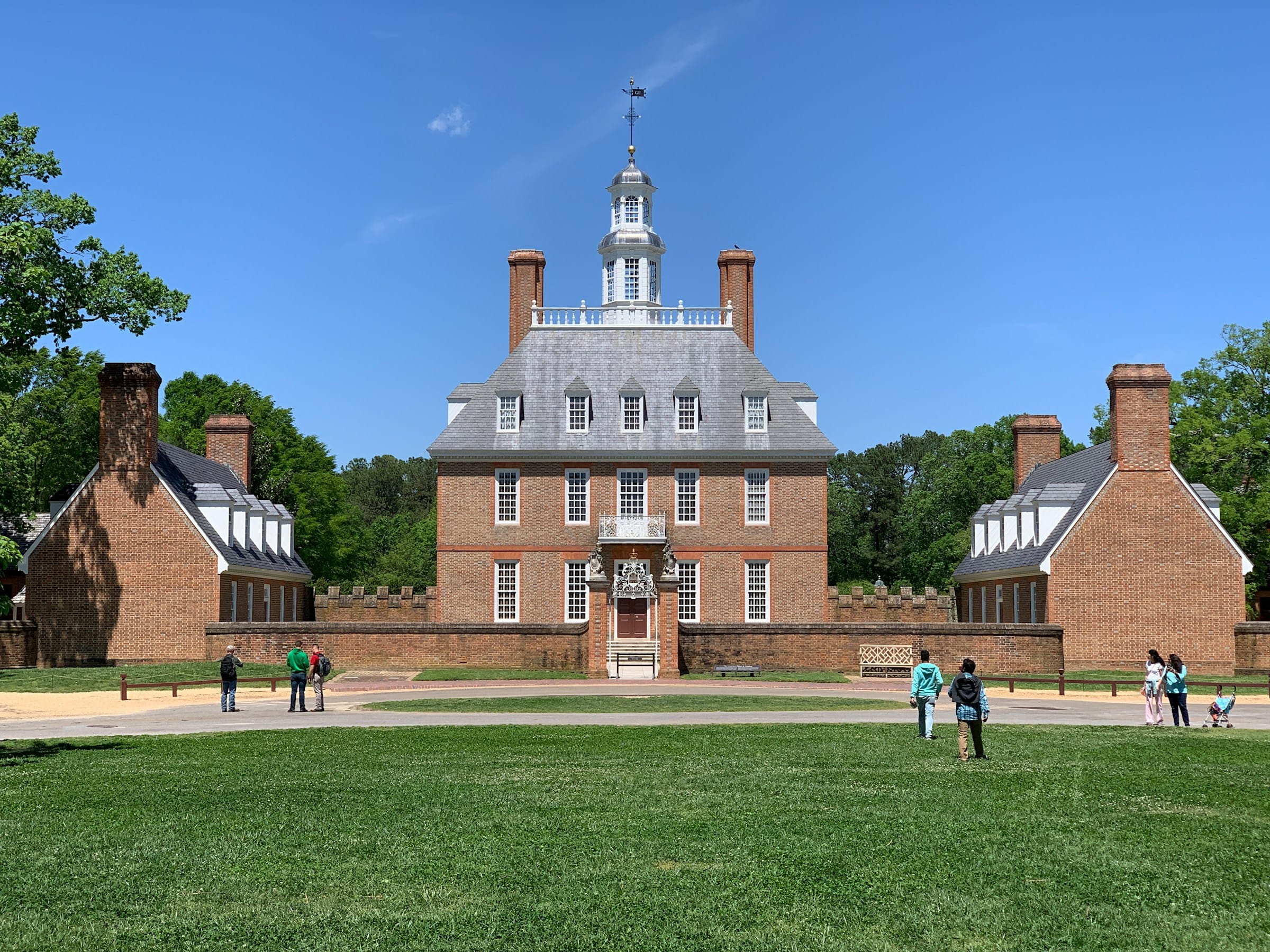
Historic buildings and interpreters recreate life in Virginia’s colonial capital.
Look beyond powdered wigs.
Modern interpretation increasingly explores enslaved people, women, Native peoples and ordinary residents alongside famous political figures.
That’s where the history gets interesting.
Historic Jamestowne
Location: Jamestown
Map: Open in Google Maps
Official Site: National Park Service
Jamestown became the first permanent English settlement in what became the United States in 1607.
But Europeans did not arrive in an empty landscape.
Indigenous peoples had lived throughout the region for thousands of years.
The interactions among English settlers, Powhatan peoples and Africans are central to understanding early Virginia.
Yorktown
Location: Yorktown
Map: Open in Google Maps
The 1781 Siege of Yorktown effectively ended major fighting in the American Revolution.
Today the waterfront, battlefield and historic village make an excellent complement to Williamsburg and Jamestown.
Colonial Parkway
Connect Jamestown, Williamsburg and Yorktown for one of America’s best history-focused road trips.
Allow a full day.
Better yet, allow two.
Four centuries of history deserve more than a speed run.
Virginia Beach
Location: Virginia Beach
Map: Open in Google Maps
Planning: Visit Virginia Beach
The resort oceanfront gets the attention.
But Virginia Beach extends far beyond the boardwalk.
Explore coastal parks, wildlife areas and quieter beaches too.
First Landing State Park
Location: Virginia Beach
Map: Open in Google Maps
Trails wind through maritime forest, wetlands and shoreline.
It’s a surprisingly wild escape inside a major metropolitan area.
Norfolk
Location: Norfolk
Map: Open in Google Maps
Naval history, museums and waterfront neighborhoods make Norfolk worth its own day.
Nauticus & Battleship Wisconsin
Location: Norfolk
Map: Open in Google Maps
Explore maritime history beside one very large battleship.
And by “very large,” we mean you will reconsider your personal definition of large.
Chesapeake Bay & Eastern Shore Day Trips
Cross the Chesapeake Bay Bridge-Tunnel and Virginia changes again.
The Eastern Shore is narrow, quiet and wonderfully different from the mainland.
Fishing villages, wildlife refuges, beaches and historic towns stretch between Chesapeake Bay and the Atlantic.
Chincoteague Island
Location: Chincoteague
Map: Open in Google Maps
Planning: Chincoteague Chamber of Commerce
Chincoteague is the gateway to one of Virginia’s most famous coastal landscapes.
Wildlife, seafood and a relaxed island atmosphere make it an excellent Eastern Shore base.
Chincoteague National Wildlife Refuge
Location: Assateague Island
Map: Open in Google Maps
Marshes, beaches and maritime habitat support migratory birds and other wildlife.
The famous ponies live on Assateague.
Observe them from a respectful distance.
Wild pony does not translate to “free petting zoo.”
Cape Charles
Location: Cape Charles
Map: Open in Google Maps
Historic streets, a public beach and Chesapeake Bay sunsets make Cape Charles one of Virginia’s most charming coastal towns.
Kiptopeke State Park
Location: Cape Charles area
Map: Open in Google Maps
Beaches, birding and Chesapeake Bay views make Kiptopeke a strong addition to an Eastern Shore trip.
Chesapeake Bay Bridge-Tunnel
Location: Virginia Beach to Eastern Shore
Map: Open in Google Maps
The drive itself is part of the adventure.
Bridges and tunnels carry US 13 across the mouth of Chesapeake Bay for more than 17 miles.
It’s an impressive piece of engineering.
And slightly surreal when the road simply disappears beneath the ocean.
Southern Virginia Day Trips
Southern Virginia doesn’t receive the attention of Shenandoah or Virginia Beach.
That’s precisely why City Unknown should be looking here.
Small towns, lakes, motorsports, Civil Rights history and quiet countryside make this excellent detour territory.
Danville
Location: Danville
Map: Open in Google Maps
Danville’s tobacco and textile history shaped the city.
Historic districts and revitalized riverfront areas tell a story of a community continuing to reinvent itself.
Danville Riverwalk Trail
Location: Danville
Map: Open in Google Maps
Walk or bike beside the Dan River through the city.
Martinsville
Location: Martinsville
Map: Open in Google Maps
Motorsports fans know the name immediately.
But racing isn’t the only reason to visit.
Virginia Museum of Natural History
Location: Martinsville
Map: Open in Google Maps
Fossils, geology and natural history make this an excellent family stop.
Occoneechee State Park
Location: Clarksville
Map: Open in Google Maps
This park sits beside Buggs Island Lake, also known as Kerr Reservoir.
Boating, fishing and trails make it a relaxed southern Virginia getaway.
The park’s name reflects the Occaneechi people, whose history in this region predates European settlement.
Virginia Waterfall Day Trips
Virginia’s mountains hide dozens of waterfalls.
Start with:
Dark Hollow Falls
Whiteoak Canyon Falls
Crabtree Falls
Cascade Falls
Falling Spring Falls
Apple Orchard Falls
Dismal Falls
Stiles Falls
Roaring Run
Bent Mountain Falls
Some require serious hikes.
Others are practically roadside attractions.
Waterfall conditions vary dramatically with rainfall.
Wet rocks are slippery.
And the top of a waterfall is an especially poor location to test gravity.
Best Scenic Drives in Virginia
Skyline Drive
The classic.
105 miles through Shenandoah National Park.
Blue Ridge Parkway
Mountain overlooks and hiking trails continue south from Shenandoah.
Colonial Parkway
Connect Jamestown, Williamsburg and Yorktown.
Route 11
Travel through Shenandoah Valley towns rather than racing along Interstate 81.
Route 58
One of Virginia’s great east-west road-trip corridors.
The Crooked Road
Combine mountain scenery with southwest Virginia’s musical heritage.
Route 5
Historic landscapes follow the James River between Richmond and Williamsburg.
George Washington Memorial Parkway
Potomac River scenery connects northern Virginia destinations.
Best Small-Town Day Trips in Virginia
Put these on the list:
Staunton
Lexington
Abingdon
Cape Charles
Middleburg
Leesburg
Occoquan
Smithfield
Culpeper
Orange
Floyd
Farmville
Chincoteague
Clifton
Washington
Wytheville
Luray
Front Royal
Onancock
Irvington
Some have mountain views.
Some have seafood.
Some have centuries of history.
And several have enough ghost stories to keep our Halloween calendar busy.
Hidden Gems Worth the Virginia Detour
Natural Chimneys
Towering limestone formations hiding in the Shenandoah Valley.
Great Channels of Virginia
Location: Channels State Forest area
Map: Open in Google Maps
Huge sandstone blocks form narrow passageways resembling a natural maze.
It’s one of Virginia’s strangest geological landscapes.
Devil’s Bathtub
Location: Southwest Virginia
Map: Open in Google Maps
A striking blue-green pool sits along a rugged mountain stream.
Parking and trail conditions can be challenging.
Check local conditions and access rules before visiting.
Tangier Island
Location: Chesapeake Bay
Map: Open in Google Maps
Accessible by boat, Tangier preserves a distinctive Chesapeake Bay community with deep ties to fishing and crabbing.
This is a living community, not a theme park.
Visit accordingly.
Breaks Interstate Park
Virginia and Kentucky share one enormous gorge.
Burke’s Garden
Location: Tazewell County
Map: Open in Google Maps
A huge mountain-ringed valley forms one of Virginia’s most unusual landscapes.
From above, it resembles an enormous crater.
It isn’t.
But let’s be honest.
“Secret mountain valley” is already good enough.
Virginia History Day Trips
Few states can build history road trips quite like Virginia.
Explore:
Jamestown
Williamsburg
Yorktown
Mount Vernon
Monticello
Manassas
Appomattox Court House
Fredericksburg
Richmond
Petersburg
Arlington
Hampton
Fort Monroe
Booker T. Washington National Monument
Maggie L. Walker National Historic Site
But Virginia history is complicated.
Native nations lived here long before English settlement.
Colonial wealth became deeply connected to enslaved labor.
Virginia became central to the American Revolution, the creation of the United States, slavery, the Civil War, emancipation and the long struggle for civil rights.
The best historic sites don’t simplify that story.
Neither should we.
Best Virginia Day Trips for Families
Try:
Luray Caverns
Virginia Aquarium
Colonial Williamsburg
Virginia Museum of Natural History
Natural Bridge
Shenandoah National Park
Virginia Beach
Chincoteague
Nauticus
Virginia Living Museum
Science Museum of Virginia
Frontier Culture Museum
Great Falls Park
Grayson Highlands
Caves.
Ponies.
Battleships.
Beaches.
Mountains.
Virginia has this family-trip thing pretty well covered.
Best Virginia Fall Day Trips
Fall is when Virginia’s mountains become difficult to ignore.
Try:
Skyline Drive
Shenandoah National Park
Blue Ridge Parkway
Grayson Highlands
Mount Rogers
Roanoke
Staunton
Lexington
Abingdon
Burke’s Garden
Peaks of Otter
George Washington National Forest
Virginia Creeper country
Peak foliage varies by elevation, latitude and weather.
Mountain elevations generally change before lower Piedmont and coastal areas.
Follow current foliage reports rather than last year’s Instagram date.
Trees remain stubbornly unwilling to coordinate with vacation schedules.
Best Virginia Spring Day Trips
Spring works beautifully for:
Shenandoah waterfalls
Richmond gardens
Charlottesville
Williamsburg
Northern Virginia
Great Falls
Shenandoah Valley
Eastern Shore
Mountain weather can still be chilly while coastal Virginia feels comfortably warm.
Best Virginia Summer Day Trips
Try:
Virginia Beach
Chincoteague
Cape Charles
Shenandoah
Blue Ridge Parkway
Mountain waterfalls
Smith Mountain Lake
Lake Moomaw
New River
Start strenuous mountain hikes early.
Summer humidity has a remarkable ability to make an innocent hill feel personally offensive.
Best Virginia Winter Day Trips
Winter brings a completely different Virginia.
Try:
Colonial Williamsburg
Richmond museums
Alexandria
Staunton
Luray Caverns
Virginia Beach
Mountain resorts
Blue Ridge winter scenery when roads permit
Skyline Drive and Blue Ridge Parkway sections can close because of snow, ice or storm damage.
Check conditions before leaving.
Virginia Food Day Trips
A proper Virginia road trip should include:
Chesapeake Bay oysters
Virginia ham
Peanuts
Blue crabs
Appalachian food
Country biscuits
Fresh seafood
Apple butter
Farm markets
Local barbecue
Then there are Virginia’s wineries, cideries and breweries for adults who choose to include them.
Always designate a driver.
Our preferred road-trip souvenir is a refrigerator magnet.
Not a court date.
Virginia Road-Trip Combinations
Try:
Alexandria → Mount Vernon → Occoquan
Great Falls → Middleburg → Leesburg
Front Royal → Skyline Drive → Luray
Luray → Luray Caverns → Shenandoah
Staunton → Natural Chimneys → Shenandoah Valley backroads
Lexington → Natural Bridge → Blue Ridge Parkway
Roanoke → Mill Mountain → Peaks of Otter
Charlottesville → Monticello → Blue Ridge foothills
Richmond → Route 5 → Williamsburg
Williamsburg → Jamestown → Yorktown
Virginia Beach → First Landing → Norfolk
Cape Charles → Kiptopeke → Eastern Shore
Chincoteague → Assateague
Abingdon → Virginia Creeper Trail
Bristol → Abingdon → Crooked Road
Grayson Highlands → Mount Rogers country
Those are actual day trips.
Trying:
Alexandria → Virginia Beach → Grayson Highlands → Alexandria
is technically also a trip.
It’s just a terrible one.
Virginia Road-Trip Safety
Virginia looks gentle on a map.
The mountains occasionally disagree.
Watch for:
Mountain weather
Snow and ice
Flash flooding
Hurricane and tropical-storm impacts
Rocky trails
Waterfall hazards
Ticks
Black bears
Limited mountain cell service
Seasonal road closures
Coastal flooding
Strong ocean currents
Fall traffic
Fog on mountain roads
Download maps before remote hikes.
Check park and road conditions after storms.
Carry water.
And don’t treat Skyline Drive like a racecourse.
The deer definitely aren’t checking for traffic before crossing.
City Unknown Tip
Virginia is one of the best states for building two-stop day trips.
Pair a major destination with something smaller nearby.
Shenandoah + Luray.
Woodstock + a backroad.
Williamsburg + Yorktown.
Natural Bridge + Lexington.
Stowe—
Wrong state.
We’ve been doing a lot of these.
Make that:
Staunton + Shenandoah Valley backroads.
The famous attraction gets you moving.
The unexpected stop is usually the story you remember.